NorthStar 958 Operator's Manual
Integrated navigation system
Hide thumbs
Also See for 958:
- Operator instructions manual (10 pages) ,
- Installation manual (50 pages)

Related Manuals for NorthStar 958


Summary of Contents for NorthStar 958
-
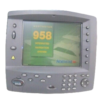
Page 1: Navigation System
NORTHSTAR 958 Integrated Navigation System Operator’s Manual P/N GM958UM Revision A... - Page 3 (RMA) number. Call your Northstar dealer or Northstar for instructions. During the 958’s warranty period, Northstar will repair or replace, at its option, any part of the 958 it finds to be defective due to faulty material(s) or workmanship. All such repairs and/or replacements will be promptly performed by Northstar free-of-charge to the owner, excluding freight costs incurred in shipping to the factory.
- Page 4 CAUTION! Northstar products are designed to be very useful navigation tools, but they are not substitutes for good seamanship. The prudent navigator should never rely on any single device as the sole source of navigation guidance. Exercise caution and good judgment when underway.
-
Page 5: Table Of Contents
Turning the 958 on and off ........ - Page 6 Using GPS ........
- Page 7 Changing the time zone ........... . 182 Appendix A - Understanding GPS, WAAS, and Radar ......183 Introducing GPS and WAAS.
- Page 8 Page iv 958 Operator’s Manual, Rev. A...
-
Page 9: Getting Started
Getting Started Welcome to the 958 ......2 Using this manual ......2 Obtaining technical support . -
Page 10: Welcome To The 958
958’s display screen. Once you start using the 958, you’ll discover that you can use it without constantly referring to this manual. After you’ve read the manual once, you probably won't have to refer to it very often. -
Page 11: Obtaining Technical Support
958). DISPLAY TEXT is the type style used for text that appears • on the display screens. Sample 958 screen is the type style used for captions of • display screens. Figure 1 •... - Page 12 (you can send email to Northstar from this site). Your feedback is important and helps Northstar ensure that this manual is a valuable resource for all 958 users. Send your questions, comments, or suggestions about this manual to: manuals@northstarcmc.com In case of a 958 operating problem, you can contact your dealer or return the 958 to Northstar for diagnosis and repair.
-
Page 13: Turning The 958 On And Off
For details about service procedures, see the Limited Warranty Policy in this manual. To turn the 958 on, briefly press the PWR key. The 958 emits several short beeps as it displays the START-UP screen, then the 958 performs a series of self-tests to check its critical components and functions. - Page 14 (CHART, STAR, STEER, NAV LOG, or WAYPTS/ROUTES) located below the display screen. A 958 that has recently been used at or near that same loca- tion will usually be ready to navigate within one minute.
-
Page 15: Displaying The Chart Screen
See ”Turning radar on and off” beginning on page 128. To turn the 958 off, press and hold the PWR key for a few seconds until the screen goes dark. After the 958 successfully completes its start-up sequence, press the CHART function key to display the CHART screen. - Page 16 If the 958 doesn’t acquire GPS or WAAS signals within two minutes, you’ll see a flashing NO GPS alarm icon on the lower right side of the screen. This means the 958 has an alarm message that needs your acknowledgement: Press the STAR function key (twice if the echo sounder is installed) to display the ALARMS screen.
-
Page 17: Using Chart Data
The alarm message NO GPS POSITION FIX is shown in the RECENT ALARMS box. This message is a normal part of using a 958 for the first time, and advises you that the 958 is acquiring the necessary satellite information. This situation usually occurs in a 958 that’s been shipped more than several... - Page 18 The cartridge slot is located at the lower left-hand corner of the 958. You can see if a cartridge is inside by opening the cartridge access door and looking inside the slot. If the 958 is on, press the CHART SETUP menu key to the right of the...
- Page 19 958 Operator’s Manual, Rev. A • If a cartridge isn’t installed or is installed incorrectly, the words NONE INSERTED are shown (screen at right, below). NONE INSERTED The cartridge name comes from its Navionics catalog number. Not all cartridges will have a date, especially older ones; in this case, only the word PRESENT is shown rather than the name and date.
- Page 20 Be careful when inserting the cartridge into the 958 (see description and illus- tration at right). When you’re not using the cartridge, store it in a clean, dry place away from heat, humidity, and dust.
-
Page 21: Displaying Detailed Position Information
Displaying detailed position information 958 Operator’s Manual, Rev. A You can display detailed position information on two screens: the CHART screen • the GPS POSITION screen • To display position information on the CHART screen, press the MORE INFO menu key to display an “info bar” at the bottom of the screen. -
Page 22: Using Demo Mode
CHART screen. To access demo mode, on the CHART screen, press the CHART SETUP key, then press the DEMO CONTROL key to display the DEMO CHART screen. 958 Operator’s Manual, Rev. A... - Page 23 EXIT DEMO key. This immediately returns you to the CHART screen. NOTE: Video image display, simulated radar image, chart rotation, and zooming DEMO CHART in and out all work normally on the screen. 958 Operator’s Manual, Rev. A Page 15...
-
Page 24: Going To A Quick Waypoint Now
1. Press the CHART function key to display the CHART screen. 2. Move the cursor to the desired chart location by pressing the CURSOR PAD in the lower right corner of the 958. 3. Press the GO TO CURSOR menu key at the lower right of the screen. - Page 25 The 958 displays a track line to the new waypoint named -QUIK-, and guides you directly to this point. That’s all you have to do to use the 958 in its simplest form. To learn more about navigating to waypoints, see ”Navigating to waypoints”...
- Page 26 Chapter 1 - Getting Started Page 18 958 Operator’s Manual, Rev. A...
-
Page 27: Introducing The 958
Maintaining the 958 ......26 Interfacing the 958 ......28 his chapter introduces you to the 958’s features, functions,... -
Page 28: Introducing The Controls
Page 20 Figure 2 below illustrates the functions of the 958’s controls. Feel free to try any of the 958’s controls! You can’t hurt anything, and can only learn more about how to use the 958 more efficiently. The 958 always asks you to verify what you’re doing when changing or deleting information. -
Page 29: Introducing The Display Screen
958 is changing or redrawing the chart. If your 958 is equipped with radar and/or echo sounder, you can split the screen to show the chart, radar, and sounder together in various combinations. In addition, you can overlay a radar image on the chart and/or overlay a video image on most screens. - Page 30 Adjusting the brightness The fluorescent tubes that illuminate the 958 slowly dim after several thousand hours of use. If you use your 958 for many hours each day, you may want to keep the level of the display lighting low when you don’t really need it. To adjust the screen’s brightness, press the BRIGHTNESS key: Pressing the...
- Page 31 Chapter 2 - Introducing the 958 Occasionally, the 958 needs to tell you something or ask Special display permission to do something. When this happens, a special windows information or question window appears on the display. This window may contain an alarm icon, or an INFO label or a large question mark along with a message for you to read.
- Page 32 Chapter 2 - Introducing the 958 Page 24 Question windows A question window appears when the 958 needs a response from you. You must respond to any question window by pressing the ENTER key to answer yes, or the CLEAR key to answer no.
-
Page 33: Introducing Radar
The 958 has several alarms that automatically alert you to certain situations. For example, when you’re approaching a waypoint, the 958 lets you know by sounding a beep and Chapter 2 - Introducing the 958 Page 25... -
Page 34: Maintaining The 958
TideTrack, see ”Understanding TideTrack™” starting on page 158. The 958 offers a video display feature that lets you overlay an image from a connected video source onto most of the 958’s display screens. You can also easily adjust the size, position, and transparency of the image (that is, how much of the underlying screen you can see through the video image). - Page 35 Excessive heat can cause short- and long-term damage to the 958. Although the 958 can recover from short-term effects, long-term damage may be permanent. When the 958 is out in the hot sun, but isn’t being used, always use the protective plastic cover.
-
Page 36: Interfacing The 958
Chapter 2 - Introducing the 958 Interfacing the 958 Page 28 The 958 can be connected to a wide variety of compatible marine devices, including the Northstar 490 that adds complete fishfinding capability to the 958. This type of connection should be done by a qualified marine electronics technician. -
Page 37: Using The Controls
958 Operator’s Manual, Rev. A Using the Controls Using the PWR key ......30 Using the five function keys ....30 Using the CURSOR PAD . -
Page 38: Using The Pwr Key
Page 30 To turn the 958 on, briefly press the PWR key. The 958 emits several short beeps as it first displays the STARTUP screen, followed by the SELF-TEST screen. This screen displays the results of the 958’s self-tests, which are automatically run each time you turn power on. - Page 39 • display an explanation of alarms and any messages the 958 has for you, and set the alarms that are adjustable display the VIDEO SETUP screen, where you enable the • video image and adjust its size and placement on the dis- play screen •...
-
Page 40: Using The Cursor Pad
”Using the Nav Log” starting on page 121. Pressing the large CURSOR PAD — located in the lower right corner of the 958 — while you’re displaying the CHART screen will move the cursor across the CHART screen in an up and down, left to right, or diagonal direction. -
Page 41: Using The Save Key
(-S002-, -S003-, etc.) every time you save a new waypoint this way. Three-digit numbering of waypoints will restart at -S001-, which means the 958 will start to overwrite the existing numbered waypoints, as soon as the 958 reaches the maximum number of saved waypoints you’ve set. -
Page 42: Using The Alphanumeric Keypad
For details about this procedure, check your autopilot manual. To leave MOB mode and return to normal navigation, press the MOB key until the 958 displays the BACK TO NORMAL — MOB TURNED OFF message. Notice that the waypoint named -MOB- is still stored. -
Page 43: Using The Menu Keys
The CLEAR and ENTER keys are also used to reject or accept actions displayed in question boxes that appear on the screen. For example, if you press the GO TO CURSOR key, the 958 displays the message START NAVIGATING TO CURSOR POSITION? YES... -
Page 44: Using The Brightness Key
Using the BRIGHTNESS key Using the IN and OUT keys Page 36 To get the best picture for the current conditions, the 958’s screen may require minor adjusting for different viewing angles, temperature conditions, etc. Press the BRIGHTNESS key (the unlabelled double arrow) to adjust the screen’s brightness. -
Page 45: Using The Chart Screen
958 Operator’s Manual, Rev. A Using the Chart Screen Understanding electronic charts ... . 38 Understanding nav aids ....39 Zooming in and out . -
Page 46: Understanding Electronic Charts
Don’t become overly confident when using electronic charts. Always be cautious! The 958 displays the boundary line of each chart on the CHART screen. To turn this feature off, press the CHART SETUP key on the CHART screen, then press the CHART DETAIL key and turn off the CHART EDGES option. -
Page 47: Understanding Nav Aids
Some nav aids have no chart symbol, and are shown on the CHART screen as text only. When you move the cursor onto a nav aid, the 958 displays a description in the INFO BAR at the bottom of the screen, along with the distance and bearing from your vessel to the nav aid. - Page 48 Chapter 4 - Using the Chart Screen Landmarks Page 40 There are other objects shown on the CHART screen that aren’t classified as nav aids, including various onshore landmarks. 958 Operator’s Manual, Rev. A...
-
Page 49: Zooming In And Out
OUT key approximately halves or doubles the chart scale, respectively. At the highest detail for a particular chart, you can use the 958 as a precision plotter. When you zoom in past that level, the center of the chart is magnified to fill the screen and all text and symbols are doubled in size. -
Page 50: Controlling The Cursor On The Chart Screen
Page 42 As a reminder that no charted hazards or nav aids are shown, the 958 displays the words NO CHART multiple times across the screen. Even without any chart data displayed, you can still use the 958 as a precision plotter If the chart has a radar overlay and if you change the chart’s scale (by... - Page 51 958 Operator’s Manual, Rev. A After pressing the CURSOR PAD to scroll around on the chart, you can press the GO TO CURSOR menu key to start navigating to the designated cursor location. If you place the cursor on a waypoint or nav aid, this menu key would be GO TO WAYPT or GO TO NAV AID, respectively.
-
Page 52: Comparing Vessel And Browse Modes
Chapter 4 - Using the Chart Screen Comparing vessel and browse modes Vessel mode Page 44 The 958 offers two display modes: • vessel • browse As long as the CONTROL key shows (CHART), Pressing the CURSOR PAD at any time instantly changes the display from vessel mode to browse mode. - Page 53 Browse mode 958 Operator’s Manual, Rev. A • rotate the chart (ROTATE key); for details, see ”Rotating the chart” starting on page 49 • restart your course line from your present position to your intended waypoint (RESTART key); for details, see ”Restarting navigation”...
-
Page 54: Splitting The Screen
View the chart and sounder together • View the chart and radar together • View the chart, radar, and sounder together • View the radar alone The following figure shows examples of the available screens. 958 Operator’s Manual, Rev. A... - Page 55 Chart and sounder Chart and radar Chart, radar, and sounder Figure 3: Examples of split screens To split the screen: 1. Press the SPLIT key to view the SELECT A SPLIT SCREEN menu: 958 Operator’s Manual, Rev. A Page 47...
-
Page 56: Controlling The Screen
You are controlling the chart when the word CHART appears on the CONTROL key. The CONTROL key (like the ROTATE key, and several other keys in the 958) has two parts: the upper part shows the NOTE: 958 Operator’s Manual, Rev. A... -
Page 57: Rotating The Chart
Course-up represents your true COG as determined by the GPS receiver. The 958 ignores any course changes if your speed is under half a knot. The chart will rotate sooner for rapid turns than for slower ones. - Page 58 Leg-up - You’ll see your vessel’s current leg to a waypoint—whatever direction that is—pointing straight upwards. The 958 will adjust the chart on a leg-by-leg basis, so the chart turns accordingly whenever you start navigating on a new leg, even if you haven’t turned the vessel yet.
- Page 59 Notice the new direction of the north-pointing arrow. Figure 3: Leg-up chart angle (third leg going south) 958 Operator’s Manual, Rev. A Page 51...
- Page 60 The edges of other charts in the 958’s built-in world atlas are shown, in addition to those in your local cartridge. These edges are shown as black or red dashed lines.
-
Page 61: Setting Up The Chart Screen
On the CHART SETUP/STATUS SCREEN you can set up the details on the CHART screen, turn the radar overlay on and off, and adjust the 958’s track control. Chapter 4 - Using the Chart Screen And the radar image is ... - Page 62 The ON setting shows the names of local cities, towns, harbors, channels, bodies of water, etc. Waypoint names The ON setting shows the name of each waypoint below its symbol. The OFF setting displays just the symbol itself. 958 Operator’s Manual, Rev. A...
- Page 63 Press the RADAR OVERLAY menu key to place a radar overlay Turning the radar on the CHART screen (ON) or remove it (OFF). For details overlay on and off about the radar overlay, see ”Overlaying radar on the chart” starting on page 128. 958 Operator’s Manual, Rev. A Page 55...
- Page 64 Changing the track control Page 56 The 958 displays your track history as a series of dots indicating the path you’ve recently traveled. You can choose how often to store a position fix as a point in your track history. The 958 stores up to 1,024 position fixes. When it reaches this limit, the 958 starts erasing the oldest points to add your new points to the track line.
-
Page 65: Using Distance And Bearing Mode
Set the TRACK DISPLAY option to OFF to remove the track display from the CHART screen, while the 958 continues to record the track in its memory. To resume viewing your track, change this option to ON. - Page 66 Page 58 4. To make a waypoint at the next cursor location, press the ADD WAYPT menu key, then enter its name, symbol, or description on the NEW WAYPOINT screen and press ENTER to save it. 958 Operator’s Manual, Rev. A...
-
Page 67: Determining Your Position
Displaying position, COG, and speed ..60 Using GPS ........60 Using DGPS . -
Page 68: Displaying Position, Cog, And Speed
> from GPS plus WAAS satellites The 958 can display position as Loran TDs if the 958 is connected to a loran receiver. Also, it can display “Phantom Loran” coordinates; that is, if you don’t have a loran receiver, but want to see your position as loran TDs, the 958 will convert GPS coordinates into Loran coordinates. - Page 69 (see ”Changing your receiver settings” starting on page 172). The 958 displays the name of the datum currently in use in the center of the screen. The datum describes the reference of the chart you’re currently using. Most new charts use the NAD83 or WGS84 datum, which are nearly identical.
- Page 70 To display more information about signals received from the GPS satellites, press the SAT INFO menu key on the GPS POSITION screen. The GPS SATELLITES screen is displayed showing the received Signal-to-Noise Ratio (SNR) for each...
-
Page 71: Using Dgps
When you’re using DGPS as your navigation source, your position coordi- nates, as calculated by the 958, may actually exceed the accuracy of some charts. Chapter 5 - Determining Your Position... - Page 72 Displaying DGPS status Page 64 When the DGPS indicator is displayed, it means the 958 is using this higher level of accuracy. When you require this additional accuracy, be sure to check often to see that either the DGPS or WAAS indicators are present.
- Page 73 DGPS has been turned off by the user (to enable DGPS, see ”Changing your receiver settings” starting on page 172). The GPS receiver is trying to initialize the messages from the bea- con receiver. Chapter 5 - Determining Your Position...
-
Page 74: Using Loran
DGPS is on and the corrections are current. An unknown status code has been received from the GPS receiver. This section explains how you can use the 958 to navigate using displayed loran coordinates if the 958 is connected to an loran receiver (such as the Northstar 800). - Page 75 TDs you want to use, or the loran-derived latitude/longitude. If you want the 958 to display loran position coordinates from a connected loran, the loran must support the standard NMEA 0183 “RMA” output data sentence structure. Without this output capability, the 958 won’t receive position data from the loran.
-
Page 76: Using Phantom Loran
GRI must correctly match the GRI being used by your loran receiver. Three possible loran warning indicators obtained from any Northstar 800 series loran receiver are displayed to the right of each TD. (These indicators are available only from Northstar 800 series lorans.) - Page 77 GPS. Phantom Loran lets you display your position as TDs, or enter waypoints as TDs. You can use the 958 to simulate the full operation of a loran receiver, using all of the 958’s navigation functions as if it was actually receiving loran signals.
- Page 78 GRIs one at a time. When the GRI is correct, press the ENTER key. Press the SAT INFO menu key to display the status of the GPS receiver. Press the DGPS INFO menu key to display the current status of the differential receiver, including SNR, SIGNAL, and NOISE values.
-
Page 79: Understanding The Waypoints Function
Understanding the Waypoints Function 958 Operator’s Manual, Rev. A Introducing waypoints ..... 72 Displaying waypoints ..... . . 72 Displaying waypoint coordinates . -
Page 80: Introducing Waypoints
• transfer all waypoints (and routes) between any two 958’s • transfer waypoints (and routes) from the 958 to a PC, and back again You can display waypoints in any of four ways: • A graphic (chart) view of waypoints •... - Page 81 Chapter 6 - Understanding the Waypoints Function the order shown above. Press the CURSOR PAD to move up or down the list. (If your 958 is new, these lists will be empty.) WAYPOINTS (LOCAL) points within 100 nm, nearest one first...
-
Page 82: Displaying Waypoint Coordinates
• as distance and bearing from your position (often the most useful way to display coordinates, since it may be easier to understand “3 miles north” than lat/lon digits) • as loran time differences 958 Operator’s Manual, Rev. A... -
Page 83: Creating New Waypoints
To permanently store a waypoint, you must give it a name. The name can be from one to six characters long, and must be different from all the other waypoint names stored in the 958. You can also enter a description of up to 16 characters on the line below the name. - Page 84 3. Press the CURSOR PAD to move the cursor where you want to add the new waypoint. You can zoom in or out, as necessary, to precisely place your waypoint. 4. Press the ADD WAYPT menu key to display the NEW WAYPOINT screen. 958 Operator’s Manual, Rev. A...
- Page 85 FROM HERE menu key on the waypoint list screen. If you’ve travelled to a part of the world that’s south of the Equator or east of the Prime Meridian (running through Greenwich, England), the 958 automatically displays your lat/lon coordinates as...
- Page 86 1. Press the WAYPTS/ROUTES key. 2. Press the WAYPOINTS menu key. The 958 displays a waypoint list if you had displayed a list during a previous viewing; however, if you had previously displayed a graphical screen, you must press the NEXT VIEW menu key to display the list views.
- Page 87 958 Operator’s Manual, Rev. A Chapter 6 - Understanding the Waypoints Function 3. Press the ADD key to display the NEW WAYPOINT screen. 4. Enter a waypoint name and optional description. 5. Choose a symbol for the waypoint by pressing the SYMBOL menu key to find the symbol you want.
-
Page 88: Creating Avoidance-Area Waypoints
The 958 displays an avoidance area on the CHART screen as a waypoint surrounded by a circle. The circle is the avoidance area’s warning radius, which you set when you create or edit the waypoint. - Page 89 In other words, just assigning a waypoint with the slashed circle symbol doesn’t mean the 958 will treat that waypoint like an avoidance point. Also, you must turn on the 958’s avoidance area alarm (see “Setting the avoidance-area alarm” on page 82).
- Page 90 5. Press the ENTER key to make your selection, or CLEAR to leave it unchanged. If you want to set the 958’s alarm to sound only when you enter an avoid- ance area, turn off the anchor drag, cross track, arrive radius, and DGPS alarms.
-
Page 91: Editing Waypoints
958’s waypoint editing function. To change a waypoint’s name, description, position coordinates, or warning radius: 1. Press the WAYPTS/ROUTES key, then the WAYPOINTS menu key. The 958 displays waypoints in whatever format you last used: WAYPOINTS CHART screen, WAYPOINTS (LOCAL) screen, WAYPOINTS (AVOIDANCE) screen. -
Page 92: Updating Waypoint Coordinates
When you travelled to that waypoint, however, its position might have been slightly different than what you expected. NOTE: 958 Operator’s Manual, Rev. A... -
Page 93: Moving Waypoints/Routes Between Units
The 958’s import/export function lets you transfer all waypoints and routes between two 958’s (or Northstar 941, 951, or 952). To import or export waypoints and routes to and from older Northstar units, these older units must have software version 3.12 or higher NOTE:... - Page 94 Northstar units: • two 958’s • a 958 and a 952, or 951, or 941 Only one unit, called the “master,” actually enters the import/export function. The other unit can remain in normal operation, including the displaying of different screens, as long as you do not add or change any of its waypoints or routes during the actual transfer process.
- Page 95 958 Operator’s Manual, Rev. A Chapter 6 - Understanding the Waypoints Function to that point are in the receiving unit (be aware that a particular route may not comprise all of its waypoints due to the transfer interruption). Press START...
- Page 96 If the other unit is off-line, the master unit displays the dialog-box message COULDN’T GET REMOTE WAYPT/ROUTE COUNT and the status-bar message COMMUNICATION ERROR. • If the other unit doesn’t have any waypoints and routes, the master unit displays the dialog-box message NO 958 Operator’s Manual, Rev. A...
- Page 97 Moving waypoints and routes from a unit 958 Operator’s Manual, Rev. A Chapter 6 - Understanding the Waypoints Function WAYPTS OR ROUTES TO TRANSFER and the status-bar message NO TRANSFER DONE. • If the master unit is completely full of waypoints and...
- Page 98 5. Before transferring, check the communication link between the two units by pressing the TEST COMM key. If the status bar now displays the message REMOTE LINK OK, you may begin to transfer waypoints. 958 Operator’s Manual, Rev. A...
-
Page 99: Transferring Waypoints To And From A Pc
TRANSFER COMPLETE. You can now press any key to resume other operations. If you’ve stored many waypoints or routes in the 958, or if these waypoints are the only record you have of these important locations, you may want to keep a separate copy on your PC. - Page 100 Chapter 6 - Understanding the Waypoints Function Page 92 transfer software and instructions, and cable ordering information, contact your authorized Northstar dealer. 958 Operator’s Manual, Rev. A...
-
Page 101: Understanding The Routes Function
Understanding the Routes Function 958 Operator’s Manual, Rev. A Introducing routes ......94 Creating routes from the chart ....95 Creating routes from a waypoints list . -
Page 102: Introducing Routes
You can store as many as 500 routes in the 958, but the maximum number depends on how the number of stored waypoints. -
Page 103: Creating Routes From The Chart
Creating routes from the chart 958 Operator’s Manual, Rev. A Chapter 7 - Understanding the Routes Function To create a route graphically from the CHART screen: 1. Press the WAYPTS/ROUTES key, and then press the ROUTES menu key. The names of any previously stored routes are shown on the ROUTES screen. - Page 104 WAYPT or the ADD NEW WP menu key for each new waypoint in the route. A line will be drawn on the NEW ROUTE screen connecting the waypoints, with small arrows indicating the direction of the route. 958 Operator’s Manual, Rev. A...
-
Page 105: Creating Routes From A Waypoints List
First, you tell the 958 that you want to save a route as you travel, then you press the SAVE key as you pass each waypoint, then you tell the 958 to stop saving the route when you reach the end of the route. - Page 106 3. Enter the name of the new route to be saved using the KEYPAD and CURSOR PAD, then press the ENTER key. The 958 displays the message SAVING TO: ROUTE NAME at the bottom of the ROUTES screen, confirming that your route is now being saved.
- Page 107 Note: While you’re automatically saving a route, you can access all of the 958’s navigation functions (except you can’t edit the route you’re presently saving). If at any time you’re not sure if you’re still saving a route, press the WAYPTS/ROUTES key, then the ROUTES menu key to display the ROUTES screen.
-
Page 108: Editing A Route
On a routes list, you can perform all the functions above, plus: • you can erase the entire route To edit a existing route on the CHART screen: 1. Press the WAYPTS/ROUTES key, then press the ROUTES menu key to display the ROUTES screen. 958 Operator’s Manual, Rev. A... - Page 109 958 Operator’s Manual, Rev. A Chapter 7 - Understanding the Routes Function 2. Press the CURSOR PAD to select the route you want to change, then press the EDIT menu key. The name of the route is displayed on the EDIT ROUTE screen.
- Page 110 As you move the cursor, the 958 displays the new route leg as a dotted line from that first waypoint to the cursor position.
- Page 111 As you move the cursor, the 958 displays the new connecting route legs as dotted lines to and from the new waypoint. 3. If you’ve selected an existing waypoint, press the INSERT WAYPT menu key.
- Page 112 As you move the cursor, the 958 displays the new route leg as a dotted line from that last waypoint to the cursor position.
- Page 113 REMOVE WAYPT menu key. Even if you remove all the waypoints from a route, the 958 still stores the empty route. To remove the route entirely, see ”Erasing an entire route” starting on page 108.
- Page 114 3. If you want to change the route’s name, do so now. If the message at the bottom of the screen says PRESS ENTER TO CONTINUE (USING CHARTS), press the USE LIST menu key to switch to list-based editing. 958 Operator’s Manual, Rev. A...
- Page 115 958 Operator’s Manual, Rev. A Chapter 7 - Understanding the Routes Function 4. Press the ENTER key to display the second EDIT ROUTE screen. From here you can add or remove any waypoints from the route. Adding waypoints to a route 1.
- Page 116 3. Press the ENTER key (or the CLEAR key to cancel the action). If you change a route you’re navigating along, the 958 stores the changes, but they won’t appear in the copy of the route you’re navigating along. To enable these changes, you must start following the route again (see ”Navigating along routes”...
-
Page 117: Understanding Waypoint/Route Navigation
Understanding Waypoint/Route Navigation 958 Operator’s Manual, Rev. A Navigating to waypoints ....110 Steering to a waypoint ....112 Navigating along routes . -
Page 118: Navigating To Waypoints
If you selected an existing waypoint, the 958 begins guid- ing you directly to it. If you chose a new cursor location, the 958 stores the location as a new waypoint with the name -QUIK-, and begins guiding you directly to it. Repeating this same pro- cedure will create a new -QUIK- waypoint that overwrites the existing one;... - Page 119 -QUIK- waypoint you make will overwrite this one: Just move the cursor to the NAME field and change the name from -QUIK- to a unique permanent name before continuing. 4. Press the ENTER key twice. The 958 begins guiding you directly to the waypoint. Page 111...
-
Page 120: Steering To A Waypoint
3. Press the GO TO menu key, then press the ENTER key. The 958 begins guiding you directly to the waypoint. To display information that helps guide you directly to your destination waypoint, press the STEER key. If you press the STEER key twice, you’ll display two versions of the steering... - Page 121 Displaying distance and your Speed-Over-Ground (SOG) and Course-Over-Ground and bearing (COG). Your 958 may show an arrow between the SOG and COG displays, pointing upwards when the trend of your speed is increasing, and down when it’s decreasing. When you’re less than a mile away from a destination waypoint, you can show the distance to the waypoint in feet by setting the 958’s steering distance precision option to HIGH.
- Page 122 If you’re following a route and the 958 sequences to a new leg, your ves- sel symbol will show your COG relative to the new leg and should be straight ahead once you’ve finished turning the vessel.
- Page 123 958 Operator’s Manual, Rev. A Chapter 8 - Understanding Waypoint/Route Navigation In the center of the STEERING screen is an information box where you can display the following information: • Estimated Time Enroute (ETE) to the waypoint, and Esti- mated Time and Date of Arrival (ETA) •...
-
Page 124: Navigating Along Routes
ROUTES key, then press the ROUTES menu key to display the ROUTES screen. Press the CURSOR PAD to select the route you want to follow, then press the GO menu key. The 958 displays the CHART screen with the nearest waypoint in the route selected, but you haven’t actually begun to follow the... - Page 125 To go directly to any selected waypoint in the route (the nearest one is the default), press the GO TO WAYPT menu key, then press the ENTER key. The 958 calculates a track line from your present position to the selected route waypoint.
-
Page 126: Restarting The Course Line
• after passing the obstacle, if you don’t have to go back to your original course line, you can go right to the next waypoint by using the 958’s restart function (Course 2 below) Figure 5: Restarting the course line... - Page 127 ENTER key. If you’re on the chart screen, you must first press the vessel key The 958 recalculates the course line to go from your present position directly to the next waypoint, and resets your cross-track error to zero.
- Page 128 Chapter 8 - Understanding Waypoint/Route Navigation Page 120 958 Operator’s Manual, Rev. A...
-
Page 129: Using The Nav Log
Changing your trip ......123 Stopping and restarting navigation ..124 his chapter explains the 958’s nav log function, which gives you a quick and easy way to check your progress during your trip, and make changes to it while you travel. -
Page 130: Introducing The Nav Log
Chapter 9 - Using the Nav Log Introducing the nav log Page 122 The 958’s nav log helps you plan and log your trip. The nav log provides three main functions: • to display your progress along your trip •... -
Page 131: Changing Your Trip
4. Repeat these steps for any more waypoints you want to add. If you go to a waypoint or along a route by using the 958’s GO TO func- tion, the 958 automatically enters and organizes the waypoints in the nav log. -
Page 132: Stopping And Restarting Navigation
Restarting navigation Page 124 Whenever you press the nav log’s STOP menu key, the 958 stops navigating, and won’t display distance and bearing to waypoints or ETA or ETE. You can restart navigation along any leg or to any waypoint of the trip. -
Page 133: Understanding Radar Functions
Using the radar markers keys ....137 his chapter first describes radar briefly, and then explains how to display, control, and adjust the 958’s radar. Page 125... -
Page 134: Understanding How Radar Works
For more information about how radar works, see ”Introducing radar” starting on page 187. To display radar alone on a full screen: 1. Press the CHART key to display the CHART screen. 958 Operator’s Manual, Rev. A... - Page 135 958 Operator’s Manual, Rev. A Chapter 10 - Understanding Radar Functions 2. Press the SPLIT key to display the SELECT A SPLIT SCREEN menu. 3. Press the RADAR key to view the radar: If you haven’t turned the radar transmitter on, you’ll see a blank screen or a residual echo.
-
Page 136: Turning Radar On And Off
For information about rotating and scaling the radar, see ”Changing scale and rotation” starting on page 130. When you power up the Northstar 958, radar is off. This is a safety feature. To turn radar on, you must turn on the radar transmitter: 1. - Page 137 958 Operator’s Manual, Rev. A Chapter 10 - Understanding Radar Functions 2. Press the CHART SETUP key to display the CHART SETUP screen: 3. Press the RADAR OVERLAY ON key to overlay radar on the chart: Page 129...
-
Page 138: Changing Scale And Rotation
Press the FADE key to select off (no transparency), 1, • or 2 (maximum transparency). If you power off the 958, when you turn it on again, the chart still has a radar overlay. To remove the radar overlay, press the CHART SETUP key, then press RADAR OVERLAY OFF. - Page 139 ... Browse mode Vessel mode 958 Operator’s Manual, Rev. A Chapter 10 - Understanding Radar Functions If there’s no radar overlay on the chart, you scale the chart and radar separately; zooming in on the chart, for example, has no affect on the radar.
-
Page 140: Using The Main Radar Keys
Then choose the split you prefer from the following: Press VIDEO to overlay video on the screen • Press the CHART key to see the chart only • Press the CHART|SOUNDER key to see the chart and • sounder together 958 Operator’s Manual, Rev. A... - Page 141 134. Press the RADAR MARKERS key to display the first of three pages of controls for the 958’s range rings, bearings, electronic bearing lines (EBLs), variable range markers (VRMs), and guard zones. For more information about using these keys, see see ”Using the radar markers keys”...
-
Page 142: Using The Adjust Radar Keys
• Either press the CONTROL PAD up and down arrow keys Or use the number keys on the KEYPAD to enter the • quantity you want 958 Operator’s Manual, Rev. A... - Page 143 Press the DONE key to return to the main radar menu keys. The 958 comes with default factory settings that you can leave in place. If you turn off the 958, it remembers any changes you made to these adjustments.
- Page 144 958; therefore, you must turn the RADAR TX key to ON every time you power up the 958. Turning the transmitter off when it is not in use can save electrical power and allows you to work safely in the vicinity of the rotating antenna.
-
Page 145: Using The Radar Markers Keys
The 958 comes with default factory settings that you can leave in place. If you turn off the 958, it remembers any changes you made to these adjustments. These keys let you adjust the electronic bearing lines. Elec-... - Page 146 Chapter 10 - Understanding Radar Functions Page 138 track of your surroundings. The 958 uses two types of EBLs: fixed and floating. The fixed EBL is a blue line from your present position (Point “A”) to Point “B.” You can move Point B on the screen using the cursor pad as described below.
- Page 147 958 Operator’s Manual, Rev. A Chapter 10 - Understanding Radar Functions • In the bottom right-hand corner, you’ll see the radius of the VRM(s). These numbers are color coded blue for fixed EBL and pink for floating EBL. • In the bottom left-hand corner, you’ll see the length of the electronic bearing line(s).
- Page 148 Point A and Point B using the CURSOR PAD. Press the EDIT key repeatedly to select the point you want to move. Then press the CURSOR PAD to move the point and create an arc-shaped zone. Figure 7: Guard zone 958 Operator’s Manual, Rev. A...
- Page 149 Press the Bearings key repeatedly to display radar bearing digits as relative to the vessel heading, or as True bearings/ Magnetic bearings (see ”Choosing magnetic variation” starting on page 169). 958 Operator’s Manual, Rev. A Page 141...
- Page 150 Chapter 10 - Understanding Radar Functions Page 142 958 Operator’s Manual, Rev. A...
-
Page 151: Alarms, Tidetrack, And Video Display
Understanding TideTrack™ ....158 Using the video display option ... . . 160 his chapter describes the 958’s alarms, TideTrack, and the optional video display. -
Page 152: Understanding Alarms
Page 144 Alarms automatically alert you to certain situations, for example, when you’re approaching a waypoint, or entering an avoidance area, or when you’ve lost position fixes. The 958 displays its alarms in two different ways: • as specific alarm icons on the display screens •... - Page 153 “cleared” yet (see “Clearing alarms” below). There may also be other uncleared alarms. Recent alarm messages The 958 keeps a record of the one most recent alarm from each main category (anchor, avoidance, communications, cross track, and waypoints). This lets you “browse” through the older alarm messages.
- Page 154 Alarms that require manual clearing - These will stay onscreen until you clear them on the ALARMS screen. All of the 958’s alarms are described in Table 6 below. The following abbreviations are used in Table 6. For alarm message, ‘NAME’ = name of waypoint.
- Page 155 YOU’VE ENTERED AVOID ZONE NOW NAVIGATING TO WAYPT: ‘NAME’ 958 Operator’s Manual, Rev. A Chapter 11 - Alarms, TideTrack, and Video Display Table 6: 958 alarms (continued) Vessel has entered the arrive radius of an active waypoint. This alarm is shown only if you’ve chosen manual waypoint switch-...
- Page 156 This alarm is shown only if you’ve turned it on ALARMS at the screen. You’ve powered-up the 958 while already in demo mode Within 10 seconds. Does not time out. Does not time out. 958 Operator’s Manual, Rev. A...
- Page 157 NO WAAS/DGPS BIG JUMP IN GPS POSITION NO GPS POSITION 958 Operator’s Manual, Rev. A Chapter 11 - Alarms, TideTrack, and Video Display Table 6: 958 alarms (continued) DGPS or WAAS corrections were previ- ously used, but are now temporarily unus- able.
- Page 158 LORAN COMMUNICATION FAILURE Page 150 Table 6: 958 alarms (continued) The 958 hasn’t received any messages from the GPS receiver pod for over 30 seconds. Position fix from an external loran receiver is unavailable and external loran is the chosen position source. This alarm is delayed for three minutes at power-up.
- Page 159 YOU’VE PASSED WAYPT: ‘NAME’ POOR LORAN SIGNALS Sounder alarms (only shown on the 958 if sounder is enabled) BOTTOM COLLISION! Radar alarms (only shown on the 958 if radar is enabled) 958 Operator’s Manual, Rev. A Chapter 11 - Alarms, TideTrack, and Video Display...
- Page 160 Page 152 Table 6: 958 alarms (continued) An object enters the guard zone. The 958 hasn’t received radar data for several seconds. You can manually adjust four of the 958’s alarms: • anchor alarm • cross track • arrive radius •...
- Page 161 958 Operator’s Manual, Rev. A Chapter 11 - Alarms, TideTrack, and Video Display You can also turn the alarm audio on or off for all of the 958’s alarms Alarm audio You can turn the alarm audio on so that the 958 will beep when any alarm goes off, or you can turn the audio off completely so that you’ll only see alarm icons and messages...
- Page 162 There are two alarms triggered by the arrive radius. If you’re following a route and have chosen automatic waypoint switching, entering the radius makes the 958 switch to the next leg and display the CHANGING alarm icon. If there are no more waypoints in the route, or if you’ve chosen manual...
- Page 163 Press the CURSOR PAD to turn the alarm to ON, then press the ENTER key. You can set the 958 to honk, in addition to the beep, if a honker has been connected to pin #14 on the interface connector.
- Page 164 This honking starts simultaneously with any flashing alarm icons. After you set all alarms to honk, an alarm causes the 958 to emit a sound for half a second, followed by silence for half a second. This honking sequence stops when the alarms either automatically clear or you manually clear them.
- Page 165 ANCHOR ALM Description The 958’s standard alarm beep. The 958’s standard alarm beep. Alarm icons flash; the 958 simulta- neously emits an output sound for half a second, followed by silence for half a second until the alarm is manually cleared.
-
Page 166: Understanding Tidetrack
Understanding TideTrack Page 158 ™ The 958 calculates tide information for any of over 3,540 NOS/ NOAA tide stations. To display this information, press the STAR key until you see the TIDE TRACK screen. The entire U.S. coastline--including Alaska and Hawaii--is covered, plus many Caribbean islands and eastern and western Canada. - Page 167 1. On the TIDE TRACK screen, press the CONFIGURE menu key. 2. Press the CHOOSE CLOSEST TIDE STATION menu key. The 958 searches for the nine stations closest to your present position, and displays this list with the closest sta- tion at the top.
-
Page 168: Using The Video Display Option
3. When the date is correct, press ENTER twice to display the tides for the new date. If the 958 is connected to a video camera or other video source, you can display the image right on the 958’s display screens. - Page 169 Adjusting the video’s transparency 958 Operator’s Manual, Rev. A Chapter 11 - Alarms, TideTrack, and Video Display • On a full ECHO SOUNDER screen, you must first press MORE, then press VIDEO. To turn the image off, press VIDEO again.
- Page 170 Press the STAR key to display the VIDEO SETUP screen. To change the size of the image, press a number from 1 to 9 on the KEYPAD. To move the image around on the screen, press the CURSOR PAD. 958 Operator’s Manual, Rev. A...
-
Page 171: Setting Up Your 958
Changing the time zone ....182 his chapter explains the various options for changing how the 958 displays information, computes navigation data, and communicates with other devices. You can change each option at any time according to your specific needs. -
Page 172: Changing Your Display Settings
Changing your display settings Changing the settings Page 164 To access the 958’s display options, press the STAR key until you see the OPTIONS/SERVICE INFO screen. Press the DISPLAY OPTIONS menu key to access the DISPLAY OPTIONS screen. To change any of the options (explained in detail on the... - Page 173 You can set the 958’s display of distances and speeds to any of the following units of measurement: •...
- Page 174 Page 166 You can set the time of day to either a 12- or 24-hour format. The option you select here affects all of the 958’s time-related displays, including high and low tides, sunrise/sunset, and ETA. You can set the precision of the 958’s latitude and longitude displays to either degrees, minutes, and seconds (two decimal places, or .XX), or to degrees, minutes, and thousandths of...
-
Page 175: Changing Your Navigation Settings
Your message can be changed only by entering your access code number and repeating the above procedure. The 958 gives you three attempts at entering the correct access code; after that, all operations freeze, requiring you to turn power off, then turn it back on again to resume functioning. - Page 176 • external loran - choose this if a loran receiver is connected to the 958 If your 958 is connected with an optional external radiobeacon differential receiver, differential GPS corrections will automatically be used even if you select Phantom Loran.
- Page 177 • manual - you manually switch to the next waypoint When set to automatic, the 958 displays the new distance and bearing information for the next waypoint when you arrive at the previous one. It immediately stops navigating when you pass a lone waypoint or the last waypoint in a route.
- Page 178 ENTER key. For a list of the 958’s available datums, see Appendix C at the back of this manual. You can specify a different datum for the 958’s output ports than the one set for the positional display. For instructions, see the Northstar 958 Installation Manual (part number GM958IM).
- Page 179 “high,” the distance-to-waypoint and cross-track error are displayed in feet or meters—when you’re under one mile or kilometer from the destination waypoint. Chapter 12 - Setting Up Your 958 Cross-track full scale setting Then... you can choose among 1000 FT, 2000 FT, or ½...
-
Page 180: Changing Your Receiver Settings
Chapter 12 - Setting Up Your 958 Changing your receiver settings Page 172 To access the 958’s receiver options, press the STAR key until you see the OPTIONS/SERVICE INFO screen. Press the RECEIVER OPTIONS menu key to access the RECEIVER OPTIONS screen. - Page 181 GPS satellites, are slightly erratic, varying by up to several knots. The 958’s GPS speed averaging function can help steady these readings. This function lets you select the time over which your speed is averaged, with choices between two and ten seconds.
- Page 182 If the signal that’s received and monitored by Channel 1 degrades for any reason (such as bad weather between your vessel and the transmitter), the 958 tries to select a better frequency from the directory it has compiled. This function allows it to switch to the best differential signal before your GPS accuracy is affected negatively.
- Page 183 Although the need is rare, you can manually override automatic mode at any time by issuing tuning commands using the 958’s KEYPAD. In manual mode, the differential receiver outputs its corrections only from the selected station. To manually choose a differential station, you must select the frequency of the desired station: 1.
- Page 184 • WAAS - the 958 will use WAAS differential corrections The DGPS data timeout setting determines how long the 958 will continue to use old DGPS corrections if no new corrections are received due to bad weather, extreme distance from beacon, etc.
-
Page 185: Changing Your Port Settings
SETUP OPTIONS key, then the WIRING INFO key. For details about interfacing the 958, contact your local authorized Northstar dealer. For the sounder to work with the 958, you must set up the 958’s AUX port for fishfinding: 1. Press the STAR key to display the OPTIONS/SERVICE INFO screen. -
Page 186: Installing Software Updates
Northstar dealer. Do not remove the card and do not turn the unit off while the update is in progress or your 958 system will be corrupted. 1. Press the STAR key to display the OPTIONS/SERVICE INFO screen. - Page 187 If this isn’t the source of the failure, you may have to return the 958 to the factory for service. Chapter 12 - Setting Up Your 958...
- Page 188 RCVR SELF TEST field. If the message FAILED is displayed, you may have to return the 958 to the factory for service. A built-in keypad test lets you check the integrity of the 958’s keys. This function works for all keys except PWR,...
- Page 189 MORE key on the OPTIONS/SERVICE INFO screen, then the IGNORE DOOR key on the MORE OPTIONS/SERVICE INFO screen, then the ENTER key. The 958 will then let you use the cartridge as if the door was functioning properly. Leaving the cartridge door open may cause serious water damage to the 958’s internal components.
-
Page 190: Changing The Time Zone
Chapter 12 - Setting Up Your 958 Changing the time zone Page 182 Press the STAR key until you see the TIME OF DAY screen. The time, date, local time zone, and time of today’s sunrise and sunset are shown. -
Page 191: Appendix A - Understanding Gps, Waas, And Radar
GPS has an absolute and repeatable accuracy of 20 to 30 meters (better than 100 feet) 95 percent of the time, according to the U.S. government. This means that you can expect to be... - Page 192 What is WAAS satellite differential? One type of differential corrections involves the tracking of WAAS satellites using Northstar’s 2201, a 12-channel GPS/ WAAS pod. The self-contained 2201 provides the 958 with accuracy of better than 2 meters 2dRMS. What is radiobeacon satellite differential? Another type of differential corrections comes from fixed “reference stations,”...
- Page 193 When using beacon differential through an optional external Northstar radiobeacon receiver, the 958 provides an accuracy of one to three meters 50 percent of the time, and an accuracy of four meters 95 percent of the time. Lat/lon positions are displayed to thousandths of minutes (approximately six feet).
- Page 194 GPS. Instead, you could be as far as 200 feet from your expected position. This is especially apparent when you’re displaying the 958’s CHART screen, where you can see your vessel’s plotted position appear to wander around within an area up to 200 feet in diameter (see figure below).
-
Page 195: Introducing Radar
(repeatable and absolute) 95 percent of the time. SOG readings should be accurate to 0.1 knot. You can connect your 958 to your loran receiver (as long as the loran has the appropriate NMEA 0183 output capability), and display and navigate with real-time loran TDs. - Page 196 For this reason, and when set to a long range, a coast line may not be seen yet the high mountains inland further away may be detected. Page 188 958 Operator’s Manual, Rev. A...
- Page 197 Among the strong reflectors are bluffs facing the ship, buildings, breakwaters, rock walls, and mountains. Some of the weaker targets are wooden boats, sandy beaches, and rubber lifeboats. 958 Operator’s Manual, Rev. A Page 189...
- Page 198 Page 190 958 Operator’s Manual, Rev. A...
-
Page 199: Appendix B - System Features
• bearing accuracy better than +1 degree • power requirements, 10.1 to 40.1VDC • connects directly to Northstar 958, with a choice of antennas • Course-up, leg-up, heading-up, and north-up chart view- ing angles •... - Page 200 Estimated Time of Arrival (ETA) • Estimated Time Enroute (ETE) • Automatic magnetic variation • Course correction • Speed of Advance • Enter waypoints graphically or numerically: as lat/lon, dis- tance and bearing, or loran TDs 958 Operator’s Manual, Rev. A...
- Page 201 Waypoint navigation 958 Operator’s Manual, Rev. A • User-entered avoidance waypoints Displays up to 30 closest waypoints (3D STEER screen) • • Store up to 1,000 waypoints and 500 routes • Store 35 waypoints per route • Displays waypoints: on the CHART screen >...
- Page 202 GLL, GSA, GSV, LCD, HSC, MSS, RNN, RMA, RMB, VTG, WCV, XTE, ZDA, ZTG. Conforms to NMEA v 2.0 and later. Supports 1.5 GLL and BWC. • One VGA out port (connects to Northstar 1200 Series or other monitor) • One VIDEO in port (NTSC/PAL) - accepts all standard video sources •...
- Page 203 Physical/ environmental features 958 Operator’s Manual, Rev. A • Waterproof control head • 10.4” diagonal color LCD display screen • Unsurpassed sunlight viewability • 640 x 480 pixel, high- temperature, backlit, transmissive, color LCD • Flush mount standard • High-contrast, anti-reflective screen •...
- Page 204 Page 196 958 Operator’s Manual, Rev. A...
-
Page 205: Appendix C - Geodetic Datums
ARC-1960 mean value ARC60_K ARC 1960—Kenya ARC60_T ARC 1960—Tanzania Ascension Island 1958 Astro Beacon “E” (Pacific Isl.) Astro B4 Sorol Atoll (Hawaiian Islands) 958 Operator’s Manual, Rev. A Table 9: Available 958 datums ELLIPSOID delta x delta y CL1880 -166 CL1880... - Page 206 Table 9: Available 958 datums (continued) Datum name AD714 Astro Dos 71/4 (Atlantic Isl.) AS52 Astronomic Station 1952 AG66 Australian Geodetic 1966 AG84 Australian Geodetic 1984 Bellevue (IGN) Bermuda 1957 Bogota Observatory (Colombia) Campo Inchauspe CA66 Canton Astro 1966 CAPE...
- Page 207 Table 9: Available 958 datums (continued) Datum name EUR50_SA European 1950—Sardinia EUR50_SI European 1950—Sicily EUR50_NF European 1950—Norway and Finland EUR50_PS European 1950—Portugal and Spain EUR79 European 1979 GAND Gandajika Base (Indian Ocean) GD49 Geodetic Datum 1949 GUAM63 Guam 1963 Gux 1 Astro HJOR Hjorsey 1955—Iceland...
- Page 208 Table 9: Available 958 datums (continued) Datum name MASI Marco Astro—Salvage Islands MASS Massawa (Africa) MERCH Merchich (Africa) MA61 Midway Astro 1961 MINA Minna (Africa) NAH_O Nahrwan—Masirah Island (Oman) NAH_UA Nahrwan—United Arab Emirates NAH_SA Nahrwan—Saudi Arabia Naparima BWI (Trinidad and Tobago) NAD27_MN North American 1927—CONUS mean value...
- Page 209 Table 9: Available 958 datums (continued) Datum name NAD27_GR North American 1927—Greenland NAD27_MX North American 1927—Mexico NAD83 North American 1983 OB1966 Observatorio 1966 (Atl. Isl.) Old Egyptian OHW_MN Old Hawaiian—mean value OHW_HW Old Hawaiian—Hawaii OHW_KA Old Hawaiian—Kauai OHW_MA Old Hawaiian—Maui OHW_OA Old Hawaiian—Oahu...
- Page 210 Table 9: Available 958 datums (continued) Datum name PSA56_GY Provisional S. American 1956—Guyana PSA56_PR Provisional S. American 1956—Peru PSA56_VN Provisional S. American 1956—Venezuela PRICO Puerto Rico QUAT Qatar National QORN Qornoq (Greenland) REUN Reunion (Indian Ocean) ROME Rome 1940 SDOS Santo (DOS) (S.W.
- Page 211 Table 9: Available 958 datums (continued) Datum name SEBAS Southeast Base SWBAS Southwest Base TIMB Timbalai 1948 (Malaysia) TOK_MN Tokyo mean value TOK_JP Tokyo—Japan TOK_KR Tokyo—Korea TOK_OK Tokyo—Okinawa TA68 Tristan Astrological 1968 (S. Atl.) VL16 Viti Levu 1916 (S.W. Pac. Isl.)
- Page 212 Page 204 958 Operator’s Manual, Rev. A...
-
Page 213: Appendix D - Glossary
The positions of lat/lon and TDs are referred to as absolute, and distance and bearing are relative (that is, distance and bearing are in relation to a certain reference point). 958 Operator’s Manual, Rev. A Page 205... - Page 214 It’s activated and positioned by the user when required. The 958’s cursor appears as an arrow or a flashing block, depending on whether you’re choosing or entering data. Also known as the red circle on the CHART screen, which you manually activate and position.
- Page 215 LOng RAnge Navigation. A system of land-based radio transmitters emitting precisely timed pulses that are received and translated into position “fixes” by a loran receiver. The 958 can convert and display its GPS coordinates into Loran-C position measurements, or TDs.
- Page 216 Northstar 958 automatically calculates magnetic variation and uses it to display bearings as magnetic north. The variation at any location changes slowly over a period of years, and the unit compensates, according to the current calendar year. master The primary loran transmitter in a “chain” of at least three stations which initiates a series of coded pulses and is followed by the secondaries.
- Page 217 The “slave” loran transmitters in a chain of at least three stations. Signal-to-Noise Ratio. Guide number for determining the relative quality of GPS, DGPS, or loran signals as compared to background radio “noise.” Speed Over Ground. The actual speed of your vessel relative to the sea bottom.
- Page 218 Page 210 958 Operator’s Manual, Rev. A...
-
Page 219: Index
9, 23, 145 cross-track 154 DGPS 155 honk. See Alarms, audible icons 23, 144, 146–152 messages 145 setting 152 understanding 31, 144–157 Arrive radius. See Alarms Avoidance area creating on the chart screen 80 958 Operator’s Manual, Rev. A Index Page 211... - Page 220 74 displaying with Navionics Nav-Chart cartridges 7 displaying your present position on 7 editing a route from 100 menu keys 10 plotter function 22, 42 radar and. See Radar rotating 49–52 Page 212 958 Operator’s Manual, Rev. A...
- Page 221 55 understanding 38 CLEAR key 35 Clearing alarms. See Alarms 23 COG. See Course-over-ground. Connecting the 958. See Interfacing 72 Contacting Northstar 3 Controls (keys), introducing the functions of 20 Course-over-ground displaying on chart screen 13, 134...
- Page 222 111 understanding 57–58 Echo sounder. See Sounder Electronic bearing lines (EBL) 137–139 ENTER key 35 Entering data using the keypad 34 Ephemeris, definition of 206 definition of 206 Page 214 958 Operator’s Manual, Rev. A...
- Page 223 138 displaying on steering screens 115 Exporting all waypoints and routes from a unit 85 Factory defaults 154, 166, 169, 175, 176 Feedback, sending yours to Northstar 4 Fishfinder. See Sounder Function keys, using 30–35 Global Positioning System. See GPS...
- Page 224 Icons, alarm. See Alarms Identification numbers 958 serial number 178 owner’s ID message 166 Import/export between two 958’s 85 Importing all waypoints and routes to a unit 85 IN key 36 Info bar 85, 102 displaying on chart screen 13...
- Page 225 111 receiver, displaying data from 66–68 Magnetic variation changing 169 definition of 169, 207 Maintaining the 958 cleaning 27 protecting 26 Man overboard mode. See MOB key Menu keys, overview of 35 958 Operator’s Manual, Rev. A Page 217...
- Page 226 Overlay. See Radar, and Video display image Personal computer, interfacing to 72 Phantom Loran 168 definition of 69 displaying 168 Position converting coordinates 85 converting coordinates from GPS to TDs 68 displaying 7, 60–70, 168 increasing accuracy of 174 Page 218 958 Operator’s Manual, Rev. A...
- Page 227 141 rotating 53, 131, 133 tuning 137 turning on/off 128 variable range marker (VRM) 138–139 Range rings 141 Returning the 958 for service 4 Rhumb line, definition of 165 RMA number. See Service Rotating chart/radar 49–52, 131 Routes adding waypoints...
- Page 228 100–105 using a waypoints list 106–108 while navigating 108 erasing entire 108 importing and exporting between two 958’s 85 navigating from stored 116 removing waypoints from 105, 108 reversing 117 saving as you travel 97–99 starting 117–118...
- Page 229 123 arrows for routes 101, 117, 118 arrows for SOG and COG 113 buoys 39 cursor 32, 34, 42, 206 diamond shaped box 42 dotted line 102, 103 hourglass 21 958 Operator’s Manual, Rev. A Page 221...
- Page 230 77, 79 Track clearing track history 57 definition of 209 definition of track line 55 displaying track history 56 relative to cross-track distance 171 Transmitters 126, 136 transmitters 205 Turning off the 958 7 Page 222 958 Operator’s Manual, Rev. A...
- Page 231 72, 209 designating as avoidance areas 80–82 displaying 55, 193 displaying coordinates of 74 editing 83–84 importing and exporting between two 958’s 85 listing 72 making a new waypoint on the chart screen 76–78 on the waypoints screen 78–80 naming 83, 96, 99 958 Operator’s Manual, Rev.
- Page 232 16 navigating to stored 112 steering to 112–116 storing 75 transferring to a personal computer 91 warning radius for avoidance areas 81, 83 WAYPTS/ROUTES function key 31 Zooming chart screen 41–42 radar 131 Page 224 958 Operator’s Manual, Rev. A...