NorthStar 972 Quickstart Manual And Reference Manual
Integrated navigation system
Hide thumbs
Also See for 972:
- Install manual (2 pages) ,
- Installation manual (46 pages) ,
- Install manual (38 pages)
Table of Contents
Advertisement
Quick Links
Download this manual
See also:
Installation Manual
Advertisement
Table of Contents

Related Manuals for NorthStar 972


Summary of Contents for NorthStar 972
- Page 1 Northstar 972 Quickstart Guide Reference Manual Revision B...
- Page 2 P/N GM972IM for additional installation, troubleshooting and warranty information. For advice regarding equipment placement, please consult with an authorized Northstar Servicing Dealer before beginning the installation. To locate a Northstar Servicing Dealer near you call 978-897-6600...
-
Page 3: Table Of Contents
Using GPS ........46... - Page 4 11 Setup........972 configuration ......146 Navigation options .
-
Page 5: Getting Started
Maintaining the 972........4 Interfacing the 972........4 Technical support . -
Page 6: Welcome To The Northstar 972
The Quickstart Guide begins on page 9 • and has all the basic information you need to operate the 972. Be sure to read this section as you start using the unit. A Reference Section starts on page 27. •... -
Page 7: Networking The 972
Networking the 972 Northstar’s networking technology lets you connect two or more 972 units in order to share navigation data (including radar and sounder data) and all waypoints and routes between the units. The system can be... -
Page 8: Interfacing The 972
Interfacing the 972 The 972 can be connected to a wide variety of compatible marine devices, including Northstar’s echo sounder and radar. A qualified marine electronics tech- Maintaining the 972 Basic maintenance To help retain the 972’s best possible performance, Northstar recommends the... -
Page 9: Technical Support
Reference Manual Revision B www.NorthstarNav.com Hearing from you Your feedback is important and helps ensure that this manual is a valuable resource for all 972 users. Send your ques- tions, comments, or suggestions about this manual to: manuals@bntmarine.com Service and repair In case of a 972 operating problem, check all interconnecting cables and fuses. -
Page 10: Electronic Charts And The 972
Shipments to BNT Marine Electronics should be made to the following address: Electronic Charts and the 972 One of the 972’s unique features is the ability to display both raster and vector charts. In split screen mode, you can even display a raster chart and a vector chart side by side. -
Page 11: Purchasing Charts
– both in cartography and marine electronics – this disadvantage is disappearing. See page 28 for more on charts in the 972. In addition, a menu key for purchasing charts is displayed on the chart screen, whenever there are additional charts that you have not purchased, at the current vessel position. - Page 12 Getting Started Purchasing charts Northstar 972...
-
Page 13: Northstar 972 Quickstart Guide
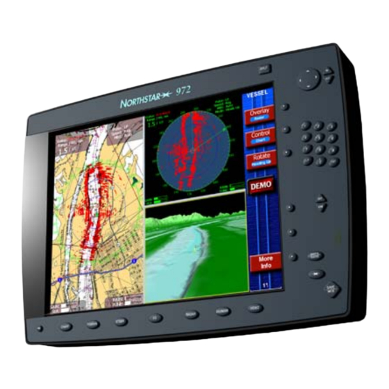
Quickstart Guide Revision B - Review Turning the 972 on and off ......11 Displaying the chart screen . - Page 14 Power Key RADAR CHART POSITION STEER Function Keys Soft Keys SPLIT WAYPTS ROUTES SAVE SOUNDER VIDEO STAR Key Figure 1: 972 controls Northstar 972...
-
Page 15: Turning The 972 On And Off
Now you’re ready to get underway with your 972! If this 972 was recently used at or near its present location, it will usually be ready to navigate within one minute after it is turned Turning the 972 off To turn the 972 off, press and hold the key until the screen goes dark. -
Page 16: Introducing The Controls
A question window appears when the 972 needs a Introducing the controls Feel free to try any of the 972’s controls! You can’t hurt anything, and you’ll only learn more about how to use the 972 more efficiently. The 972 always asks you to verify what you’re doing before it changes... -
Page 17: Detailed Chart Data
All available charts are already stored within your 972, and you can activate chart, current and tide data at any time by simply obtaining and entering a permit code. -
Page 18: Displaying The Chart Screen
Safe mariners always use up-to-date charts and information. Displaying the chart screen After the 972 completes its start-up sequence, press the acknowledge the warning message and display the key repeatedly until the STAR screen appears. - Page 19 Chart screen Displaying the chart screen Quickstart Guide Revision B...
- Page 20 Clearing a GPS or WAAS alarm If the 972 isn’t able to obtain a position from GPS within three minutes, you’ll see a flashing NO GPS alarm icon on the right side of the screen. This means the 972 has...
- Page 21 Press Vessel to recenter the chart on your vessel. Vessel Info bar The GPS status is shown on the right side of the screen: — navigating with normal GPS • GPS signals —...
-
Page 22: Chart Options
Alarms The Northstar 972 alerts you to conditions that may require attention. Some alerts are strictly informative, such as nearing a waypoint, and some warn of conditions... -
Page 23: Using Demo Mode
Demo mode is useful for training, and could be used for dead reckoning in the event that GPS signals should ever fail. To access the demo control screen, display screen and press and hold Chart to display the chart options. -
Page 24: Displaying Numeric Data On The Position Screen
• geodetic datum (for details, see • Choosing a geodetic datum, starting on page 149) Press a second time to see POSITION Phantom loran TDs See Using Phantom Loran, on page 49. Northstar 972... -
Page 25: Going Immediately To A Quick Waypoint
POSITION 3. Press 4. Press ENTER. Going immediately to a quick waypoint GPS position screen Go to cursor The 972 displays a track line to the new -QUIK- waypoint named , and guides you directly to this point. -
Page 26: Radar
STEER straight-line course to the waypoint (see Steering to a waypoint, starting on page 54). That’s all you have to do to use the 972 in its simplest form. To learn more about navigating to waypoints, See Navigating to Waypoints, starting on page 51. -
Page 27: The Echo Sounder
For information on installing radar and making it operational, see the Northstar The echo sounder If your 972 is equipped with Northstar’s optional echo sounder, press display the full Split function The SPLIT key You can split the screen to display several navigation functions on the screen at the same time. -
Page 28: The Star Key: Alarms, Tidetrack And Setup
For details, see Alarms, starting on page 132. Using TideTrack™ Press the the 972’s Tide Track screen, a 24-hour tide graph for any of over 3,000 NOAA tide stations covering the entire U.S. coastline, key repeatedly until you see... -
Page 29: Save And Man Overboard (Mob)
(see Editing waypoints, starting on page 69). Saving routes You can set the 972 to automatically save a sequence of waypoints as a route. Each Quickstart Guide Revision B always saves your briefly to save a waypoint. - Page 30 SAVE and Man Overboard (MOB) Northstar 972...
-
Page 31: Using The Chart Screen
his section explains the electronic chart, the two chart modes (Vessel and Browse), the various chart symbols and their meanings, and how to set up the chart display to operate the way you want it to be. Reference Manual Revision B Using the Chart Screen Using electronic charts . -
Page 32: Using Electronic Charts
Chart boundaries fore aren’t necessarily as accurate as the The 972 displays the boundary line of each paper charts. In some chart on the areas, only the most these lines off if you prefer (see Choosing important nav aids may vector chart details, starting on page 35). -
Page 33: Using The Cursor On The Chart Screen
Chart screen, just look at the edges of the screen for the red cursor pointers: They line up with the cursor. When you press the cursor pad, the 972 goes into browse mode, described on page 29. - Page 34 Reference section 1 — Using the Chart Screen Comparing vessel and browse modes Vessel mode Browse mode The word BROWSE in the upper right corner of the screen means you are currently using Browse mode. Northstar 972...
-
Page 35: Rotating The Chart
Reference section 1 — Using the Chart Screen COG as determined by the GPS receiver. The 972 ignores any course changes if your speed is under half a knot. The chart reacts very slowly to turns of less than 5°, to avoid annoying small rotations. - Page 36 NOTES: The edges of other charts in the 972’s built-in world chart folio are shown, in addition to those installed. These edges are shown as black or red dashed lines.
-
Page 37: Setting Up The Chart Screen
Chart and radar both rotate together. If you change the rotation of one, the other automatically changes to match. screen lets you select the screen, adjust the 972’s Chart key to display the Chart CHART CHART screen. - Page 38 Magnetic variation True or magnetic Browse popups On or Off. Displays information next to the cursor about depths, navaids, obstructions, etc. False floor To improve the appearance of below-the-surface colors, this function Northstar 972...
- Page 39 compresses the range so that the full range of colors is displayed between the surface and the false floor. Choose Off, 100ft, 250ft, 500ft, 1000ft, 2000ft, 4000ft. (This option applies only when the Shaded relief is turned on). Depth units Feet, meters or fathoms.
- Page 40 Tide Bars Current Arrows Changing the wake display The 972 displays your wake as a line indi- cating the path you’ve recently traveled. (The wake is sometimes referred to as a track line). You can choose how often to...
- Page 41 store a position fix as a point in your wake and the length of the wake in minutes. To show the Wake control on the To change any of these options, use the cursor pad to move the arrow to the field you want to change, then press Edit.
-
Page 42: Using The Course Predictor Line
1. Press WAYPTS/ROUTES. 2. Press The 972 displays a symbol at the cursor position. Reference section 1 — Using the Chart Screen Using the course predictor line screen. You can also turn the Distance and Bearing 1. - Page 43 If you want to make a waypoint at the cursor location, press Add waypoint, then enter its name, symbol, and any descrip- tion on the screen. Press New Waypoint to save it. ENTER Reference section 1 — Using the Chart Screen Reference Manual Revision B Using the distance and bearing calculator...
- Page 44 Reference section 1 — Using the Chart Screen Using the distance and bearing calculator Northstar 972...
-
Page 45: 3D Maps
key displays your position on a three-dimensional view of the ocean floor or land. Marine charts, topo maps or photos can be overlaid on the image. Reference Manual Revision B Introduction to 3D images ......42 Configuring the screen . -
Page 46: Introduction To 3D Images
Introduction to 3D images Using the 972’s 3D screens, you can view the ocean floor and land information as a three-dimensional image. You can see favorite fishing spots, harbor entrances, and even navigation channels in a full 3D view, both above and below the water surface. -
Page 47: Configuring The Screen
Bottom/Lock — look at bottom — look at vessel Camera up In browse mode, causes the camera to pan upward. Configuring the screen While on the key to display the can set the following: Reference Manual Revision B Screen, press and hold the screen. -
Page 48: Flying Around The Vessel
Press the cursor pad left or right to control the camera heading and thus the direction the camera will move when the cursor pad is pressed up or down. Use the menu keys to move the camera position up or down. Northstar 972... -
Page 49: Position Coordinates
Using GPS........ -
Page 50: Displaying Position, Cog, And Speed
WAAS corrections remove most of the errors caused by atmospheric variations. When the WAAS indicator is displayed at the right edge of the screen, the 972 is using this higher level of accuracy. When you require this additional accuracy, be Northstar 972... -
Page 51: Position Screen Options
WAAS indicator is present. A brief status summary of the GPS receiver is displayed at the left side of the screen. Table 1 describes the GPS status messages. Position screen options To display the and hold screen. -
Page 52: Viewing Gps Satellite Status
It is calculated from the satel- lites’ current positions. You’ll usually see an invalid HDOP value displayed immedi- ately after the 972 is turned on, before it’s ready to navigate. HDOP can range from an ideal value of slightly less than one, up to poor values of 10 or more. -
Page 53: Using Phantom Loran
This feature, called Phantom Loran, can help your transition from loran to GPS. You can use the 972 to simulate the full opera- tion of a loran receiver, using all of the 972’s navigation functions as if it were actually receiving loran signals. - Page 54 Reference section 3 — Position coordinates Using Phantom Loran Northstar 972...
-
Page 55: Navigating To Waypoints
Hundreds of waypoints can be stored in the 972’s memory, and can be strung together to form a variety of routes. Reference Manual Revision B Navigating to Waypoints Introducing waypoints . -
Page 56: Introducing Waypoints
• You can also string together several waypoints to form a route, and let the 972 guide you from one waypoint to the next (see Introducing routes, on page 71). Reference section 4 — Navigating to Waypoints... - Page 57 If you chose a new cursor location, the 972 makes a new waypoint named -QUIK-, and guides you directly to it. Repeating this same procedure will create a new -QUIK- waypoint that overwrites the existing one; therefore, you may want to save the -QUIK- waypoint as a regular waypoint by renam- ing it.
-
Page 58: Steering To A Waypoint
4. Press The 972 begins guiding you directly to the waypoint. Steering to a waypoint If your 972 is interfaced to an autopilot, it can steer your vessel automatically along a 1. On track track line directly to the active waypoint. - Page 59 When the 972 sequences to a new leg of a route, your vessel symbol will immediately show your COG relative to the new leg.
- Page 60 You can use the out, changing the scale. screen by 2D Steer screen is similar to the 3D Steer 2D Steer keys to zoom in and ZOOM 3D Steer screen Northstar 972...
-
Page 61: The Course Predictor Line
Steering on the chart You can also steer by watching your progress directly on the chart screen, rather than using the steer screens described above. Several aids in the 972 help you do this: dotted green line on the chart shows •... -
Page 62: Navigating Along Routes
To follow a previously stored route, press WAYPTS/ROUTES display the to select the route you want to follow, then press Go. The 972 displays a chart showing the chosen route. From here, you can do the following: select a starting waypoint or leg •... -
Page 63: Restarting The Track Line
Restart and Reference Manual Revision B Restart is found on the vessel mode only) and on the The 972 calculates a new track line from your present position directly to the next waypoint, and resets your cross-track error to zero. -
Page 64: The Navlog Screen
Display menu key. For waypoints you haven’t passed yet, the times of arrival shown are estimates based on your current speed. For waypoints you’ve already passed, actual times of arrival are shown. The 972 updates this information as you travel. Northstar 972... -
Page 65: Stopping And Restarting Navigation
Any waypoints added in this manner aren’t permanently added to the original route stored in the 972. To permanently change a route, you must use the edit-route function. (For details, see ”Editing a route” starting on page 76.) - Page 66 You can add or delete waypoints from the navlog, provided you first stop navigation as described above. You can clear the Navlog by pressing while the navlog is displayed Reference section 4 — Navigating to Waypoints The NAVLOG screen Northstar 972...
-
Page 67: Creating Waypoints And Routes
his chapter explains how to create new waypoints and modify existing ones, how to make a route from stored waypoints, and how to create a route by saving it as you travel. You’ll also learn how to change a route by inserting, removing or changing the order of its waypoints. -
Page 68: Displaying Waypoints
(within 100 nm) in order of distance from your present position. NOTE: Using the waypoint lists After you’ve stored a few waypoints in the 972, you can press the cursor pad to move screen displays up to Waypoints (local) screen displays all Waypoints (alpha) -
Page 69: Creating New Waypoints
The name can be from one to six characters long, and must be different from all the other waypoint names stored in the 972. You can also enter a description of up to 16 characters on the line below the name. - Page 70 4. Enter a waypoint name and optional descrip- tion. Press (several times if necessary) the key on the 972 keypad that contains the letter or digit you wish to enter. Press the cursor pad when necessary to move the cursor to the next character.
- Page 71 For loran TDs, enter any valid pair • of TDs and the GRI for the pair. After entering the GRI, check the name of the GRI that’s automatically displayed to ensure it’s correct. For distance and bearing from your • present position, leave the From point set to -VESSEL-, and enter the bearing and the distance to the...
-
Page 72: Creating Avoidance-Area Waypoints
972 will sound a beep and flash an alarm on the screen. The 972 displays an avoidance area on the screen as a waypoint surrounded by a Chart circle. The circle is the avoidance area’s warning radius, which you set when you create or edit the waypoint. -
Page 73: Editing Waypoints
Setting the avoidance-area alarm The 972 will sound an audio alarm when you enter an avoidance area, provided Warn radius you’ve turned on the audio alarm. (See New Waypoint or Edit “Alarm audio”... - Page 74 For details about editing routes, see Editing a route, starting on page 76. Updating waypoint coordinates You can “fine tune” a waypoint’s position by actually sailing to the exact desired position and setting the waypoint’s stored coordinates to your present position. You Northstar 972...
-
Page 75: Introducing Routes
• Route and waypoint capacity A route can have up to 35 waypoints. You can store as many as 500 routes in the 972, but the maximum number depends on the number of stored waypoints. Each route takes up space that otherwise could be occupied by one or two waypoints. -
Page 76: Creating A Route From The Chart
6. To add waypoints to the route, move the cur- sor to the first waypoint’s location, which can be a nav aid, an existing waypoint, or any unmarked point on the chart. Press Northstar 972... -
Page 77: Creating Routes From A List Of Waypoints
new WP the menu key will read Newly created waypoints are named (0001), (0002), etc. The parentheses indicate that the Creating routes from a list of waypoints To create a route from a list of existing waypoints: 1. Press WAYPTS/ROUTES, then press Routes 2. -
Page 78: Saving A Route As You Travel
The save-route function makes this a very simple process: First, you tell the 972 that you want to save a route as you travel, then you press new waypoint, then you tell it to stop saving the route when you reach the end of the route. - Page 79 Enter the name of the route to be saved using the keypad and cursor pad, then press ENTER. The unit displays the message “ route:” confirming the name of the route being saved. Reference Manual Revision B Save Route setup screen saving to at the bottom of the Routes screen, Reference section 5 —...
-
Page 80: Editing A Route
Stop save 2. Press and ENTER twice. Routes screen 2. Press the cursor pad to select the route you Edit want to change, then press . The name of the route is displayed on the Edit Route screen. Northstar 972... - Page 81 3. If you want to change the route’s name, do so now. 4. Press ing to list-based editing. 5. Press ENTER. You can alternate between list and chart editing at any time. Reference Manual Revision B Edit Route screen to change from chart-based edit- Reference section 5 —...
- Page 82 3. Move the cursor to the location that you want to add to the route (either an existing way- point, or any other spot). As you move the cursor, the 972 displays the new route leg as a dotted line to the cursor position.
- Page 83 Navlog screen. If you change a route you’re navigating along, the 972 stores the changes, but they won’t appear in the navplan you’re following. To activate these changes in your current navigation, you must start following the route again.
-
Page 84: Transferring Waypoints/Routes To Other Units
Northstar units. The 972’s import/export function lets you transfer all waypoints and routes between a 972 and a Northstar 941, 951, 952, 957, 958, or 6000i. To import or export waypoints and routes to and from older Northstar units, these older units must contain software version 3.12 or... - Page 85 1. Choose the unit you’d like to use as the control unit. The instructions below are for a 972. Remember: You can use either of the two units because both units are capable of importing or exporting waypoints and routes.
- Page 86 Notes on waypoint transfer The user should stop navigating when • performing an import on the 972. If the transfer is not initiated from the 972, it will allow the transfer, but cause an error if any of the waypoints in the active route are uploaded.
-
Page 87: Transferring Waypoints To And From A Pc
Transferring waypoints to and from a PC If you’ve stored many waypoints or routes in the 972, or if these waypoints are the only record you have of these important locations, you may want to keep a separate copy on your Personal Computer. - Page 88 Reference section 5 — Creating waypoints and routes Transferring waypoints to and from a PC Northstar 972...
-
Page 89: Radar
972’s radar. Reference Manual Revision B How radar works ........87 Turning the radar transmitter on and off . - Page 90 Reference section 6 — Radar Transferring waypoints to and from a PC Northstar 972...
-
Page 91: How Radar Works
972’s screen. By knowing Turning the radar transmitter on and off Each time you turn on the Northstar 972, the radar transmitter must be turned on separately, as a safety feature. -
Page 92: Using The Radar's Main Menu Keys
• show more navigation information on • the info bar at the bottom of the screen Reference section 6 — Radar Using the radar’s main menu keys screen. Press Demo Chart Options Radar screen Radar screen (split) Northstar 972... - Page 93 Reference Manual Revision B Using the radar markers Press Adjust Markers… to display the key, a controls for the 972’s electronic bearing RADAR line (EBL), variable range marker (VRM), and guard zone. For more information about using these keys, see Using the Markers keys, starting on page 94.
-
Page 94: Overlaying Radar On The Chart
Course Up, Leg Up or Heading Up (see Rotating the chart, starting on page 31). The rotation of the chart and the rotation of the radar interact under certain circum- stances, as described in the table below. If the Control key indicates , you’re Radar Northstar 972... -
Page 95: Using The Adjustment Keys
rotating the radar; if it indicates you’re rotating the chart. Range rings Range rings are concentric circles around your vessel that can be used to measure Using the Adjustment keys Press Adjust radar… to display a menu accessing several pages of radar adjust- ments. - Page 96 • keypad to enter the value is a Northstar exclusive feature, can be selected on the screen. key to Gain to 99. Manual gain adjustments will be different for each range scale.
- Page 97 Manual vs. automatic settings When gain or sea clutter is in manual mode, the same setting is applied at all directions from the vessel. In automatic mode, settings are calculated scan line by scan line. This provides the advantage that the settings can be optimized for each direction.
-
Page 98: Using The Markers Keys
1nm, or for range is set to greater than 1 mile). Using the Markers keys Press Adjust Markers to display controls for the 972’s electronic bearing line (EBL), variable range marker (VRM), and guard zone. Reference section 6 — Radar... - Page 99 Electronic Bearing Line (EBL) The Electronic Bearing Line is a marker that you can place on top of the radar image to aid in navigation and to keep track of your surroundings. Use the cursor pad to move the EBL around your position to measure the bearing to any object on the screen.
-
Page 100: Radar Cursor
If you can’t see the target on the radar, then the MARPA feature can’t see it either. The 972 has built-in intelligence that compensates for all this variation and makes every attempt to track MARPA targets —... - Page 101 Each target being tracked will be indicated by a symbol placed over the target. A list of symbols and their meanings is shown below. The symbols follow the targets for as long as they can be tracked by the 972. Reference Manual Revision B Targets Symbol...
- Page 102 The target list may be shown in order of target distance (range), Threat level, CPA or TCPA. Show on chart… Press this menu key to switch to the screen with the selected target centered on the screen. . To keep the same Chart Northstar 972...
- Page 103 Delete Press to delete the target from the list. Target options… Press to display the Target options screen Target Options target data is displayed, and how the target alarm works. Reference Manual Revision B Detail Choose the data that labels the target on the radar image: name of the target •...
- Page 104 Set the distance of the range alarm, and turn it on or off. Set the distance of the CPA alarm and turn it on or off. TCPA Set the time of the TCPA alarm. Reference section 6 — Radar MARPA targets Northstar 972...
-
Page 105: Echo Sounding
Reference Manual Revision B Welcome to the Northstar Echo Sounder....103 Displaying the echo sounder’s picture ....106 Using automatic mode. - Page 106 Reference section 7 — Echo sounding MARPA targets Northstar 972...
-
Page 107: Welcome To The Northstar Echo Sounder
CAUTION! what’s happening underneath your vessel. The 491 module automatically turns on and off as the 972 is turned on and off. There is a 20-second delay after the 972 turns off before the 491 turns off. Setting up the sounder Your sounder should be installed by a quali- fied marine technician. - Page 108 (feet, meters, or fathoms) • on the screen temperature units (Celsius or • Fahrenheit) on the screen temperature graph scale (lowest and • highest) on the screen Reference section 7 — Echo sounding Welcome to the Northstar Echo Sounder Northstar 972...
- Page 109 Return Data on-screen Speed Tmp box Tmp graph Depth box Return Figure 5: Echo sounder menu structure Reference section 7 — Echo sounding Welcome to the Northstar Echo Sounder SOUNDER key Auto Picture settings Gain Clutter Noise Signal level Return...
-
Page 110: Displaying The Echo Sounder's Picture
Color Water temperature scale Depth Navigation information You can also review old echoes using Northstar’s exclusive SoundTrac Reference section 7 — Echo sounding Displaying the echo sounder’s picture . You’ll see live echoes SOUNDER Echo data Lat/lon of Dist/brg Steering indicator... -
Page 111: Using Automatic Mode
Using demo mode The echo sounder can be operated in “demo mode” for training and familiariza- Using automatic mode To operate the echo sounder automati- cally, just press Auto. All of the sounder’s adjustments will be set to produce a useful picture under most conditions. -
Page 112: Changing The Frequency Of Echoes
To choose the transducer frequency, press Frequency until the desired combination is shown. When you change the frequency, echoes already on the screen don’t change, they just move off the screen as they are replaced by echoes at the new frequency. Northstar 972... -
Page 113: Zooming In And Out
A dual-frequency screen is split into two halves separated by a vertical line in the center. Zooming in and out The echo sounder’s zoom feature expands a portion of the echoes. You can examine closely any part of the water column to determine the composition of the bottom or look at the echoes of fish, rocks, or wrecks. - Page 114 Bottom lock zoom is similar to bottom zoom, except the magnified sea bottom is flattened-out and displayed on the left side of the screen at the lower edge. You can see any fish that are swimming near the bottom. Bottom zoom Bottom lock zoom Northstar 972...
- Page 115 Bottom lock/center zoom When you select bottom lock/center zoom, the flattened-out sea bottom is displayed in the center of the screen. You can see any fish near the bottom — as with the bottom lock zoom — and also examine the seabed’s composition.
-
Page 116: Echo Sounder Setup
You can change the depth units to feet, meters, or fathoms: 1. Press the Cursor pad up or down to highlight Depth Units option. Edit 2. Press 3. Press the Cursor pad up or down to display the desired units. 4. Press ENTER. Northstar 972... - Page 117 The temperature graph’s units and scale You can change the highest and lowest water temperatures that will be displayed on the temperature graph (settings can range from 32°F to 100°F): 1. Press the Cursor pad up or down to highlight the temperature scale option.
-
Page 118: The Picture Menu
A setting of 0 allows all echoes to be displayed. To adjust the clutter: 1. At the Echo Sounder screen, press Picture Picture Northstar 972... - Page 119 2. Press 3. Press the cursor pad up or down to adjust the clutter, or use the keypad to manually enter the desired clutter value. The available set- tings range from zero (shows all echoes) to nine (suppresses many echoes). 4.
-
Page 120: Changing The Depth Settings
(press ENTER when done). Return 3. Press Sounder screen. Picture to go back to the Echo Echo Depth to go back to the Echo Northstar 972... -
Page 121: Using The More Key
Setting the picture’s range The range setting adjusts the overall depth covered by the echo sounder picture, from the top of its display to the bottom. The range can be set automatically (by pressing Auto), or manually. To set the range: 1. - Page 122 To display the A-scope: More 1. Press AScope 2. Press to turn the A-Scope on or off. A-scope The A-scope appears on the far right-hand side of the screen, magnifying one water column. Northstar 972...
-
Page 123: Setting The Echo Screen Data
The A-scope with dual frequencies If you’re displaying both 50 and 200 kHz echoes, the A-scope magnifies echoes from the frequency shown on the right side of the screen. Setting the ECHO screen data Numeric and graphic information can be displayed on top of the echoes, including bottom depth, water temperature, and speed through the water (STW). -
Page 124: Viewing Past Echoes Using Soundtrac
SoundTrac The position marker — a dashed vertical line — is now displayed. The 972 recalls echoes from the last 3000 pings. As you move the position marker with the cursor pad, the marker speed accelerates to quickly scroll to the desired location. -
Page 125: Echo Sounding Alarms
Echo sounding alarms The echo sounder’s alarms work just like all other alarms: they are displayed as a flashing alarm icon on the screen, with details shown on the accessed with the starting on page 132.) To alert you automatically in situations related to echo sounding, you can set three types of alarms: fish alarm... - Page 126 (press ENTER when done). 3. Press lower marker in the same way. Now you must tell the 972 whether you wish to be notified of fish detected inside the depth range you’ve set, or outside that range.
- Page 127 depth indicator, or entered into the transducer’s depth setting on the Sounder Options screen for a reading that doesn’t need to be corrected. Turning the bottom alarm on and off To turn the alarm on or off, at the window, press Alarms. alarm Setting the temperature alarm When the temperature alarm is set, an...
- Page 128 If wiring is correct, check transducer impedance. Replace transducer if open or shorted. If Once per Second, the 491 and the 972 are trying to establish communi- cation. Wait two minutes, then check all wir- ing to the 491 and try again. Northstar 972...
- Page 129 Maintaining the transducer Do not expose a transducer to gasoline or clean it with strong solvents, as either of these can penetrate and degrade the housing. If a transducer will be exposed to salt water, coat it with anti-fouling paint to prevent sea growth.
- Page 130 Reference section 7 — Echo sounding Troubleshooting the echo sounder Northstar 972...
-
Page 131: Video
Reference section 8 Video Video sources ........128 Displaying video. -
Page 132: Video Sources
Video Options Just connect the video source’s cable to one of the four BNC connectors on the back of the 972 black box, and the signals will be available for display. Video signals are not carried over the Ethernet network. A separate video cable must be run to each 972 system. - Page 133 Stretch — makes the image fill the • screen by distorting it slightly Restrict — displays the entire image, • with side bars filling the edges of the screen. Autocycle time Choose the time that each camera will be displayed when Autocycle is turned on: 5 seconds, 10 seconds, 30 seconds, 1 minute, 5 minutes.
- Page 134 Reference section 8 — Video Displaying video Northstar 972...
-
Page 135: Alarms And Tidetrack
Reference Manual Revision B Alarms and TideTrack Alarms ......... . . TideTrack™... -
Page 136: Alarms
“Clearing alarms” below). There may also be other uncleared alarms that you should acknowledge by clearing. Recent alarm messages The 972 keeps a record of the most recent key. STAR alarm from each main category (such as anchor, avoidance, communications, cross track, GPS signals, and waypoints) enabling you to “browse”... - Page 137 • stay on-screen until you clear them on the alarms screen. Some serious alarms, such as loss of position fixes, will repeat at intervals. All of the 972’s alarms are described in Table 3 below. CONTROLLED CLEARS ON ALARM AFTER SCREEN? TIME–OUT?
- Page 138 FAILURE YOU’VE PASSED WAYPT: ‘NAME’ Reference section 9 — Alarms and TideTrack Alarms Table 3: 972 alarms (continued) ACTIVATED WHEN… Vessel has switched to the next leg of the route. Vessel is within 900 feet of entering the arrive radius of the current waypoint.
- Page 139 Table 3: 972 alarms (continued) ACTIVATED WHEN… Machine is loading new charts A 972 designated as a slave and requiring a master to be present on the network is not receiving networking signals. Echo sounder detects that the seabed is higher than the specific limit you’ve set.
- Page 140 GPS inaccuracy. Reference section 9 — Alarms and TideTrack Alarms Table 3: 972 alarms (continued) ACTIVATED WHEN… The 972 is not receiving data from the heading sensor. Alarm Audio, Edit alarm then press , and set the distance...
-
Page 141: Tidetrack
0.20 nautical miles, or about 1200 feet. You can set the radius TideTrack ™ The 972 calculates tide information for any of over 3,540 NOS/NOAA tide stations. To display this information, press the key until you see the Tide Track screen. - Page 142 ) the local time at the tide At Station Pick from 1. On the Tide Track screen, press list… The 972 searches for stations closest to your present position and displays this list with the closest station at the top. Northstar 972...
- Page 143 2. Press the cursor pad to select the desired sta- tion, then press ENTER to display the tides for that station on the Tide Track screen. Tide Station Selection screen Choosing a tide station from the chart You can also choose a tide station by moving the cursor to any location along the U.S.
- Page 144 You may often see discontinuities in the currents graph. These are not errors — they are caused by rotary currents that inher- ently do not have a smooth transition as the tide goes in and out. Reference section 9 — Alarms and TideTrack Currents Northstar 972...
-
Page 145: Networking
Reference section 10 Networking General information ....... . 142 Restrictions ........142 Reference Manual Revision B... -
Page 146: General Information
Master unit unavailable If your master unit becomes unavailable due to a failure or other reason, you can replace it with any other 972 on the vessel. The GPS antenna and any necessary NMEA devices must be connected to the replace- ment unit. - Page 147 To do this: 1. Turn the unit on. When the animated Northstar screen appears, press the STAR key. 2. Follow the displayed instructions. The unit will turn on and operate as a master unit.
- Page 148 Reference section 10 — Networking Restrictions Northstar 972...
-
Page 149: Setup
Reference Manual Revision B 972 configuration ....... . . Navigation options ....... . -
Page 150: 972 Configuration
972 configuration Most of the day-to-day changes you may make to the 972’s configuration are made by pressing and holding the function key for the currently displayed function. You must be on the screen in question before you press and hold that screen’s function key. -
Page 151: Navigation Options
— you manually switch to the • next waypoint When set to automatic, the 972 displays the new distance and bearing information for the next waypoint when you arrive at the previous one. It immediately stops navigating when you pass a lone waypoint or the last waypoint in a route. - Page 152 Navigation options The maximum number of saved waypoints When you save a waypoint by pressing the key, the 972 automatically assigns a SAVE sequential waypoint number (such as –S001–) to each point stored. When this number passes the number you set in the...
- Page 153 • automatically according to your location and the date The factory default setting is “automatic.” Under most conditions, you’ll want the 972 to calculate the variation automatically for your position, since the automatically calculated variation is usually entirely adequate. Choosing the speed averaging time When you’re using uncorrected GPS, you...
- Page 154 For a list of the available datums, Appendix A beginning on page 155 in this manual. You can specify a different datum for the 972’s output ports than the one set for the positional display. For instructions on how to do this, see the Northstar 972 Installation Manual (part number GM972IM).
-
Page 155: Changing Your Port Settings
Changing your port settings You can interface the 972 directly to a variety of external equipment, such as autopilots, depth sounders, PC’s, and so on. The 972’s ports meet the specifications of most navigation devices, providing you with a customized setup for interfacing with practically any NMEA 0183-compat- ible equipment. -
Page 156: Diagnostics
Reference section 11 — Setup Diagnostics CAUTION! Do not remove the Thumb Drive or turn the unit off while the update is in progress or your 972 system will be corrupted. Network status. , then press “(me).” Keypad , then . -
Page 157: Changing The Time Zone
STAR Time To change the time zone used for all of the 972 time displays, press Time zone, and use the cursor pad to select the desired zone and standard or daylight time. Press to use the new time zone. - Page 158 Reference section 11 — Setup Changing the time zone Northstar 972...
-
Page 159: Appendix A - Datum List
Appendix A — Datum list The following pages list all of the datums available in the 972, together with the mathe- matical parameters for each. Reference Manual Revision B... - Page 160 -494 INTL -234 AUSTR -133 AUSTR -134 INTL -127 -769 CL1866 INTL -318 INTL -148 INTL -304 -375 CL1880 -136 -108 -292 CL1866 CL1880 -263 INTL INTL -134 INTL -206 B1841 -377 INTL -199 -752 INTL INTL -121 Northstar 972...
- Page 161 Datum ID EUR50_WE EUR50_CY EUR50_EG EUR50_GB EUR50_GR EUR50_IR EUR50_SA EUR50_SI EUR50_NF EUR50_PS EUR79 GAND GD49 GUAM63 HJOR IND_TV IND_BIN IRE65 ISTS JI61 JAND KERG KERT LC5A LIB64 LUZ_P LUZ_M MAHE MASI MASS MERCH MA61 MINA NAH_O NAH_UA NAH_SA NAD27_MN NAD27_WU NAD27_EU NAD27_AK Reference Manual Revision B...
- Page 162 INTL INTL -288 -376 INTL -270 -388 INTL -270 -390 INTL -305 -442 INTL -282 -371 INTL -278 -367 INTL -298 -369 INTL -279 -379 INTL -295 -371 CL1866 -101 INTL -128 -283 INTL -189 INTL -948 -1262 Northstar 972...
- Page 163 Datum ID ROME SDOS SBRAZ SHILL SCHW SA69_MN SA69_AG SA69_BO SA69_BR SA69_CH SA69_CO SA69_EC SA69_GY SA69_PA SA69_PR SA69_TT SA69_VZ SASIA SEBAS SWBAS TIMB TOK_MN TOK_JP TOK_KR TOK_OK TA68 VL16 WE60 WGS72 WGS84 ZAND Reference Manual Revision B Datum name Rome 1940 Santo (DOS) (S.W.
- Page 164 Reference section 11 — Appendix A — Datum list Changing the time zone Northstar 972...
-
Page 165: Appendix B - Specifications
GENERAL • Complete system consists of control head and remote processor box • Course up / north up /leg up • Split screens CHARTING • Jeppesen Marine Passport OnBoard • Jeppesen Marine Raster charts • 3-D Bathymetric charts of U.S. waters •... - Page 166 • Avoidance alarm • GPS clock • Tidetrack™ tide information • Current information with chart overlay INTERFACING • Networkable with other 972 units • Two bi-directional NMEA I/O ports, 1 aux port • One bi-directional RS-232 port • Waypoint upload/download capability from a PC •...
- Page 167 • 15" diagonal color TFT LCD • Complementary design to the North- star 6000i series and 1502 • 972 panel resolution 1024 x 768 (XGA) • 10-36 VDC 36 Watts power • Operating temperature 0°C to 55°C • 95% relative humidity, non-condensing •...
- Page 168 Notes: Northstar 972...
- Page 169 Notes: Operator’s Manual Revision B...
- Page 170 Notes: Northstar 972...
- Page 171 Notes: Operator’s Manual Revision B...
- Page 172 Notes: Northstar 972...
- Page 173 Notes: Operator’s Manual Revision B...
- Page 174 Notes: Northstar 972...
- Page 175 Notes: Operator’s Manual Revision B...
- Page 176 Notes: Northstar 972...
- Page 177 Notes: Operator’s Manual Revision B...
- Page 178 Notes: Northstar 972...
- Page 179 Notes: Operator’s Manual Revision B...
- Page 180 Notes: Northstar 972...
- Page 181 Notes: Operator’s Manual Revision B...
- Page 182 Notes: Northstar 972...
- Page 183 Notes: Operator’s Manual Revision B...
- Page 184 Notes: Northstar 972...