Table of Contents
Advertisement
Quick Links
Advertisement
Table of Contents

Related Manuals for Haicom HI-203E


Summary of Contents for Haicom HI-203E
-
Page 1: User Manual
HI-203E HI-203E Mini-DIN Mini-DIN GPS Receiver GPS Receiver User Manual... - Page 2 H I - 2 0 3 E H I - 2 0 3 E G P S R e c e i v e r G P S R e c e i v e r...
- Page 3 The satellites transmit signals that can be detected by anyone with a GPS receiver. Using the receiver, you can determine your location with great precision. The satellites are positioned so that we can receive signals from six of them nearly 100 percent of the time at any point on Earth.
- Page 4 Although GPS was designed for military use, many thousands of civi lians make use of it. The satellites actually broadcast two signals, one is only formilitary use, and the ther can be used by both military and civilians. Since GPS is passive (you only need to receive the signal), there are no restrictions on who can use the signal available to civilians.
-
Page 5: Global Positioning System
GLOBAL POSITIONING SYSTEM HI-203E GPS RECEIVER Pin Assignment Connectors PS/2 Connector Function Color Green White Black 1800±30mm Mini Din: 6 pin male Wire: 3.6 ± 0.1mm connector... - Page 6 Pocket PC HI-203E PS/II GPS receiver Can Connecting to a female PS/II Connector. One end from the female Connector is +12V car charger (charging PDA and GPS receiver simultaneously) the other end form the female PS/II connector is the PDA connector for connecting your PDA.
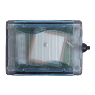
- Page 7 1. HI-203E Series Introductions HI-203E is a GPS receiver with PS/II mini-DIN interfaces and built-in active antenna for high sensitivity to tracking signal. HI-203E is well suited to system integration and users who use any kinds of mobile devices, such as, PDA, notebook PC, Tablet PC, etc.
- Page 8 Optional Accessories: • PS/II to PDA connector and car charger • PS/II to DB9 adapting cable • PS/II to USB adapting cable HI-203E-USB HI-203E-XXXX (Pocket PC Plug) HI-203E-DB9...
- Page 9 It features small size, low power consumption, and ease of use. The HI-203E is optimized for good performance and low cost. Its 12 parallel channels and 4000 time/frequency search bins provide very fast signal lock-on and rapid time to first fix.
- Page 10 1.2 Features • 12 parallel channel GPS receiver • 4000 simultaneous time-frequency search bins • Better than -135dBm sensitivity • < 10 second hot start • < 45 second cold start • 5m CEP accuracy...
-
Page 11: Receiver Operation
SECTION 2 RECEIVER OPERATION Upon power up, after initial self-test has completed, the HI-203E will begin satellite acquisition and tracking process. Under normal open-sky condition, position-fix can be achieved within approximately 35 seconds (within 10 seconds if valid ephemeris data is already collected from recent use). - Page 12 • Time • DOP error-magnification factor • GPS signal tracking status The HI-203E will perform 3D navigation when four or more satellites are tracked. When three or fewer satellites are tracked, altitude-hold is enabled using the last computed altitude and 2D navigation mode is entered.
-
Page 13: Technical Specifications
2.1 TECHNICAL SPECIFICATIONS FEATURES Receiver Type Accuracy Startup Time Reacquisition Acquisition Sensitivity Update Rate Dynamics Operational Limits Serial Interface Protocol Datum Interface Connector Input Voltage Current Consumption Dimension Weight: Operating Humidity 2.2 LED INDICATOR LED flashing 0.25Hz LED flashing 1Hz DESCRIPTIONS 12 parallel channel, L1 C/A code Position: 5m CEP... -
Page 14: Mechanical Dimensions
HARDWARE INTERFACE 3.1 MECHANICAL DIMENSIONS Top View 41±0.2 Lateral View 20±0.2 Bottom View 41±0.2 SECTION 3 58±0.2 Unit:mm I/O Cable I/O Cable LED indicator I/O Cable... -
Page 15: Pinout Description
HI-203E Lateral View 3.2 PINOUT DESCRIPTION Pin Number Signal Name Serial Data Out 1 Serial Data In 1 Serial Data Out 2 Serial Data In 2 Power Ground pin-1 Description Asynchronous serial output at LVTTL level, to output NMEA message... -
Page 16: One-Pulse-Per-Second (1Pps) Output
1usec in duration. Rising edge of the output pulse is accurate to +/-1usec with respect to the start of each GPS second. Accuracy of the one-pulse-per-second output is maintained only when the GPS receiver has valid position fix. The 1PPS output is always generated when the GPS receiver is powered-on. - Page 17 As long as enough satellite signals are received to generate valid position fixes, the 1PPS output remains synchronized to the GPS second, and the 1PPS Valid Signal remains active. If signal blockage prevents the receiver from generating valid position fix, the 1PPS output will drift away from the GPS second and the 1PPS Valid Signal will become inactive.
-
Page 18: Software Interface
SOFTWARE INTERFACE This section describes the details of the serial port commands through which the HI-203E is controlled and monitored. The serial port commands allow users to set the receiver parameters, configure output message type, and retrieve status information. The baud rate and protocol of... -
Page 19: Gga - Gps Fix Data
4.1.1 NMEA Messages The serial interface protocol is based on the National Marine Electronics Association's NMEA 0183 ASCII interface specification. This standard is fully define in "NMEA 0183, Version 3.01" The standard may be obtained from NMEA, www.nmea.org 4.1.2 GGA - GPS FIX DATA Time, position and position-fix related data (number of satellites in use, HDOP , etc.). - Page 20 Field Example Description 104549.04 UTC time in hhmmss.ss format, 000000.00 ~ 235959.99 2447.2038 Latitude in ddmm.mmmm format Leading zeros transmitted Latitude hemisphere indicator, 'N' = North, 'S' = South 12100.4990 Longitude in dddmm.mmmm format Leading zeros transmitted Longitude hemisphere indicator, 'E' = East, 'W' = West Position fix quality indicator 0: position fix unavailable...
- Page 21 4.1.3 GLL - LATITUDE AND LONGITUDE, WITH TIME OF Latitude and longitude of current position, time, and status. Format: $GPGLL,<1>,<2>,<3>,<4>,<5>,<6>,<7>*<8><CR><LF> Example: $GPGLL,2447.2073,N,12100.5022,E,104548.04,A, A*65<CR><LF> Field Example 2447.2073 12100.5022 104548.04 POSITION FIX AND STATUS Description Latitude in ddmm.mmmm format Leading zeros transmitted Latitude hemisphere indicator, 'N' = North, 'S' = South Longitude in dddmm.mmmm format...
- Page 22 4.1.4 GSA - GPS DOP AND ACTIVE SATELLITES GPS receiver operating mode, satellites used for navigation, and DOP values. Format: $GPGSA,<1>,<2>,<3>,<3>,<3>,<3>,<3>,<3>,<3>,<3>, <3>,<3>,<3>,<3>,<4>,<5>,<6>*<7><CR><LF> Example: $GPGSA,A,3,26,21,,,09,17,,,,,,,10.8,02.1,10.6*07<CR><LF> Field Example Description Mode, 'M' = Manual, 'A' = Automatic Fix type, 1 = not available,...
-
Page 23: Gsv - Gps Satellite In View
4.1.5 GSV - GPS SATELLITE IN VIEW Number of satellites in view, PRN number, elevation angle, azimuth angle, and C/No. Only up to four satellite details are transmitted per message. Additional satellite in view information is sent in subsequent GSV messages. Format: $GPGSV,<1>,<2>,<3>,<4>,<5>,<6>,<7>, ... - Page 24 4.1.6 RMC - RECOMMANDED MINIMUM SPECIFIC GPS/TRANSIT DATA Time, date, position, course and speed data. Format: $GPRMC,<1>,<2>,<3>,<4>,<5>,<6>,<7>,<8>,<9>,<10>, <11>,<12>*<13><CR><LF> Example: $GPRMC,104549.04,A,2447.2038,N,12100.4990,E, 016.0,221.0,250304,003.3,W,A*22<CR><LF> Field Example Description 104549.04 UTC time in hhmmss.ss format, 000000.00 ~ 235959.99 Status, 'V' = navigation receiver warning, 'A' = valid position 2447.2038 Latitude in dddmm.mmmm format Leading zeros transmitted...
- Page 25 4.1.7 VTG - COURSE OVER GROUND Velocity is given as course over ground (COG) and speed over ground (SOG). Format: GPVTG,<1>,T,<2>,M,<3>,N,<4>,K,<5>*<6><CR><LF> Example: $GPVTG,221.0,T,224.3,M,016.0,N,0029.6,K,A*1F<CR><LF> Field Example 221.0 224.3 016.0 0029.6 AND GROUND SPEED Description True course over ground, 000.0 ~ 359.9 degrees Magnetic course over ground, 000.0 ~ 359.9 degrees Speed over ground,...
-
Page 26: Zda Time And Date
4.1.8 ZDA TIME AND DATE Format: $GPZDA,<1>,<2>,<3>,<4>,<5>,<6>*<7><CR><LF> Example: $GPZDA,104548.04,25,03,2004,,*6C<CR><LF> Field Example Description 104548.04 UTC time in hhmmss.ss format, 000000.00 ~ 235959.99 UTC time: day (01 ... 31) UTC time: month (01 ... 12) 2004 UTC time: year (4 digit year) Local zone hour Not being output by the receiver (NULL) Local zone minutes... -
Page 27: Mechanical Characteristics
MECHANICAL CHARACTERISTICS 14.5 unit: mm 10.5 10.5... -
Page 28: Default Values
DOP Mask: Receiver Operating Mode: Commands can be issued to the HI-203E to change the settings of the receiver. The new settings will remain effective on next power-on as long as the on-board rechargeable backup battery is not discharged. After the backup battery is discharged, factory preset default settings will be used. -
Page 29: Troubleshooting
COM port Check HI-203E if Plug firmly Close all applications and exacute it again to re-open the COM port Put HI-203E to an open space or car roof, then, press the Reset button... -
Page 31: Wat E R P R O O F
WAT E R P R O O F WAT E R P R O O F G P S R e c e i v e r G P S R e c e i v e r...