Sign In
Upload
Manuals
Brands
Furuno Manuals
Monitor
TZT14
Furuno TZT14 Manuals
Manuals and User Guides for Furuno TZT14. We have
7
Furuno TZT14 manuals available for free PDF download: Operator's Manual, Installation Manual, User Handbook Manual, Setup Procedure
Furuno TZT14 Operator's Manual (291 pages)
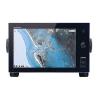
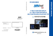
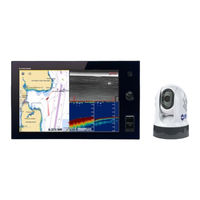
Marine GPS Chartplotters NAVnet TZ touch 9"/14.1" Multi Function Displays Black box type
Brand:
Furuno
| Category:
GPS
| Size: 49.58 MB
Table of Contents
Important Notices
2
Safety Instructions
3
Table of Contents
5
Foreword
12
System Configuration
14
1 System Introduction
16
Controls
17
Remote Control Unit (Option)
21
Remote Control Unit MCU-002
21
Remote Control Unit MCU-004
22
Power on and off
25
How to Adjust the Brilliance of Display or Power Indicator
25
How to Select a Display
26
SD Cards
27
Chart Plotter Introduction
29
Radar Introduction
30
Sounder (Fish Finder) Introduction
31
Rotokey Menus
32
Pop-Up Menus
33
Data Area (Data Box)
33
How to Set and Operate the Data Boxes
34
Data Cycling
36
How to Adjust Transparency of the Data Box
37
Menu Introduction
37
Display] Menu on the Rotokey Menu (TZT9/TZT14 Only)
40
Function Gesture on the Main Menu
40
Language
41
Boat Icon
42
Man Overboard (MOB)
42
Facsimile Receiver FAX-30
45
AIS Transponder FA-30, FA-50
46
DSC Message Information
47
DSC Notification
47
How to Show or Hide the DSC Message Information
47
How to Go to a DSC Point
47
How to Display the DSC Information
47
The DSC List
48
Wireless LAN Settings
49
Software Update
53
Operation by Wireless Terminal
53
How to Create a My Timezero ™ Account, Login to Your My Timezero ™ Account
54
2 Chart Plotter
56
Chart Type
56
Chart Scale
57
Orientation Mode
57
How to Move the Chart
58
The Boat Icon
58
How to Find the Range and Bearing to a Location
60
Chart Object Information
61
Multiple Chart Plotter Displays
62
Cartographic Text and Objects on Vector Charts
63
Control Visibility of Text and Object Information
63
Control Visibility of Cartographic Objects
64
Alarms
65
XTE Alarm
66
Depth Alarm
66
SST Alarm
67
Speed Alarm
67
Anchor Watch Alarm
68
Alarm Menus
68
How to Stop the Alarm Sound
69
Track
69
How to Show or Hide the Track Display
70
Track Interval
70
Track Color
70
Track Thickness
73
How to Delete Tracks
73
How to Turn on the Automatic Deleting of Tracks
74
How to Record Tracks
74
How to Replay a Saved Track
74
How to Remove a Replayed Track
74
Navpilot-700 Series Auto Pilot
76
How to Show the Navpilot-700 Series Data in the Data Boxes
76
How to Change the Steering Mode
76
Plotter Display Menu
80
500 D Display, Overlays
82
Display
82
Aerial View
82
How to Activate the 3D Display
83
How to Make the 3D View Clearer
83
Overlays
84
Depth Shading Overlay
84
Satellite Photo Overlay
86
Radar Overlay
87
Tide Icon Overlay
88
Tidal Current Overlay
90
4 Points
94
About Points
94
How to Put a Point or an Event Mark
94
How to Put a Point
94
How to Put an Event Mark
95
How to Display the Point Information
95
Default Point Settings
96
How to Move a Point
98
How to Move a Point on the Screen
98
How to Delete a Point
98
How to Move a Point from the Points List
98
How to Delete a Point on the Screen
98
How to Delete a Point from the Points List
99
How to Delete All Points
99
How to Edit a Point
99
How to Edit a Point on the Screen
99
How to Edit a Point from the Points List
101
How to Find a Point
103
How to Show or Hide All Points or Points Names
103
How to Set Point Density
103
How to Go to a Point
104
How to Go to an On-Screen Point
105
How to Go to a Position Selected on Screen
106
How to Go to a Point Selected from the Points List
107
How to Display the Point Information for the Active Route
108
How to Restart and Cancel Navigation to a Point
108
How to Restart Navigation to a Point
108
How to Cancel Navigation to a Point
109
5 Routes
110
What Is a Route
110
How to Create a Route
110
How to Create a New Route
110
How to Create a New Route from a Point
111
How to Insert a Route Point on a Route
112
How to Move a Route Point on a Route
112
How to Delete a Point or Route Point on a Route
113
How to Remove a Point from a Route
113
How to Extend a Route
113
How to Split a Route
114
Routes List
114
How to Join Points to Create a Route
116
How to Find a Route on the Chart
116
How to Delete a Route
117
How to Delete a Route on the Screen
117
How to Delete a Route from the Routes List
117
How to Delete All Routes
117
How to Show or Hide All Routes
117
How to Follow a Route
117
How to Follow an On-Screen Route
117
How to Follow a Route Selected from the Routes List
118
How to Start Navigation from a Route Point
119
How to Show the Detailed Information about a Route
120
Flyover
120
Operations When You Follow a Route
120
How to Restart Navigation
120
How to Follow a Route in the Reverse Direction
121
How to Stop Following a Route
121
How to Skip a Go to Point on a Route
121
Waypoint Switching Mode
121
Route Auto Zoom
122
XTE Lines
122
Waypoint Arrival Notification
122
End of Route Notification
123
Fuel Level
123
Routes Menu
124
6 Radar
126
Transmit, Stand-By
126
Tuning
126
How to Adjust the Gain
127
How to Reduce the Sea Clutter
128
How to Reduce the Rain Clutter
129
Range Scale
129
Orientation Mode
130
How to Measure the Range and Bearing from Your Ship to a Target
131
How to Display the Range Rings
131
How to Set the Number of the Range Rings
131
How to Select the Range Rings Mode
132
How to Measure the Range and Bearing with the Ruler
133
How to Measure the Range with the VRM
133
How to Measure the Bearing with the EBL
134
How to Select the EBL Reference
134
How to Measure the Range and Bearing between Two Targets
135
How to Off-Center the Picture
135
Heading Line
135
How to Reduce Radar Interference
136
Guard Zone
136
How to Set the Guard Zone
136
How to Activate or Deactivate the Guard Zone
136
How to Hide the Guard Zone
137
Guard Zone Menus
137
Watchman
137
Echo Trails
138
How to Show or Hide Echo Trails
138
How to Clear Echo Trails to Restart New Echo Trails
138
Echo Trail Time
138
Echo Trail Mode (Reference)
139
Echo Trail Color
139
Echo Trail Shading
140
Echo Stretch
140
Echo Average
140
Sweep Fade
141
How to Show, Hide or Cancel an Active Route
141
How to Show or Hide the Boat Icon
142
Echo Color
142
Background Color
142
Radar Overlay Range Link
143
Dual-Range Display
143
Target Analyzer
144
Rezboost
145
Bird Mode
145
FAR-2Xx7 Radar Series and Navnet Tztouch
147
How to Understand the Radar Display
148
False Echoes
148
Search and Rescue Transponder (SART), Racon
149
Pulse Compression Radar Principles
151
ARPA Operation
152
How to Show or Hide the ARPA Display
152
How to Manually Acquire a Target
153
How to Automatically Acquire a Target
153
How to Display Target Data
154
How to Stop Tracking Targets
155
How to Clear a Lost Target
155
CPA/TCPA Alarm
155
CPA Graphic Display
156
7 Fish Finder
158
How the Fish Finder Operates
158
How to Select a Display
158
Single Frequency Display
159
Dual Frequency Display
160
A-Scope Display (Display Only)
162
Bottom Discrimination Display
163
How to Select an Automatic Fish Finder Mode
164
How to Shift the Range
165
Picture Advance Speed
166
How to Reduce Interference
167
How to Balance Echo Strength
168
How to Set an Alarm
169
Alarm Sensitivity
170
Fish Size Correction
172
Fish Finder Menu Operation
173
LCD Color Sounder FCV-1150 and Navnet Tztouch
176
Interpreting the Display
178
8 Multi Beam Sonar Dff-3D
182
Multi-Sounder Display Operations
185
Availability of Points and Event Marks Registration, and Go to a Point
186
Side Scan Display Operations
187
Cross Section Display Operations
188
How to Smooth Echoes (Distance)
189
How to Show or Hide the Scale Box
190
D Sounder History Display Operations
191
How to Stop Advancement of the Display
192
How to Use Terrain Shading
193
How to Show or Hide the Scale Box
196
Availability of Points and Event Marks Registration, and Go to a Point
197
9 File Operations
198
Files Menu Operation
199
File Format
200
How to Export Points and Routes
201
How to Import or Export Tracks
202
How to Backup the Equipment Settings
203
How to Copy Files from an SD Card
204
How to Backup Data to the Cloud
205
10 CAMERA/VIDEO/FUSION-Link
206
How to Set the Video Display
207
How to Adjust the Image Size
210
Pop-Up Menus by the FLIR Camera
211
How to Adjust the Video Image
212
FUSION-Link
213
FUSION Settings
215
11 Instrument Display
216
Instrument Displays
217
Tank Level Display
218
Wind Display
219
Highway Display
220
Weather
222
12 Weather
223
Navcenter Weather
223
How to Download the Navcenter Data
224
How to Display the Navcenter Data
225
How to Load a Weather File
226
Sirius Weather
227
How to Display the Sirius Data
228
Weather Icons (Sirius Weather)
229
Weather Data (Navcenter or Sirius)
230
Weather Reports
235
13 Automatic Identification System (Ais)
236
Proximity AIS Target Alarm
237
How to Ignore the AIS Targets
238
How to Display the Target Data
239
AIS List
240
How to Register an AIS or DSC to the Buddies List
241
Receiving AIS Messages
243
CPA Graphic Display
244
14 How to Adjust Settings
246
How to Set the Display Selection Window
253
General and Units Menus
255
Advertisement
Furuno TZT14 Operator's Manual (253 pages)
MULTIFUNCTION DISPLAY
Brand:
Furuno
| Category:
Marine Equipment
| Size: 33.83 MB
Table of Contents
Important Notices
2
Table of Contents
5
Foreword
11
System Configuration
13
1 System Introduction
16
Controls
17
Remote Control Unit MCU-002 (Option)
21
Power on and off
22
How to Adjust the Brilliance of Display or Power Indicator
23
How to Select a Display
23
SD Cards
24
Chart Plotter Introduction
26
Radar Introduction
27
Sounder (Fish Finder) Introduction
28
Rotokey Menus
29
Pop-Up Menus
30
Data Area (Data Box)
30
How to Set the Data Boxes
31
Data Cycling
33
How to Adjust Transparency of the Data Box
34
Menu Introduction
34
Display] Menu on the Rotokey Menu (TZT9/TZT14 Only)
37
Function Gesture on the Main Menu
37
Language
38
Boat Icon
39
Man Overboard (MOB)
39
Facsimile Receiver FAX-30
42
AIS Transponder FA-30, FA-50
43
DSC Message Information
44
DSC Notification
44
How to Show or Hide the DSC Message Information
44
How to Go to a DSC Point
44
How to Display the DSC Information
44
The DSC List
45
Wireless LAN Settings
46
Software Update
50
Operation by Wireless Terminal
50
2 Chart Plotter
52
Chart Type
52
Chart Scale
53
Orientation Mode
53
How to Move the Chart
54
The Boat Icon
54
How to Find the Range and Bearing to a Location
56
Chart Object Information
57
Multiple Chart Plotter Displays
58
Cartographic Text and Objects on Vector Charts
59
Control Visibility of Text and Object Information
59
Control Visibility of Cartographic Objects
60
Alarms
61
XTE Alarm
62
Depth Alarm
62
SST Alarm
63
Speed Alarm
63
Anchor Watch Alarm
64
Alarm Menus
64
How to Stop the Alarm Sound
65
Track
65
How to Show or Hide the Track Display
66
Track Interval
66
Track Color
66
Track Thickness
69
How to Delete Tracks
69
How to Turn on the Automatic Deleting of Tracks
70
How to Record Tracks
70
How to Replay a Saved Track
70
How to Remove a Replayed Track
70
Navpilot-700 Series Auto Pilot
72
How to Show the Navpilot-700 Series Data in the Data Boxes
72
How to Change the Steering Mode
72
Plotter Display Menu
75
500 D Display, Overlays
78
Display
78
Aerial View
78
How to Activate the 3D Display
79
How to Make the 3D View Clearer
79
Overlays
80
Depth Shading Overlay
80
Satellite Photo Overlay
82
Radar Overlay
83
Tide Icon Overlay
84
Tidal Current Overlay
86
4 Points
90
About Points
90
How to Put a Point or an Event Mark
90
How to Put a Point
90
How to Put an Event Mark
91
How to Display the Point Information
91
Default Point Settings
92
How to Move a Point
94
How to Move a Point on the Screen
94
How to Delete a Point
94
How to Move a Point from the Points List
94
How to Delete a Point on the Screen
94
How to Delete a Point from the Points List
95
How to Delete All Points
95
How to Edit a Point
95
How to Edit a Point on the Screen
95
How to Edit a Point from the Points List
97
How to Find a Point
99
How to Show or Hide All Points or Points Names
99
How to Go to a Point
99
How to Go to an On-Screen Point
100
How to Go to a Position Selected on Screen
101
How to Go to a Point Selected from the Points List
102
How to Display the Point Information for the Active Route
103
How to Restart and Cancel Navigation to a Point
103
How to Restart Navigation to a Point
103
How to Cancel Navigation to a Point
103
5 Routes
104
What Is a Route
104
How to Create a Route
104
How to Create a New Route
104
How to Create a New Route from a Point
105
How to Insert a Route Point on a Route
106
How to Move a Route Point on a Route
106
How to Delete a Point or Route Point on a Route
107
How to Remove a Point from a Route
107
How to Extend a Route
107
How to Split a Route
108
Routes List
108
How to Join Points to Create a Route
110
How to Find a Route on the Chart
110
How to Delete a Route
111
How to Delete a Route on the Screen
111
How to Delete a Route from the Routes List
111
How to Delete All Routes
111
How to Show or Hide All Routes
111
How to Follow a Route
111
How to Follow an On-Screen Route
111
How to Follow a Route Selected from the Routes List
112
How to Start Navigation from a Route Point
113
How to Show the Detailed Information about a Route
114
Flyover
114
Operations When You Follow a Route
115
How to Restart Navigation
115
How to Follow a Route in the Reverse Direction
115
How to Stop Following a Route
115
How to Skip a Go to Point on a Route
115
Waypoint Switching Mode
116
Route Auto Zoom
116
XTE Lines
117
Waypoint Arrival Notification
117
End of Route Notification
117
Fuel Level
118
Routes Menu
118
6 Radar
120
How to Transmit, Set the Radar in Stand-By, Tune
120
How to Adjust the Gain
121
How to Reduce the Sea Clutter
122
How to Reduce the Rain Clutter
123
Range Scale
123
Orientation Mode
124
How to Measure the Range and Bearing from Your Ship to a Target
125
How to Display the Range Rings
125
How to Set the Number of the Range Rings
125
How to Select the Range Rings Mode
126
How to Measure the Range and Bearing with the Ruler
127
How to Measure the Range with the VRM
127
How to Measure the Bearing with the EBL
128
How to Select the EBL Reference
128
How to Measure the Range and Bearing between Two Targets
129
How to Off-Center the Picture
129
Heading Line
129
How to Reduce Radar Interference
130
Guard Zone
130
How to Set the Guard Zone
130
How to Activate or Deactivate the Guard Zone
130
How to Hide the Guard Zone
131
Guard Zone Menus
131
Watchman
131
Echo Trails
132
How to Show or Hide Echo Trails
132
How to Clear Echo Trails to Restart New Echo Trails
132
Echo Trail Time
132
Echo Trail Mode (Reference)
133
Echo Trail Color
133
Echo Trail Shading
134
Echo Stretch
134
Echo Average
134
Sweep Fade
135
How to Show, Hide or Cancel an Active Route
135
How to Show or Hide the Boat Icon
136
Echo Color
136
Background Color
136
Radar Overlay Range Link
137
Dual-Range Display
137
FAR-2Xx7 Radar Series and Navnet Tztouch
138
How to Understand the Radar Display
139
False Echoes
139
Search and Rescue Transponder (SART)
141
ARPA Operation
142
How to Show or Hide the ARPA Display
142
How to Manually Acquire a Target
142
How to Automatically Acquire a Target
143
How to Display Target Data
144
How to Stop Tracking Targets
144
How to Clear a Lost Target
144
CPA/TCPA Alarm
145
7 Fish Finder
146
How the Fish Finder Operates
146
How to Select a Display
146
Single Frequency Display
147
Dual Frequency Display
148
Zoom Displays
148
A-Scope Display (Display Only)
150
Bottom Discrimination Display
151
Automatic Fish Finder Operation
151
How the Automatic Fish Finder Operates
151
How to Select an Automatic Fish Finder Mode
152
Manual Fish Finder Operation
152
How to Select the Manual Mode
152
How to Select the Display Range
152
How to Shift the Range
153
Picture Advance Speed
154
How to Reduce Interference
154
How to Measure Range, Depth or Time to an Object
155
How to Balance Echo Strength
156
Fish Finder Alarms
156
How to Set an Alarm
156
How to Activate or Deactivate an Alarm
157
Alarm Sensitivity
158
Accu-Fishtm
158
How to Set ACCU-FISHTM
159
Fish Size Correction
160
How to Turn the Fish Symbol Indication on
160
How to Display the Fish Information
160
How to Put a Point, Go to a Point or a Position
160
Fish Finder Menu Operation
161
LCD Color Sounder FCV-1150 and Navnet
164
Interpreting the Display
166
8 File Operations
170
How to Format SD Cards
170
Files Menu Operation
170
File Format
171
How to Export Points and Routes
172
How to Import Points and Routes
172
How to Import or Export Tracks
173
How to Backup the Equipment Settings
174
How to Load the Equipment Settings
174
How to Copy the Equipment Settings
175
How to Delete Points, Routes and Tracks
175
9 CAMERA/VIDEO/FUSION-Link
176
How to Display a Video Image
176
Video Signal Type
176
How to Set the Video Display
177
How to Select the Input Source
177
How to Set each Video Signal
177
How to Adjust the Image Size
179
How to Cycle Your Video Inputs
180
Pop-Up Menus by the FLIR Camera
181
How to Adjust the Video Image
181
Touch Control on the Camera Display
182
FUSION-Link
183
10 Instrument Display
186
How to Show the Instrument Display
186
How to Select an Instrument Display
186
Instrument Displays
187
Steering Display
187
Engine Display
187
Tank Level Display
188
Weather Display
188
Wind Display
189
11 Weather
190
Weather Display Introduction
190
Navcenter Weather
191
Pre-Settings
191
How to Download the Navcenter Data
192
How to Display the Navcenter Data
193
How to Load a Weather File
194
Sirius Weather
195
Pre-Settings
195
How to Display the Sirius Data
196
Weather Icons (Sirius Weather)
197
Weather Data (Navcenter or Sirius)
198
Weather Reports
203
12 Automatic Identification System (Ais)
204
AIS Introduction
204
How to Show or Hide the AIS Symbols
204
AIS Target Symbols
204
Proximity AIS Target Alarm
205
How to Ignore the AIS Targets
206
How to Display the Target Data
207
How to Show and Hide the Target Ids
207
AIS List
208
How to Register an AIS or DSC to the Buddies List
209
13 How to Adjust Settings
212
Rotokey Mode
212
How to Set the Display Selection Window
219
General and Units Menus
221
Furuno TZT14 Operator's Manual (223 pages)
9 inch multi function display, 14 inch multi function display
Brand:
Furuno
| Category:
Monitor
| Size: 25.18 MB
Table of Contents
Important Notices
2
Table of Contents
5
Foreword
11
System Configuration
13
1 System Introduction
14
Controls
15
Power on and off
18
How to Adjust Display Brilliance
18
How to Select a Display
19
SD Cards
19
Chart Plotter Introduction
22
Radar Introduction
23
Sounder (Fish Finder) Introduction
24
Rotokey Menus
25
Pop-Up Menus
26
Data Area (Data Box)
26
How to Set the Data Boxes
27
Data Cycling
29
How to Adjust Transparency of the Data Box
30
Menu Introduction
30
Display] Menu on the Rotokey Menu
33
Function Gesture on the Main Menu
33
Language
34
Boat Icon
35
Man Overboard (MOB)
35
Facsimile Receiver FAX-30
38
AIS Transponder FA-30, FA-50
39
DSC Message Information
40
How to Show or Hide the DSC Message Information
40
How to Go to a DSC Point
40
How to Display the DSC Information
40
The DSC List
41
Wireless LAN Settings
42
2 Chart Plotter
46
Chart Type
46
Chart Scale
47
Orientation Mode
47
How to Move the Chart
47
The Boat Icon
48
How to Find the Range and Bearing to a Location
50
Chart Object Information
50
Multiple Chart Plotter Displays
51
Cartographic Text and Objects on Vector Charts
52
Control Visibility of Text and Object Information
52
Control Visibility of Cartographic Objects
53
Alarms
54
XTE Alarm
55
Depth Alarm
55
SST Alarm
56
Speed Alarm
56
Anchor Watch Alarm
57
Alarm Menus
57
How to Stop the Alarm Sound
58
Track
58
How to Show or Hide the Track Display
59
Track Interval
59
Track Color
59
Track Thickness
62
How to Delete Tracks
62
How to Turn on the Automatic Deleting of Tracks
63
How to Record Tracks
63
How to Replay a Saved Track
63
How to Remove a Replayed Track
63
Plotter Display Menu
65
500 D Display, Overlays
68
Display
68
Aerial View
68
How to Activate the 3D Display
69
How to Make the 3D View Clearer
69
Overlays
70
Depth Shading Overlay
70
Satellite Photo Overlay
71
Radar Overlay
72
Tide Icon Overlay
74
Tidal Current Overlay
76
4 Points
78
About Points
78
How to Put a Point or an Event Mark
78
How to Put a Point
78
How to Put an Event Mark
79
How to Display the Point Information
79
Default Point Settings
80
How to Move a Point
81
How to Move a Point on the Screen
81
How to Delete a Point
82
How to Delete a Point on the Screen
82
How to Delete a Point from the Points List
82
How to Delete All Points
82
How to Edit a Point
83
How to Edit a Point on the Screen
83
How to Edit a Point from the Points List
84
How to Find a Point
86
How to Show or Hide All Points or Points Names
86
How to Go to a Point
86
How to Go to an On-Screen Point
87
How to Go to a Position Selected on Screen
88
How to Go to a Point Selected from the Points List
89
How to Display the Point Information for the Active Route
90
How to Restart and Cancel Navigation to a Point
90
How to Restart Navigation to a Point
90
How to Cancel Navigation to a Point
90
5 Routes
92
What Is a Route
92
How to Create a Route
92
How to Create a New Route
92
How to Create a New Route from a Point
93
How to Insert a Route Point on a Route
94
How to Move a Route Point on a Route
94
How to Delete a Point or Route Point on a Route
95
How to Remove a Point from a Route
95
How to Extend a Route
95
Routes List
96
How to Split a Route
96
How to Join Points to Create a Route
98
How to Find a Route on the Chart
98
How to Delete a Route
99
How to Delete a Route on the Screen
99
How to Delete a Route from the Routes List
99
How to Delete All Routes
99
How to Show or Hide All Routes
99
How to Follow a Route
99
How to Follow an On-Screen Route
99
How to Follow a Route Selected from the Routes List
100
How to Start Navigation from a Route Point
101
How to Show the Detailed Information about a Route
102
Flyover
102
Operations When You Follow a Route
103
How to Restart Navigation
103
How to Follow a Route in the Reverse Direction
103
How to Stop Following a Route
103
How to Skip a Go to Point on a Route
103
Waypoint Switching Mode
104
Route Auto Zoom
104
XTE Lines
105
Waypoint Arrival Notification
105
End of Route Notification
105
Routes Menu
106
6 Radar
108
How to Transmit, Set the Radar in Stand-By, Tune
108
How to Adjust the Gain
109
How to Reduce the Sea Clutter
110
How to Reduce the Rain Clutter
111
Range Scale
111
Orientation Mode
112
How to Measure the Range and Bearing from Your Ship to a Target
112
How to Display the Range Rings
112
How to Set the Number of the Range Rings
113
How to Select the Range Rings Mode
113
How to Measure the Range and Bearing with the Ruler
114
How to Measure the Range and Bearing between Two Targets
115
How to Off-Center the Picture
115
Heading Line
115
How to Reduce Radar Interference
116
Guard Zone
116
How to Set the Guard Zone
116
How to Activate or Deactivate the Guard Zone
117
How to Hide the Guard Zone
117
Guard Zone Menus
117
Echo Trails
117
How to Show or Hide Echo Trails
117
How to Clear Echo Trails to Restart New Echo Trails
117
Echo Trail Time
117
Echo Trail Mode (Reference)
118
Echo Trail Color
119
Echo Trail Shading
119
Echo Stretch
120
Echo Average
120
Sweep Fade
121
How to Show, Hide or Cancel an Active Route
121
How to Show or Hide the Boat Icon
121
Echo Color
122
Background Color
122
Radar Overlay Range Link
123
Dual-Range Display
123
How to Understand the Radar Display
124
False Echoes
124
Search and Rescue Transponder (SART)
125
ARPA Operation
127
How to Show or Hide the ARPA Display
127
How to Manually Acquire a Target
127
How to Automatically Acquire a Target
128
How to Display Target Data
129
How to Stop Tracking Targets
129
How to Clear a Lost Target
129
CPA/TCPA Alarm
130
7 Fish Finder
132
How the Fish Finder Operates
132
How to Select a Display
132
Single Frequency Display
133
Dual Frequency Display
133
Zoom Displays
134
A-Scope Display (Display Only)
135
Bottom Discrimination Display
136
Automatic Fish Finder Operation
136
How the Automatic Fish Finder Operates
136
How to Select an Automatic Fish Finder Mode
137
Manual Fish Finder Operation
137
How to Select the Manual Mode
137
How to Select the Display Range
137
How to Shift the Range
137
How to Adjust the Gain
138
How to Reduce the Clutter
138
Picture Advance Speed
139
How to Reduce Interference
139
How to Measure Range, Depth or Time to an Object
140
How to Balance Echo Strength
141
Fish Finder Alarms
141
How to Set an Alarm
141
How to Activate or Deactivate an Alarm
142
Alarm Sensitivity
143
Accu-Fish Tm
143
How to Set ACCU-FISH TM
144
Fish Size Correction
145
How to Turn the Fish Symbol Indication on
145
How to Put a Point, Go to a Point or a Position
145
Fish Finder Menu Operation
146
Interpreting the Display
149
8 File Operations
154
How to Format SD Cards
154
Files Menu Operation
154
File Format
155
How to Export Points and Routes
156
How to Import Points and Routes
156
How to Backup the Equipment Settings
157
How to Load the Equipment Settings
157
How to Copy the Equipment Settings
158
9 Camera/Video
160
How to Display a Video Image
160
How to Set the Video Display
160
How to Select the Input Source
160
How to Cycle Your Video Inputs
161
How to Adjust the Video Image
161
10 Instrument Display
162
How to Show the Instrument Display
162
How to Select an Instrument Display
162
Instrument Displays
163
Steering Display
163
Engine Display
163
Weather Display
164
Wind Display
164
11 Weather
166
Weather Display Introduction
166
Navcenter Weather
167
Pre-Settings
167
How to Download the Navcenter Data
168
How to Display the Navcenter Data
169
Sirius Weather
170
Pre-Settings
170
How to Display the Sirius Data
172
Weather Icons (Sirius Weather)
173
Weather Data (Navcenter or Sirius)
173
12 Automatic Identification System (Ais)
180
AIS Introduction
180
How to Show or Hide the AIS Symbols
180
AIS Target Symbols
180
Proximity AIS Target Alarm
181
How to Ignore the AIS Targets
182
How to Display the Target Data
183
How to Show and Hide the Target Ids
183
AIS & DSC List
184
How to Register an AIS or DSC to the Buddies List
185
13 How to Adjust Settings
188
Rotokey Mode
188
How to Set the Display Selection Window
194
General and Units Menus
196
Advertisement
Furuno TZT14 Installation Manual (74 pages)
Multi function display
Brand:
Furuno
| Category:
Monitor
| Size: 8.82 MB
Table of Contents
Table of Contents
1
Safety Instructions
3
System Configuration
4
Equipment Lists
6
Mounting
9
Installation of Multi Function Display
9
Installation of Transducers
15
Wiring
27
Interface Connections (Rear of Unit)
27
Composite Connector
28
How to Secure and Waterproof Connections
28
Power Cable
29
MULTI Cable
29
DRS Radar Sensor Connections
30
Network Connection with Other TZT Series Units
30
NMEA 2000 Connector
30
Transducer (Option)
35
Example TZT9F System Configurations
36
How to Set up the Equipment
39
How to Set Time Zone, Time Format and Language
42
How to Set Units of Measurement
44
Initial Setup
45
How to Set up the Radar
51
How to Set up the Fish Finder
54
Wireless LAN Setting
59
Ferry Mode
61
How to Manage Your Charts
61
IP Camera Setup
64
Appx. 1 Transducer List
65
Furuno TZT14 Installation Manual (52 pages)
Multi Function Display
Brand:
Furuno
| Category:
Monitor
| Size: 11.25 MB
Table of Contents
Table of Contents
1
Safety Instructions
3
System Configuration
4
Equipment Lists
5
1 Mounting
7
Mounting Considerations
7
Flush Mounting
8
Desktop Mounting
10
2 Wiring
11
Wiring Instructions
11
CAN Bus/Nmea0183 Data Conversion and CAN Bus Bridging
18
Example Navnet Tztouch System Configurations
21
3 Setting up the Equipment
23
How to Set Time Zone, Language and Units
25
Menu Initial Setup
27
How to Set up the Radar
30
How to Set up the Sounder
33
Wireless LAN Setting
35
Furuno TZT14 User Handbook Manual (16 pages)
Multi Function Display
Brand:
Furuno
| Category:
Monitor
| Size: 12.23 MB
Table of Contents
Table of Contents
1
Controls
1
Chart Plotter
3
Radar
6
AIS (Automatic Identification System)
10
Fish Finder
11
Wireless LAN Setting
14
Furuno TZT14 Setup Procedure (11 pages)
FLIR Camera Setup Procedures
Brand:
Furuno
| Category:
Security Camera
| Size: 1.03 MB
Advertisement
Related Products
Furuno TZT12F
Furuno TZT19F
Furuno TZT16F
Furuno TZT16X
Furuno TZtouchXL TZT10X
Furuno TZtouchXL TZT13X
Furuno TZT9
Furuno NAVNET TZTOUCH2 TZTL15F
Furuno TZtouch2 TZTL12F
Furuno TZtouch2 TZT2BB
Furuno Categories
Marine Radar
Marine Equipment
Sonar
Monitor
GPS
More Furuno Manuals
Login
Sign In
OR
Sign in with Facebook
Sign in with Google
Upload manual
Upload from disk
Upload from URL