Sign In
Upload
Manuals
Brands
Garmin Manuals
GPS
GPSMAP 720s
Garmin GPSMAP 720s Chartplotter Manuals
Manuals and User Guides for Garmin GPSMAP 720s Chartplotter. We have
6
Garmin GPSMAP 720s Chartplotter manuals available for free PDF download: Owner's Manual, Important Safety Information, Installation Instructions Manual, Quick Reference Manual
Garmin GPSMAP 720s Owner's Manual (104 pages)
GPSMAP 700 Series
Brand:
Garmin
| Category:
GPS
| Size: 5.02 MB
Table of Contents
Tips and Shortcuts
3
Manual Conventions
3
Table of Contents
4
Getting Started
5
Front and Back Panels
5
Turning on the Chartplotter
5
Turning off the Chartplotter
6
Initial Chartplotter Settings
6
GPS Satellite Signal Acquisition
6
Adjusting the Backlight
6
Adjusting the Color Mode
6
Inserting and Removing Data and Memory Cards
6
Viewing System Information
7
About the Home Screen
7
Charts and 3D Chart Views
8
Navigation Chart
8
Chart Symbols
9
Navigating to a Point on the Chart
9
Viewing Location and Object Information on a Chart
10
Viewing Tide Station Information
11
Viewing Details about Navaids
12
Automatic Identification System
16
Perspective 3D
20
Bluechart G2 Vision
21
Mariner's Eye 3D
22
Fish Eye 3D
24
Fishing Chart
24
Showing Satellite Imagery on the Navigation Chart
25
Viewing Aerial Photos of Landmarks
26
Animated Tide and Current Indicators
27
Detailed Road and POI Data
27
Auto Guidance
27
Combinations
28
About the Combinations Screen
28
Combinations Screen Configuration
28
Navigation
31
Basic Navigation Questions
31
Navigation with a Chartplotter
31
Waypoints
33
Routes
34
Creating and Saving a Route
35
Editing a Saved Route
36
Deleting a Saved Route
36
Deleting All Saved Routes
36
Tracks
37
Setting the Color of the Active Track
38
Saving the Active Track
38
Viewing a List of Saved Tracks
38
Editing a Saved Track
38
Saving a Track as a Route
38
Deleting a Saved Track
38
Deleting All Saved Tracks
38
Retracing the Active Track
38
Navigating with a Garmin Autopilot
39
Where to
40
Marine Services Destinations
40
Browsing for and Navigating a Saved Route
42
Browsing for and Navigating a Recorded Track
43
Almanac, On-Boat, and Environmental Data
44
Almanac Data
44
Current Information
45
On-Boat Data
46
Environmental Data
49
Device Configuration
52
Basic Device Configuration Questions
52
Simulator Mode
52
Turning the Chartplotter on Automatically
52
Display Configuration
53
Navigation Preferences
53
Auto Guidance Line Configurations
54
Coordinate Systems
56
Units of Measure
56
Information about Your Boat
60
Alarms
60
System Alarms
61
Chartplotter Data Management
62
Backing up Data to a Computer
63
Restoring Backup Data to a Chartplotter
63
Radar
64
Transmitting Radar Signals
64
Adjusting the Zoom Scale on the Radar Screen
64
Radar Display Modes
65
Sentry Mode
67
Waypoints and Routes on the Radar Screen
70
Optimizing the Radar Display
72
Radar Display Appearance
76
Radar Display Settings
77
Sonar
80
Sonar Views
80
Split Zoom
81
Transducer Temperature Log
82
Waypoints on the Sonar Screen
82
Sonar Display Appearance
83
Configuring the Appearance of Suspended Targets
84
Adjusting the Gain on the Sonar Screen
85
Selecting Frequencies
85
Adjusting the Range of the Depth Scale
85
Sonar Alarms
86
Transducer Configuration
87
Digital Selective Calling
88
Chartplotter and VHF Radio Functionality
88
Turning on DSC
88
About the DSC List
88
Incoming Distress Calls
89
Man-Overboard Distress Calls Initiated from a VHF Radio
89
Man-Overboard Distress Calls Initiated from the Chartplotter
90
Position Tracking
90
Individual Routine Calls
92
Making an Individual Routine Call to an AIS Target
93
Appendix
94
Specifications
94
Calibrating the Touchscreen
94
Screenshots
95
Viewing GPS Satellite Locations
95
Using WAAS/EGNOS
95
System Information
95
NMEA 0183 and NMEA 2000
96
Nmea 2000
97
Product Registration
98
Contact Garmin
98
Declaration of Conformity
98
Software License Agreement
98
Index
99
Advertisement
Garmin GPSMAP 720s Owner's Manual (100 pages)
Garmin Chartplotter Owner's Manual
Brand:
Garmin
| Category:
GPS
| Size: 7.96 MB
Table of Contents
Introduction
3
Manual Conventions
3
Tips and Shortcuts
3
Table of Contents
4
Front and Back Panels
5
Getting Started
5
Turning off the Chartplotter
5
Turning on the Chartplotter
5
Adjusting the Backlight
6
Adjusting the Color Mode
6
GPS Satellite Signal Acquisition
6
Initial Chartplotter Settings
6
Inserting and Removing Data and Memory Cards
6
About the Home Screen
7
Viewing System Information
7
Charts and 3D Chart Views
8
Navigation Chart
8
Chart Symbols
9
Navigating to a Point on the Chart
9
Viewing Tide Station Information
11
Viewing Details about Navaids
12
Heading Line
13
Automatic Identification System
16
Perspective 3D
19
Bluechart G2 Vision
20
Mariner's Eye 3D
21
Fish Eye 3D
22
Fishing Chart
23
Showing Satellite Imagery on the Navigation Chart
24
Viewing Aerial Photos of Landmarks
24
Animated Tide and Current Indicators
25
Auto Guidance
25
Detailed Road and Point of Interest Data
25
About the Combination Screen
26
Combination Screen Configuration
26
Combinations
26
Configuration
26
Basic Navigation Questions
29
Navigation
29
Navigation with a Chartplotter
29
Waypoints
30
Routes
32
Creating and Saving a Route
33
Editing a Saved Route
33
Tracks
34
Navigating with a Garmin Autopilot
36
Marine Services Destinations
37
Where to
37
Almanac Data
40
Almanac, On-Boat, and Environmental Data
40
Current Information
41
Current Station Information
41
On-Boat Data
42
Environmental Data
45
Basic Device Configuration Questions
48
Device Configuration
48
Simulator Mode
48
Turning the Chartplotter on Automatically
48
Display Configuration
49
Navigation Preferences
49
Coordinate Systems
51
Information about Your Boat
54
Alarms
55
Chartplotter Data Management
56
Backing up Data to a Computer
57
Restoring Backup Data to a Chartplotter
57
Adjusting the Zoom Scale on the Radar Screen
58
Radar
58
Transmitting Radar Signals
58
Radar Display Modes
59
Sentry Mode
61
Waypoints and Routes on the Radar Screen
64
About the Radar Overlay
65
Optimizing the Radar Display
66
Radar Display Appearance
70
Radar Display Settings
71
Radar Overlay Display Appearance
73
Sonar
75
Sonar Views
75
Depth Log
77
Transducer Temperature Log
77
Sonar Display Appearance
78
Waypoints on the Sonar Screen
78
Configuring the Appearance of Suspended Targets
79
Selecting Frequencies
80
Sonar Alarms
81
Transducer Configuration
82
About the DSC List
83
Chartplotter and VHF Radio Functionality
83
Digital Selective Calling
83
Turning on DSC
83
Incoming Distress Calls
84
Man-Overboard Distress Calls Initiated from a VHF Radio
84
Man-Overboard Distress Calls Initiated from the Chartplotter
84
Position Tracking
85
Individual Routine Calls
87
Making an Individual Routine Call to an AIS Target
87
Appendix
88
Calibrating the Touchscreen
88
Specifications
88
Screenshots
89
System Information
89
Using WAAS/EGNOS
89
Viewing GPS Satellite Locations
89
NMEA 0183 and NMEA 2000
90
Agreement
93
Contacting Garmin Product Support
93
Declaration of Conformity
93
Registering Your Device
93
Software License Agreement
93
Index
94
Garmin GPSMAP 720s Owner's Manual (100 pages)
GPSMAP 700 Series
Brand:
Garmin
| Category:
GPS
| Size: 4.32 MB
Table of Contents
Introduction
3
Manual Conventions
3
Tips and Shortcuts
3
Table of Contents
4
Front and Back Panels
5
Getting Started
5
Turning off the Chartplotter
5
Turning on the Chartplotter
5
Adjusting the Backlight
6
Adjusting the Color Mode
6
GPS Satellite Signal Acquisition
6
Initial Chartplotter Settings
6
Inserting and Removing Data and Memory Cards
6
About the Home Screen
7
Viewing System Information
7
Charts and 3D Chart Views
8
Navigation Chart
8
Chart Symbols
9
Navigating to a Point on the Chart
9
Viewing Tide Station Information
11
Viewing Details about Navaids
12
Automatic Identification System
16
Perspective 3D
19
Bluechart G2 Vision
20
Mariner's Eye 3D
21
Fish Eye 3D
22
Fishing Chart
23
Showing Satellite Imagery on the Navigation Chart
23
Viewing Aerial Photos of Landmarks
24
Animated Tide and Current Indicators
25
Auto Guidance
25
Detailed Road and Point of Interest Data
25
About the Combination Screen
26
Combination Screen Configuration
26
Combinations
26
Configuration
26
Basic Navigation Questions
29
Navigation
29
Navigation with a Chartplotter
29
Waypoints
30
Routes
32
Creating and Saving a Route
33
Editing a Saved Route
33
Tracks
34
Navigating with a Garmin Autopilot
36
Marine Services Destinations
37
Where to
37
Almanac Data
40
Almanac, On-Boat, and Environmental Data
40
Current Information
41
Current Station Information
41
On-Boat Data
42
Environmental Data
45
Basic Device Configuration Questions
48
Device Configuration
48
Simulator Mode
48
Turning the Chartplotter on Automatically
48
Display Configuration
49
Navigation Preferences
49
Information about Your Boat
54
Alarms
55
Chartplotter Data Management
56
Backing up Data to a Computer
57
Restoring Backup Data to a Chartplotter
57
Adjusting the Zoom Scale on the Radar Screen
58
Radar
58
Transmitting Radar Signals
58
Radar Display Modes
59
Sentry Mode
61
Waypoints and Routes on the Radar Screen
64
About the Radar Overlay
65
Optimizing the Radar Display
66
Radar Display Appearance
70
Radar Display Settings
71
Radar Overlay Display Appearance
73
Sonar
75
Sonar Views
75
Depth Log
77
Transducer Temperature Log
77
Sonar Display Appearance
78
Waypoints on the Sonar Screen
78
Selecting Frequencies
80
Sonar Alarms
81
Transducer Configuration
82
About the DSC List
83
Chartplotter and VHF Radio Functionality
83
Digital Selective Calling
83
Turning on DSC
83
Incoming Distress Calls
84
Man-Overboard Distress Calls Initiated from a VHF Radio
84
Man-Overboard Distress Calls Initiated from the Chartplotter
84
Position Tracking
85
Individual Routine Calls
87
Making an Individual Routine Call to an AIS Target
87
Appendix
88
Calibrating the Touchscreen
88
Specifications
88
Screenshots
89
System Information
89
Using WAAS/EGNOS
89
Viewing GPS Satellite Locations
89
NMEA 0183 and NMEA 2000
90
Agreement
93
Contacting Garmin Product Support
93
Declaration of Conformity
93
Registering Your Device
93
Software License Agreement
93
Index
94
Advertisement
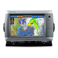
Garmin GPSMAP 720s Important Safety Information (48 pages)
Important Safety and Product Information
Brand:
Garmin
| Category:
Fish Finder
| Size: 0.72 MB
Table of Contents
Table of Contents
1
Important Safety and Product Information
2
Fcc Compliance
3
Cleaning the Case
3
Cleaning the Screen
3
Water Immersion
3
Limited Warranty
4
Informations Importantes Relatives Au Produit Et À la Sécurité
5
Informazioni Importanti Sulla Sicurezzae Sul Prodotto
8
Wichtige Sicherheits- und Produktinformationen
11
Información Importante sobre el Producto y Tu Seguridad
14
Informações Importantes de Segurança E Do Produto
17
Belangrijke Veiligheids- en Productinformatie
20
Vigtige Produkt- Og Sikkerhedsinformationer
23
Tärkeitä Turvallisuus- Ja Tuotetietoja
26
Viktig Sikkerhets- Og Produktinformasjon
29
Viktig Säkerhets- Och Produktinformation
32
Важные Сведения О Продукте И Информация О Безопасности
35
Važne Informacije O Proizvodu I Sigurnosti
38
Σημαντικές Πληροφορίες Για Την Ασφάλεια Και Το Προϊόν
41
Önemli Güvenlik Ve Ürün Bilgileri
44
Garmin GPSMAP 720s Installation Instructions Manual (10 pages)
Garmin Chartplotter Installation Instructions
Brand:
Garmin
| Category:
GPS
| Size: 1.52 MB
Table of Contents
Product Registration
1
Updating the Chartplotter Software
7
Physical Specifications
8
Gps Performance
8
Nmea 2000 Pgn Information
8
NMEA 0183 Information
9
Garmin GPSMAP 720s Quick Reference Manual (2 pages)
Brand:
Garmin
| Category:
Marine GPS System
| Size: 0.52 MB
Advertisement
Related Products
Garmin 72H - Waterproof Handheld GPS
Garmin GPSMAP 720
Garmin GPSMAP 721xs Guide
GARMIN StreetPilot 7200
Garmin GPSMAP 723xsv
Garmin GPSMAP 78S
Garmin GPSMAP 702 series
Garmin Montana 750i
Garmin Rino 750t
Garmin DRIVESMART 7
Garmin Categories
GPS
Watch
Car Navigation system
Avionics Display
Marine Equipment
More Garmin Manuals
Login
Sign In
OR
Sign in with Facebook
Sign in with Google
Upload manual
Upload from disk
Upload from URL