
Related Manuals for RoyalTek RGM-3800


Summary of Contents for RoyalTek RGM-3800
- Page 1 All manuals and user guides at all-guides.com RoyalTek Data Log GPS Receiver RGM-3800 User Manual Version 1.0 Published on May 2007 by RoyalTek Company Ltd. Design and specification are subject to change without notice.
-
Page 2: Table Of Contents
3.4 Transfer data to your PC or Notebook ............22 3.4.1 Connect RGM-3800................22 3.4.2 Download Data ...................23 3.4.3 Get and Set RGM-3800 Device Status ..........25 3.4.4 Get the Data Logger Data Downloader revision information.....27 3.4.5 How to connect the Photo Match Tool..........27... -
Page 3: Product Introduction
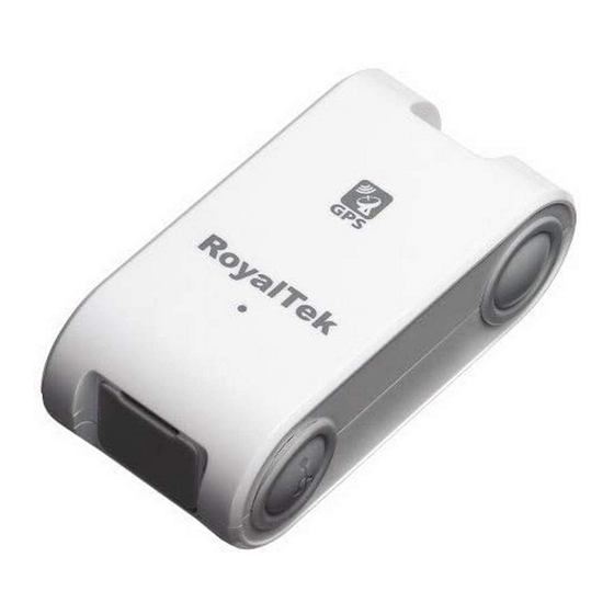
1.1 Overview RoyalTek Data log GPS receiver, RGM-3800, is the successor of well-known Data log GPS receiver in 2007. RGM-3800 can receive and record time, date, position and altitude information. It uses SIRF Star III extreme fast TTFF GPS engine and provide accurate position tracking solution. -
Page 4: Specification
All manuals and user guides at all-guides.com 2. Specification 2.1 Specification Specification GPS Chipset Sirf GSC3f/LP Frequency L1, 1,575.42 MHz Channel 20 parallel C/A Code 1,023 MHz Fix time Reacquisition: less than 1s (Open Hot start: less than 1s SKY,typical) Warm start: less than 35s Cold start: less than 42s Accuracy... - Page 5 All manuals and user guides at all-guides.com (when used at *Operating time may differ depending on the situation or the 25ºC) environment condition. Mechanical Dimension Dimension: 70mm x 36.6mm x 24mm Weight <=50g (without battery) Location Log Log data UTC Time, Longitude, Latitude, Altitude, Velocity Log Interval 5secs ~ 60secs, user configurable (Default 15secs) Stored Data Type There are three types setting for intervals.
-
Page 6: Check The Package Content
All manuals and user guides at all-guides.com 2.2 Check the Package Content Before you start using RGM-3800, please check out if your package includes the following items. If any item is damaged or missed, please contact your reseller at once. -
Page 7: Hardware Overview
All manuals and user guides at all-guides.com 2.3 Hardware Overview Mini USB Connector Antenna Location LED for GPS Status, Battery Status And Memory Status Memory Clear Button Power Button... -
Page 8: Detailed Hardware Function
All manuals and user guides at all-guides.com 2.4 Detailed Hardware Function 2.4.1. Power Switch Power ON / Power OFF 2.4.2. USB Jack Using the supplied USB cable to connect with the GPS receiver ‘s USB connector for data transfer. USB Cable is without the charging function. 2.4.3. -
Page 9: Usage Tip
All manuals and user guides at all-guides.com lower than 1%), the Battery LED flashes more frequently and please replace the batteries. If Battery low, The RGM-3800 will stop to log GPS position data. 2.5. Usage Tip 2.5.1. Inserting the Battery Insert the batteries with the correct polarity +/- 2.5.2. - Page 10 Battery duration can last Approx. over 10 hours in continuous operation mode (when used at 25ºC). Cautions: Remove the batteries when you do not use the RGM-3800 for a long time. Otherwise, it may result in leakage of the batteries.
-
Page 11: Software Installation And Usage
The Main Menu of Installation CD shows as above. Click the Install USB Driver to install the USB Driver, which is needed when you connect the RGM-3800 to your PC or Notebook. Click the PC Software to install the software application. -
Page 12: Install Usb Driver
All manuals and user guides at all-guides.com 3.1 Install USB Driver Install the USB Driver from CD. When screen shows the installation window as follows: Click “Next> to next page”, or click”<Back” to back last stage or “Cancel” to give up installation. Please click “Finish”... - Page 13 All manuals and user guides at all-guides.com...
-
Page 14: Install Data Download Utility
All manuals and user guides at all-guides.com 3.2 Install Data download Utility Click “Next> to next page”, or click”<Back” to back last stage or “Cancel” to give up installation. To the License Agreement page: Click “ I accept the terms in the license agreement”... - Page 15 All manuals and user guides at all-guides.com Click “Install” to start installation. Or click”<Back” to back last stage or “Cancel” to give up installation.
- Page 16 All manuals and user guides at all-guides.com Start installation. Please click “Finish” to finish the Installation.
-
Page 17: Install Locr Pc Client Utility
All manuals and user guides at all-guides.com Finally you will see the icon on Programs menu. 3.3 Install locr PC Client Utility To the License Agreement page: Click “Accept” to start installation, or click ”Don’t Accept” to give up installation. Then... - Page 18 All manuals and user guides at all-guides.com Start installation. Click “Next> to next page”, or click”<Back” to back last stage or “Cancel” to give up installation.
- Page 19 All manuals and user guides at all-guides.com Select Installation folder and Click “Next> to next page”, or click”<Back” to back last stage or “Cancel” to next step. Click “Next> to start installation”, or click”<Back” to back last stage or “Cancel” to give up installation.
- Page 20 All manuals and user guides at all-guides.com locr PC Client is being installed Installation Complete...
- Page 21 All manuals and user guides at all-guides.com Finally you will see the icon on the windows desk.
-
Page 22: Transfer Data To Your Pc Or Notebook
(3) When download or erase data form RGM-3800, Receiver still continues record and save the position data. (4) The time of the log data of RGM-3800 is UTC Time. User doesn’t need to adjust the Clock setting of a camera. -
Page 23: Download Data
All manuals and user guides at all-guides.com Step 2: Push the “Connect” Button Step 3: Wait the “Get All Datalogger Head” finished then change to the “Data Download” menu bar If you don’t want to download the logger data, please choose the “Dis-Connect”... - Page 24 Step 2: Select the download data items, which you want to load from RGM-3800 Step 3: Push download the conversion button Select Folder or set a new folder for saving NMEAData. Step 4: Wait the get Data action Finish. Data from RGM-3800 was success transferred to NMEA sentence.
-
Page 25: Get And Set Rgm-3800 Device Status
All manuals and user guides at all-guides.com 3.4.3 Get and Set RGM-3800 Device Status Step1: Change to “Device Status” menu bar Step 2: You can review the RGM-3800 default setting configuration. ◆ ◆ ◆ ◆ Time Interval (user adjustable) Default setting is 15secs... - Page 26 You also can use RGM-3800 as the GPS Mouse. RGM-3800 will not output any NMEA message after power ON. You can use G_Mouse “Enable” button to let the RGM-3800 output the NMEA sentence. If you need to use RGM-3800 as a G-Mouse, just enable the G_mouse function then close the “Data Downloader Utility”.
-
Page 27: Get The Data Logger Data Downloader Revision Information
3.4.4 Get the Data Logger Data Downloader revision information Step1: Change to “About” menu bar User can get the Royaltek Data Logger Data Downloader version. 3.4.5 How to connect the Photo Match Tool -locr Step1: Change to “Data download” menu bar and Press the Photo Match... - Page 28 All manuals and user guides at all-guides.com Step 2: You can connect to the Photo match tool-locr...
-
Page 29: Locr Pc Client Introduction
All manuals and user guides at all-guides.com 4. locr PC Client introduction PC Client – Automatic Geotagging Made Easy – locr PC Client Quick Installation Guide © locr GmbH 2007 All rights reserved. No part of this manual may be reproduced or transferred to other media without explicit written permission from locr GmbH, Braunschweig, Germany. - Page 30 All manuals and user guides at all-guides.com First steps … How to sign up at locr Signing up at locr is easy. • To sign up for the first time open the locr web site: http://www.locr.com. • Click on “Sign up”. •...
- Page 31 All manuals and user guides at all-guides.com How to install the locr PC Client If you want to download, install, and use the locr PC Client you need an account and a password, so sign up (“How to sign up at locr”, see page 1). To install the locr PC Client, you can either download and open the installation program from the locr web site, or open it on the included CD-ROM.
- Page 32 All manuals and user guides at all-guides.com Geotagging with the locr PC Client To geotag your photos automatically you have to download and install the locr PC Client. Manual or automatic geotagging? There are two ways to geotag your photos: The photos can be tagged manually or automatically.
- Page 33 All manuals and user guides at all-guides.com Tip: If a location cannot be found, omit the street information. Or, in addition, specify the country. If you specify the country, you should always use the English spelling. Doing so, the location will be found reliably. If you are not sure of the right English spelling, there is a simple trick to find out.
- Page 34 All manuals and user guides at all-guides.com • To view the photos in Google Earth, first click the “Show in Google Earth”, and then the “Yes” button. • Now select the photo/s you want to upload and click the “Upload Photos” button. •...
- Page 35 All manuals and user guides at all-guides.com • Click the “Manual Geotagging” button to save the new information. • The marker will be set right into the middle of the section of the map. • If necessary, you can drag the marker to the desired position for a final adjustment, and click “Manual geotagging”...
- Page 36 All manuals and user guides at all-guides.com double-clicking the right mouse button (zoom out) makes zooming much faster. How to use automatic geotagging • Connect the datalog GPS receiver to your PC. • Start the locr PC Client.: “Start” > “Programs” > “locr”...
- Page 37 All manuals and user guides at all-guides.com “()” in the “Latitude” and “Longitude” columns will disappear. • Clicking the “Show Photos on Map” button, shows your photos in combination with their position on the map. Note: To show the position on the map, locr uses Google Maps, which means you need a fast Internet connection.
- Page 38 All manuals and user guides at all-guides.com effect after a map’s reload. Upload a Resized Copy of the Original Photo During the upload your photos will be uploaded with a maximum resolution of 1024 pixels as default. This accelerates the upload procedure! If you’d like to upload your photos with maximum quality and resolution, you’ll have to de-activate the “Upload a resized copy of the original photo”...
- Page 39 All manuals and user guides at all-guides.com Important note: For an exact calculation of the position during the automatic geotagging you should always set and keep the camera time set according to the system time of your computer — regardless, where you are driving or flying to! The locr PC Client and Google Earth To be able to view locr photos in Google Earth, Google Earth has to be installed on your computer.
- Page 40 All manuals and user guides at all-guides.com • Moving the segment of the map Mouse click on one of the respective buttons: . The visible section of the map will be moved left, right, up, or down. Note: You can also zoom using the scroll wheel of your mouse - if you mouse has a scroll wheel.
- Page 41 All manuals and user guides at all-guides.com...
- Page 42 All manuals and user guides at all-guides.com I have a question … What does “Geotagging” actually mean? The term “geotagging” is sometimes also referred to as “geocoding”. Using “geotagging” e.g. photos, or videos, can be complemented with geographical coordinates (latitude and longitude, or physical address).
- Page 43 All manuals and user guides at all-guides.com Datalog GPS receivers Contrary to a “pure” GPS receiver the datalog GPS receivers store the received data to an internal memory. Being switched on, datalog GPS receivers start writing the position, date, and time into a log file. This logged data can be read and saved on e.g.
- Page 44 All manuals and user guides at all-guides.com FCC Notices This device complies with Part 15 of the FCC Rules. Operation is subject to the following two conditions: (1) This device may not cause harmful interference, and (2) This device must accept any interference received, including interference that may cause undesired operation.
- Page 45 Contact information Headquarters 1071 Chung Cheng RD., Suite 9F-1 Tao Yuan City, Taiwan. Tel: 886-3-256-9666 FAX: 886-3-358-0050 Branch Office – Sales Department 8F, 256, Yang Guang St., Nei Hu Chiu, Taipei, Taiwan. Tel: 886-2-7721-5000 FAX: 886-2-7721-5666 Http://www.royaltek.com Sales: Http://www.royaltek.com/contact FAE: fae@royaltek.com...
Need help?
Do you have a question about the RGM-3800 and is the answer not in the manual?
Questions and answers