Table of Contents
Advertisement
Advertisement
Table of Contents

Related Manuals for TomTom Rider 400

Summary of Contents for TomTom Rider 400
- Page 1 TomTom Rider User Manual 17.1...
-
Page 2: Table Of Contents
TomTom MyDrive App for iOS or Android ..................30 Connect to TomTom services using your smartphone..............31 Reconnect to TomTom services using your smartphone ..............31 Connect to TomTom services using a different smartphone ............32 Deleting phones..........................32 Unable to get a connection ........................32 What's on the screen The map view ............................33... - Page 3 Main Menu smaller buttons and symbols ..................38 Volume control...........................40 Using gestures...........................40 Reordering the Main Menu buttons ....................41 Traffic About TomTom Traffic ........................42 The route bar .............................42 Looking at traffic on the map ......................43 Looking at traffic on your route ......................44 Traffic incidents ..........................45 Approaching a traffic jam warning .....................46...
- Page 4 Planning a route using a mapcode ....................75 Planning a route in advance ......................75 Finding a parking lot ........................77 Finding a gas station ........................79 Step by step search Choosing which search to use ......................81 Using step-by-step search .........................81 About search ..........................81 Entering search terms ........................82 Working with search results ......................83 About ZIP codes ...........................84...
- Page 5 Sounds and Warnings ........................138 Language and Units ........................139 System .............................139 Help ..............................140 Getting Help Help ..............................142 Product certification Finding product certification information on your device ..............143 Updating using MyDrive Connect About MyDrive Connect ........................144 TomTom account..........................144 Setting up MyDrive Connect ......................144...
- Page 6 Addendum Copyright notices...
-
Page 7: Welcome To Navigation With Tomtom
Get going covers switching on, setting up and charging. After that, you will probably want to connect to TomTom services and you can read all about that in the Connecting to TomTom services chapter. To help you avoid traffic delays and get to your destination quicker, you can use TomTom services even on the routes you ride every day. -
Page 8: What's New
Using community POI lists in this User Manual. Pre-plan your rides with MyDrive You can plan a route on the MyDrive website, send it to your TomTom Rider, and do much more. To learn more go to Syncing using TomTom MyDrive. -
Page 9: Tomtom Videos
Other bug fixes and improvements Various performance improvements and bug fixes have been implemented. TomTom videos You can find many videos on our YouTube channel to help you learn about your new TomTom Rider and other TomTom products. Visit www.youtube.com/user/TomTomOfficial/videos... -
Page 10: Using Your Rider
Using your Rider Mounting on a motorcycle 1. Attach the RAM™ mount kit to your motorcycle. 2. Fix the holder to the mount and connect the wires to your motorcycle's wiring system. Important: The red POS (+) contact needs to be connected to the motorcycle's wiring loom at a point between the ignition and the +12V battery supply. -
Page 11: Using The Anti-Theft Solution
Important: Damage due to modifications, improper installation, road hazards or accidents, are not covered. Neither RAM nor TomTom shall be liable for any injury, loss, or damage, direct or consequential, arising out of improper installation, or inability to use the product. Before use, the user shall determine the suitability of the product for its intended use. - Page 12 1. Lock the RAM mount to your motorcycle as shown below. Note: Make sure you use the longer screws provided with your Rider lock. 2. Lock your TomTom Rider to prevent removal from the mount. Unscrew the wingnut from the RAM arm and attach the RAM lock.
-
Page 13: Installing In Your Car
Installing in your car If your box contains a car mount, use the supplied mount to install your TomTom Rider in your vehicle. Read the instructions about positioning your device before you install your Rider. If your box contains a car mount, install your Rider by doing the following: 1. -
Page 14: Bluetooth Connections
Tip: With the High-Speed Dual Charger you can charge your TomTom Rider and smartphone at the same time. Bluetooth Connections Your TomTom Rider use Bluetooth to connect to your smartphone and headset. Select Settings in the Main Menu, then select Bluetooth Connections. -
Page 15: Renaming Your Device
Rename to save the new name. Connecting a headset We recommend using a headset with your TomTom Rider to hear spoken instructions, and hear warning sounds on your Rider. This makes riding with your Rider as safe as possible. For more... -
Page 16: Navigation Buttons
An image of the parts of a typical headset is shown below: 1. Microphone 2. On/Off button 3. Speakers 4. LED 5. Volume down 6. Volume up 7. Charging connector Important: When using a headset, the volume control may not be available because your headset doesn't support remote volume control. - Page 17 Select this button to show your saved routes, recorded routes and imported My Routes routes. Select this button to ride to your home location. If this button is not included Add Home in your main menu, go to My Places to set up your home location.
-
Page 18: The Glove-Friendly Keyboard
Parking Select this button to find parking lots/garages. Gas Station Select this button to find gas stations. Select this button to see the status of your connection to the internet. Connected Services Trip Statistics Select this button to see trip statistics about how far you've been riding, how long you've been riding, and also at what speed. -
Page 19: Planning A Thrilling Route
3. Select your chosen desired character from the pop-up, for example "f". 4. Your chosen character "f" replaces the "d" character that first appeared. Available keys The keys shown below are available when using your TomTom Traffic in either portrait or landscape orientation. Planning a thrilling route You can use the Plan a Thrill button to create interesting rides on the spot. - Page 20 1. Select the Main Menu button to open the Main Menu. 2. Select Plan a Thrill. The map view opens. Move the map and zoom in until you can see the place you want to ride through. 4. Create a stop by quickly tapping the map. Your Rider plans a thrilling round trip through your chosen stop.
-
Page 21: Planning A Thrilling Ride To A Destination
Select this button to choose one of three settings for hilliness. Your Rider plans a thrilling round trip route with turns and hills through your chosen stops. 7. When you have planned your thrilling route, select Ride. Your route is shown on the map view, then guidance along your route begins. As soon as you start riding, the guidance view is shown automatically. -
Page 22: Looking At Trip Statistics
Your Rider plans a thrilling route to your chosen destination. 5. If you want to add more stops to your route, move the map and select more stops. Your Rider plans a thrilling route through your chosen stops to your destination. Tip: Select the pop-up menu button to reorder your stops. -
Page 23: Using Quick Settings
Statistics for your current trip To see statistics for the trip you are riding now, select the Since --/--/-- tab. To start a new trip, select the Clear trip button, just like resetting an mileometer in a car. After stopping your bike, if you don't press the Clear trip button, the statistics just carry on increment- ing when you start moving again. -
Page 24: Installing Tyre Pro
Installing Tyre Pro You can use Tyre Pro® to search, create and edit routes on your computer before you upload them to your TomTom Rider. To get free access to Tyre Pro®, follow the steps below: 1. Go to tomtom.com/getstarted... -
Page 25: Settings
Headset - Connect a Bluetooth headset to hear spoken instructions and warning sounds. Network - Connect your Rider to your smartphone's internet connection so you can get TomTom Services. Locking device orientation Select Settings in the Main Menu, then select Appearance. - Page 26 Select Settings in the Main Menu, then select Touch Sensitivity. Select Touch Sensitivity to choose higher or lower sensitivity when touching the buttons on your Rider: Choose Thin Gloves when wearing no gloves or summer-weight gloves. Choose Thick Gloves when wearing winter gloves or when it is raining. Tip: In very wet weather select Thick Gloves to prevent rain drops from causing false inputs on the screen.
-
Page 27: Get Going
Language and Units in the Settings menu. When you first switch on your TomTom Rider, you have to answer a few questions to set it up. Answer the questions by touching the screen. GPS reception When you first start your TomTom Rider, it may need a few minutes to determine your position. In the... -
Page 28: Sending Information To Tomtom
Note: If you choose not to send location information to us, you will no longer receive our services. This is because services need to send the location of your device to TomTom in order to receive the traffic information related to where you are. The end date of your subscription remains the same, even if you do not send this information to us. -
Page 29: Caring For Your Rider
Important: Do not charge your device using your vehicle's own USB port because it is not powerful enough. You are warned when the battery level is low or critical. You lose your connection to some TomTom services when the battery level is low or critical. When the battery is empty, your Rider goes into sleep mode. -
Page 30: Connecting To Tomtom Services
On your smartphone tap the MyDrive icon to start the app. To use TomTom services, you must create a TomTom account or you can log in using an existing TomTom account. When the app is started you can do one of the following: ... -
Page 31: Connect To Tomtom Services Using Your Smartphone
Traffic & Safety Cameras. Reconnect to TomTom services using your smartphone To reconnect your Rider to TomTom services, on your phone make sure that Bluetooth is on and that the TomTom MyDrive app is started. Your Rider will remember your phone and will find it automatically when you are in range of your navigation device. -
Page 32: Connect To Tomtom Services Using A Different Smartphone
5. Select Delete. Your phone is deleted. Tip: If you delete all your connected phones, you will no longer be able to use TomTom services. Unable to get a connection To check your connection status to the Internet, select Bluetooth Settings in the Settings Menu. If your network connection status is shown as Connecting or Not connected, select Network and follow the instructions. -
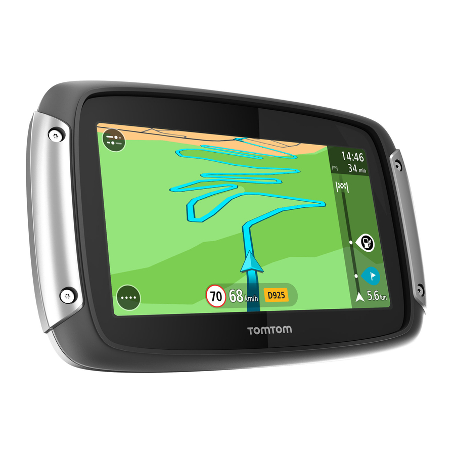
Page 33: What's On The Screen
What's on the screen The map view The map view is shown when you have no planned route. Your actual location is shown as soon as your Rider has found your GPS location. You can use map view in the same way as you might look at a traditional paper map. You can move around the map using gestures, and zoom using the zoom buttons. - Page 34 1. Back button. This button returns the map to an overview of your whole route or, if no route is planned, moves the map to put your current location at the center. 2. Switch view button. Select the switch view button to change between the map view and the guidance view.
-
Page 35: The Guidance View
10. Safety cameras on your route. Select a safety camera to display information about that camera. 11. Route bar. The route bar is shown when you have planned a route. The guidance view The guidance view is used to guide you along the route to your destination. The guidance view is shown when you start driving. -
Page 36: The Route Bar
2. Zoom buttons. Select the zoom buttons to zoom in and out. Tip: On some devices you can also pinch to zoom in and out. 3. Instruction panel. This panel shows the following information: The direction of your next turn. ... -
Page 37: Distances And The Route Bar
Tip: To quickly remove a stop, select it in the route bar and use the menu. Gas stations that are directly on your route. TomTom Traffic incidents. TomTom Safety Cameras. Rest stops directly on your route. -
Page 38: The Quick Menu
Tip: You can scroll the route bar to see your whole route (not available on iOS). For remaining distances between 6 miles (10 km) and 31 miles (50 km), the complete distance is shown. The destination icon is shown fixed at the top of the route bar. ... - Page 39 This symbol shows the status of the Bluetooth connection when you use a smartphone to connect to TomTom services. This symbol shows the power level of the battery in your Rider. This symbol shows that your Rider is connected to TomTom services.
-
Page 40: Volume Control
Volume control On the map or guidance view, select the Main Menu button to open the Main Menu. Select and slide the volume control to change the volume of voice instructions and warnings. If the voice instructions are turned off, the volume control will still change the volume of the warnings. Using gestures You use gestures to control your Rider. -
Page 41: Reordering The Main Menu Buttons
Tap or select Tap a single finger on the screen. Example of when to use this: Selecting an item in the Main Menu. Reordering the Main Menu buttons To reorder the buttons in the Main Menu to suit your preference, do the following: 1. -
Page 42: Traffic
About TomTom Traffic TomTom Traffic is a TomTom service providing real-time traffic information. In combination with historical road usage data, TomTom Traffic helps you plan the optimum route to your destination taking into account the current local traffic conditions and the weather. -
Page 43: Looking At Traffic On The Map
Tip: To quickly remove a stop, select it in the route bar and use the pop-up menu. Gas stations that are directly on your route. TomTom Traffic incidents. TomTom Safety Cameras and Danger Zones. Rest stops directly on your route. -
Page 44: Looking At Traffic On Your Route
Tip: Select an incident on the map to see more detailed information. 1. Traffic incident that affects your route in your direction of travel. A symbol or number at the start of the incident shows the type of incident or the delay in minutes, for example 5 minutes. -
Page 45: Traffic Incidents
To get more information about an incident, select an incident in the route bar. The map opens zoomed in on the incident and an information panel opens showing detailed information about the traffic incident. The information shown includes: The cause of the traffic incident - for example accident, road works, lane closure, or weather. ... -
Page 46: Approaching A Traffic Jam Warning
The color of the incident indicates the speed of traffic relative to the maximum allowed speed at that location, with red being the slowest. The stripes on the traffic jam are also animated to show the speed of the traffic, where appropriate. Traffic speed is 0% to 20% of the allowed speed Traffic speed is 20% to 40% of the allowed speed Traffic speed is 40% to 100% of the allowed speed... -
Page 47: Advanced Lane Guidance
3. Select Avoid in the pop-up menu. A new route is found that avoids the traffic jam. Avoiding a traffic jam using the map 1. On the map view, zoom in and select the traffic jam that is on your route. The traffic jam with an information panel is shown on the map. -
Page 48: Syncing Using Tomtom Mydrive
Logging into MyDrive You must log into MyDrive to sync to your TomTom account. When you log into your account from your navigation device, web browser or the MyDrive app, syncing with your TomTom account happens automatically. -
Page 49: Setting A Destination Using Mydrive
When you are logged in to MyDrive using a web browser, you can create a route with stops and send it to your navigation device. When your navigation device is logged into your TomTom account, your device syncs with MyDrive and receives the destination. -
Page 50: Showing A Planned Destination In Mydrive
Showing a planned destination in MyDrive When you plan a route on your Rider, the destination is synced with your TomTom account. You can see the destination when you are logged in to MyDrive in a web browser or when using the MyDrive app. -
Page 51: Syncing My Places Locations With Mydrive
1. In a web browser or using the MyDrive app, log into your TomTom account. 2. On the map, select a destination. Tip: You can search for a destination or you can move the map and select a destination. You can also select a destination from your My Places list. -
Page 52: Importing A Track Gpx File
Using GPX files You use MyDrive on your computer to import .GPX track files to your TomTom device. The tracks are saved in the My Routes menu. Your device will navigate along the GPX track exactly and will not offer to replan your route, even if a faster route is available. -
Page 53: Saving And Restoring Your Personal Navigation Information
If you reset your Rider, or log into MyDrive on a different device, your saved personal navigation information is restored to your Rider or the different device. The following personal navigation information is saved to your TomTom account: MyDrive destinations. -
Page 54: Quick Search
Quick search Choosing which search to use The following two types of search are available: Quick search Start typing your destination, place, or POI to immediately see a list of street names, places, and POIs that match. Step-by-step search Find your destination in easy steps. -
Page 55: Using Quick Search
Using quick search About search QUICK SEARCH ONLY You use search to find a wide range of places and then navigate to them. You can search for the following: A specific address, for example, 335 Madison Avenue, New York. ... - Page 56 3. Type of search button. You can search the whole of the current map, or you can search in a specific area, for example in a town or city, or near your destination. Select this button to change the type of search to any of the following: Whole map Select this option to search the whole of your current map with no limit...
-
Page 57: Working With Search Results
Working with search results QUICK SEARCH ONLY Your search results are shown in two columns. Address and city matches are shown in the left-hand column, and POIs, types of POIs and Places are shown in the right-hand column. Recent destinations and saved places are also shown in your search results. -
Page 58: About Zip Codes
If you show the result on the map, you can use the pop-up menu to add the location to My Places. If a route is already planned, you can add the location to your current route. Note: The best search results are shown on the map. When you zoom in, the lower ranked search results are gradually shown. - Page 59 Court house Legal - Attorneys Bank Legal - other services Food services Convenience store Fast food restaurant Restaurant Chinese restaurant Accommodation Hotel or motel Luxury hotel Campground Economy chain hotel Emergency services Hospital or clinic Dentist Police station Veterinarian Doctor Fire station Car-related services Outside parking...
- Page 60 Rental car facility Electric/hybrid car charging point(s) Rental car parking Car repair facility Other services Embassy Pet services Government office Telecommunication Company Community service Post office Pharmacy Shopping center Beauty services Tourist information office Shop Education College or university School Library Convention center Leisure...
- Page 61 Concert hall Amusement park Museum Exhibition center Opera Cultural center Nightlife Leisure center Children's Farm Sport Sports Park Swimming pool Mountain peak Water sports Beach Tennis court Park or recreation area Ice skating rink Yacht basin or marina Sports center Stadium Golf course Religion...
- Page 62 Airport Scenic or panoramic view Ferry terminal ZIP code Note: Not used in all countries. Border crossing Residential area Bus station City center Toll plaza Electric/hybrid car charging stations Rest area Truck stop...
-
Page 63: Planning A Route Using Quick Search
Planning a route using quick search Using destination prediction What is destination prediction? Your Rider can learn your daily driving habits to saved favorite Places and it can also suggest destinations when you start the device from sleep mode, for example, when driving to Work in the morning. - Page 64 2. Select Search. The search screen opens with the keyboard showing. 3. Use the keyboard to enter the name of the place you want to plan a route to. Tip: If you press and hold a letter key on the keyboard, you get access to extra characters if they are available.
-
Page 65: Planning A Route To A City Center
5. Select an address suggestion. 6. Enter the house number if you have one and haven't entered it already. Tip: If you enter a house number that is not found, then the number appears red. The nearest house number that is found is shown in the Drive button. You can enter a new house number, or you can select Drive/Ride to drive to the nearest house number. - Page 66 1. Select the Main Menu button to open the Main Menu. 2. Select Search. The search screen opens with the keyboard showing. 3. Use the keyboard to enter the name of the city or town you want to plan a route to. You can search for a town, city, or ZIP code.
-
Page 67: Planning A Route To A Poi
The city name is shown in the right side of the search input box, and the city center POI is shown below in the right-hand column. 6. Select the city center POI. The city center location is shown on the map. 7. - Page 68 2. Select Search. The search screen opens with the keyboard showing. 3. Use the keyboard to enter the name of the place you want to plan a route to. Tip: If you press and hold a letter key on the keyboard, you get access to extra characters if they are available.
-
Page 69: Planning A Route To A Poi Using Online Search
If you did a POI search but could not find the POI you were looking for, you can search TomTom Places online. To find POIs by searching online, do the following: Search for a POI using Search in the Main Menu. - Page 70 The search results are shown in two columns. 2. Select Search Places Online. 3. Use the keyboard to enter the name of the POI you want to find, then press the Search button on the keyboard. Tip: If you press and hold a letter key on the keyboard, you get access to extra characters if they are available.
-
Page 71: Planning A Route Using The Map
5. To see more information about the POI, select the POI on the map and then select the pop-up menu button. Select More Information on the pop-up menu. You see more information about the POI such as the phone number, full address, and email. 6. -
Page 72: Planning A Route Using My Places
A pop-up menu shows the nearest address. 3. To plan a route to this destination, select Drive/Ride, depending on which device you are using. A route is planned and then guidance to your destination begins. As soon as you start driving, the guidance view is shown automatically. -
Page 73: Planning A Route Using Coordinates
A list of all your Places opens. 3. Select the Place you want to navigate to, for example Home. Your chosen Place is shown on the map with a pop-up menu. 4. To plan a route to this destination, select Drive/Ride, depending on which device you are using. A route is planned and then guidance to your destination begins. - Page 74 2. Select Search. The search screen opens with the keyboard showing. 3. Select the type of search button to the right of the search box. 4. Select Latitude Longitude. Tip: The example coordinates shown on the screen are your current latitude and longitude. 5.
-
Page 75: Planning A Route Using A Mapcode
Planning a route using a mapcode QUICK SEARCH ONLY Important: In the interest of safety and to avoid distractions while you are driving, you should always plan a route before you start driving. To plan a route using a mapcode, do the following: 1. - Page 76 1. Search for the location you want to use as a starting point. 2. Select Show on Map. 3. Select the pop-up menu button. A pop-up menu shows a list of options. 4. Select Use as Starting Point. 5. Search for the location you want to use as your destination. 6.
-
Page 77: Finding A Parking Lot
Changing the starting point into a stop 1. Select the starting point on the route in the map view. 2. Select the pop-up menu button. A pop-up menu shows a list of options. 3. Select Change to a Stop. Your route is replanned with the starting point changed into a stop. Finding a parking lot Important: In the interest of safety and to avoid distractions while you are driving, you should always plan a route before you start driving. - Page 78 You can change the screen to show a list of parking lots by pressing this button: You can select a parking lot from the list to locate it on the map. Tip: You can scroll down the list of results using the scroll bar on the right side of the screen. If you want to change how the search is done, select the button to the right of the search box.
-
Page 79: Finding A Gas Station
A route is planned and then guidance to your destination begins. As soon as you start driving, the guidance view is shown automatically. Tip: You can add a parking lot as a stop on your route by using the pop-up menu. Finding a gas station Important: In the interest of safety and to avoid distractions while you are driving, you should always plan a route before you start driving. - Page 80 Tip: You can scroll down the list of results using the scroll bar on the right side of the screen. If you want to change how the search is done, select the button to the right of the search box. You can then change where the search is carried out, for example, to search near you or the whole map.
-
Page 81: Step By Step Search
Step by step search Choosing which search to use The following two types of search are available: Quick search Start typing your destination, place, or POI to immediately see a list of street names, places, and POIs that match. ... -
Page 82: Entering Search Terms
Entering search terms STEP-BY-STEP SEARCH ONLY Select Drive To in the Main Menu, then select Address or Point of Interest. The search screen shows the keyboard and the following buttons: 1. Back button Select this button to go back to the previous screen. 2. -
Page 83: Working With Search Results
Tip: Select the Shift key once to make the next letter you type upper case. Double tap the Shift key to use Caps-Lock where all the letters you type are upper case. Select the Shift key once to quit Caps-Lock. Tip: To cancel a search, select the map/guidance view button in the top right-hand corner of the screen. -
Page 84: About Zip Codes
When you show the address or POI on the map, you can use the pop-up menu to add the location My Places. If a route is already planned, you can add the location to your current route. Note: The best search results are shown on the map. When you zoom in, the lower ranked search results are gradually shown. - Page 85 Restaurant Chinese restaurant Accommodation Hotel or motel Luxury hotel Campground Economy chain hotel Emergency services Hospital or clinic Dentist Police station Veterinarian Doctor Fire station Car-related services Outside parking Gas station Parking garage Car wash Car dealer Vehicle inspection center Rental car facility Electric/hybrid car charging point(s)
- Page 86 Company Community service Post office Pharmacy Shopping center Beauty services Tourist information office Shop Education College or university School Library Convention center Leisure Casino Winery Theater Tourist attraction Movie Theater Concert hall Amusement park Museum Exhibition center Opera Cultural center Nightlife Leisure center...
- Page 87 Children's Farm Sport Sports Park Swimming pool Mountain peak Water sports Beach Tennis court Park or recreation area Ice skating rink Yacht basin or marina Sports center Stadium Golf course Religion Church Place of worship Travel Railroad station Mountain pass Airport Scenic or panoramic view Ferry terminal...
-
Page 88: Planning A Route Using Step-By-Step Search
Bus station City center Toll plaza Electric/hybrid car charging stations Rest area Truck stop Planning a route using step-by-step search Using destination prediction What is destination prediction? Your Rider can learn your daily driving habits to saved favorite Places and it can also suggest destinations when you start the device from sleep mode, for example, when driving to Work in the morning. -
Page 89: Planning A Route To An Address
Planning a route to an address STEP-BY-STEP SEARCH ONLY Important: In the interest of safety and to avoid distractions while you are driving, you should always plan a route before you start driving. To plan a route to an address, do the following: 1. -
Page 90: Planning A Route To A City Center
6. Enter the house number. Tip: If the house number does not exist then it appears red. The nearest house number is then shown in the Drive to button. 7. Select Drive/Ride, depending on which device you are using. A route is planned and then guidance to your destination begins. As soon as you start driving, the guidance view is shown automatically. - Page 91 When the correct city or town appears in the list, select the name. 5. Select the city center POI. 6. Select Drive/Ride, depending on which device you are using. A route is planned and then guidance to your destination begins. As soon as you start driving, the guidance view is shown automatically.
-
Page 92: Planning A Route To A Poi
Planning a route to a POI STEP-BY-STEP SEARCH ONLY Important: In the interest of safety and to avoid distractions while you are driving, you should always plan a route before you start driving. To plan a route to a POI type or a specific POI using search, do the following: 1. -
Page 93: Planning A Route To A Poi Using Online Search
If you did a POI search but could not find the POI you were looking for, you can search TomTom Places online. To find POIs by searching online, do the following: Search for a POI using Drive to in the Main Menu. - Page 94 2. Scroll to the bottom of the list and select Search Places Online. 3. Use the keyboard to enter the name of the POI you want to find, then press the Search button on the keyboard. Tip: If you press and hold a letter key on the keyboard, you get access to extra characters if they are available.
-
Page 95: Planning A Route Using The Map
6. To plan a route to this destination, select Drive/Ride, depending on which device you are using. A route is planned and then guidance to your destination begins. As soon as you start driving, the guidance view is shown automatically. Tip: If your destination is in a different time zone, you see a plus (+) or a minus (-) sign and the time difference in hours and half hours in the arrival information... -
Page 96: Planning A Route Using My Places
Tip: You can use the location you selected in other ways, such as adding it to Places, by selecting the pop-up menu button. Tip: If your destination is in a different time zone, you see a plus (+) or a minus (-) sign and the time difference in hours and half hours in the arrival information panel. -
Page 97: Planning A Route Using Coordinates Using Step-By-Step Search
Your chosen Place is shown on the map with a pop-up menu. 4. To plan a route to this destination, select Drive/Ride, depending on which device you are using. A route is planned and then guidance to your destination begins. As soon as you start driving, the guidance view is shown automatically. -
Page 98: Planning A Route In Advance
Tip: For decimal values you don't have to use a letter to indicate the latitude and longitude. For locations west of the 0 meridian and locations south of the equator, use a minus sign (-) before the coordinate. Degrees, minutes and seconds, for example: N 40°43′53″... - Page 99 A pop-up menu shows a list of options. 4. Select Use as Starting Point. 5. Search for the location you want to use as your destination. 6. Select Show on Map. 7. Select Drive/Ride in the pop-up menu. Your route is planned using your chosen starting point and destination. The estimated trip time is shown at the top of the route bar.
-
Page 100: Finding A Parking Lot
A pop-up menu shows a list of options. 3. Select Change to a Stop. Your route is replanned with the starting point changed into a stop. Finding a parking lot Important: In the interest of safety and to avoid distractions while you are driving, you should always plan a route before you start driving. - Page 101 You can change the screen to show a list of parking lots by pressing this button: You can select a parking lot from the list to locate it on the map. Tip: You can scroll down the list of results using the scroll bar on the right side of the screen. If you want to change how the search is done, select the button to the right of the search box.
-
Page 102: Finding A Gas Station
A route is planned and then guidance to your destination begins. As soon as you start driving, the guidance view is shown automatically. Tip: You can add a parking lot as a stop on your route by using the pop-up menu. Finding a gas station Important: In the interest of safety and to avoid distractions while you are driving, you should always plan a route before you start driving. - Page 103 Tip: You can scroll down the list of results using the scroll bar on the right side of the screen. If you want to change how the search is done, select the button to the right of the search box. You can then change where the search is carried out, for example, to search near you or the whole map.
-
Page 104: Changing Your Route
Changing your route The Current Route menu When you have planned a route or track, select the Current Route or Current Track button in the Main Menu to open the Current Route or Current Track Menu. The following buttons are available in the menu: Clear Route / Clear Select this button to clear the currently planned route or track. - Page 105 Show Instructions Select this button to see a list of turn-by-turn text instructions for your planned route. The instructions include the following: Your current location. Street names. Up to two road numbers shown in road signs whenever available. ...
-
Page 106: Avoiding A Blocked Road
Drive to Route or Select Drive to Route to plan a route from your current location to the Track starting point of a Route. The starting point is converted to a stop. Drive to Track plans a route to the nearest point of the track from your current position. -
Page 107: Avoiding Part Of A Route
Avoiding part of a route If part of a road is blocked or you wish to avoid part of a route, you can select a specific section of a route to avoid. 1. Select the Main Menu button to open the Main Menu. 2. -
Page 108: Types Of Route
Avoid interstate highways - this type of route avoids all highways. Winding route - the route with the most turns. Note: Winding routes are only available for TomTom Rider navigation devices. You can set the default route type in the Settings Menu. -
Page 109: Avoiding An Incident Or Route Feature Using The Route Bar
If you choose to avoid a route feature, a new route is planned. In Route Planning in the Settings Menu, you can set how each route feature is handled when a new route is planned. To avoid a feature on your route, do the following. 1. -
Page 110: Adding A Stop To Your Route Using The Map
Select Search and search for a location. When you have found a location, select Add. Your route is recalculated to include your stop. Adding a stop to your route using the map 1. Press the switch view button to show the map. Your complete route is shown on the map. -
Page 111: My Routes
My Routes About My Routes My Routes provides an easy way to save and retrieve routes and tracks. You may want to use My Routes in one or more of the following situations: While working - Your job involves driving several routes with multiple stops on a daily basis. Your routes can change and you need to be flexible and be able to change the order of your stops or change the planned route. -
Page 112: Saving A Route
Using ITN files There are several things you can do with your ITN file: You can import an ITN file onto your TomTom Rider so you can travel that same route again and get navigation instructions. Use tools such as Tyre Pro to view your route. -
Page 113: Navigating Using A Saved Route
5. Edit the name of the route so that you can easily recognize it. 6. Save your route in the My Routes list. Tip: You can also save a route using the Add to My Routes button in the Current Route menu. Navigating using a saved route To navigate using a previously saved route, do the following: 1. - Page 114 Note: The route from the original starting point up to the new starting point is removed from the route. Note: Your original route in My Routes is not changed. If you want to see the whole route, select the route again in My Routes. 1.
-
Page 115: Adding A Stop To A Saved Route Using The Map
The starting point of your route is converted to your first stop and then the route is planned from your current location. Guidance to your destination begins. As soon as you start driving, the guidance view is shown automatically. Tip: There are two other ways to navigate using a saved route: Select the starting point of the route. -
Page 116: Recording A Track
Tip: To update the saved route in your My Routes list with the changes, select the route on the map, then select Save Changes to Route in the pop-up menu. Recording a track You can record a track while you drive, with or without a route planned. After recording, you can then export your track so that you can share it with others or view it using tools such as Tyre Pro. -
Page 117: Deleting A Route Or A Track From My Routes
3. Select the track, then select the pop-up menu. 4. Select Drive to Starting Point. The starting point of the track is converted to your first stop and then the route is planned. Guid- ance to your destination begins from your current location. As soon as you start driving, the guidance view is shown automatically. -
Page 118: Importing Routes And Tracks From A Memory Card
GPX files - these become tracks after import. ITN files - these become routes after import. ITN files are TomTom itinerary files. Other users can record itinerary files and share them with you, or you can download both ITN and GPX file tools such as Tyre Pro. -
Page 119: Importing Routes And Tracks Using Bluetooth
GPX files - these become tracks after import. ITN files - these become routes after import. Tip: ITN files are TomTom itinerary files. Friends may share itinerary files with you or you can download both ITN and GPX files from Tyre Pro. - Page 120 Tip: You can paste your routes into the root directory or the Internal Storage folder. If you have a memory card in your Rider, you can also copy your routes to the SD Card folder. 5. On your Rider, select Done. Your Rider shows the routes you copied.
-
Page 121: My Places
You can upload community POI lists using TomTom MyDrive and choose to show the POI locations on the map. Your home location, work location, marked locations, and the locations that you have added appear in a list in My Places and are shown with a marker on the map. -
Page 122: Changing Your Home Location
Zoom in on the map at the location you want to select. Press and hold to select the location, then select Set. Select the Search button and search for a location. Select a location to set as home or work, then select Set. -
Page 123: Adding A Location From My Places
3. Select Add. Your home location is changed to the new location. Adding a location from My Places 1. In the Main Menu, select My Places. 2. Select Add a new place. 3. To select a location, do one of the following: ... -
Page 124: Adding A Location To My Places By Marking
Tip: Some TomTom Navigation devices have POI lists pre-installed. Your Rider uses .OV2 files for POI collections. - Page 125 Note: Your Rider needs at least 400 MB free space before it can import .OV2 and .GPX files. If you see the message You need more space, make space available by deleting unwanted .OV2 or .GPX files using MyDrive or deleting device content, for example delete a map you don't use. Using an .OV2 file on your Rider 1.
-
Page 126: Map Share
Select a location on the map and create the change report immediately. Mark a location and create the change report later. To send your map change reports to TomTom, you must connect your Rider to your computer and use MyDrive Connect. -
Page 127: Creating A Map Change Report From A Marked Location
7. Select Report. 8. Connect your Rider to MyDrive to send your map correction report to TomTom and receive map corrections from other TomTom users. Creating a map change report from a marked location If you see a map inconsistency while you are driving, you can mark the location so you can report the change later. -
Page 128: Types Of Map Change
MyDrive Connect to send your map changes report to TomTom and receive map changes from other TomTom users. Road Restriction Select this option to block or unblock a road. You can block or unblock the road in one or both directions by doing the following: 1. - Page 129 Turn Restriction Select this option to report incorrect road turn restrictions. 1. Press and hold to select the location of the map change on the map view. 2. Select the pop-up menu button to open the menu. 3. Select Report Map Change from the pop-up menu. 4.
-
Page 130: Safety Cameras
TomTom account. Note: TomTom services are not available on all Rider devices. Note: Some TomTom services might not be available in your current location. Safety camera warnings Warnings are given as you approach a safety camera. You are warned in several ways: ... -
Page 131: Changing The Way You Are Warned
Symbol shown on Symbol shown in Description route bar Speed trap hotspots - this type of warning shows places where speed traps are often used. Average speed safety cameras - these types of cameras measure your average speed between two points. You are warned at the start and end of the average speed zone. -
Page 132: Reporting A New Safety Camera
Select Yes if the speed trap is still there. Select No if the speed trap has been removed. Your selection is sent to TomTom. We collect reports from many users to determine if the camera warning should be kept or removed. Updating locations for cameras and hazards The locations of safety cameras can change frequently. -
Page 133: Settings
Select Show POI lists on map to choose which POI lists you want to show on the map. Note: Show POI lists on map is not available on all TomTom navigation devices or apps. Automatic map view switching By default, automatic changing of views is on. This means, for example, that your Rider shows the map view when an alternative route is being suggested, along with several other sets of circum- stances. -
Page 134: Route Bar
Brightness Select Brightness to change the following settings: Day brightness Move the slider to adjust the brightness level of the screen during the day. Night brightness Move the slider to adjust the brightness level of the screen during the night. Select Switch to night colors when dark to automatically switch to night colors when it gets dark. -
Page 135: Guidance View
When the wide route bar is shown, you see more information about your route. For example, you see time and distance to traffic and more. Guidance view Select Settings in the Main Menu, then select Appearance. Show current street name This setting displays name of the street you are driving along. -
Page 136: Highway Exit Previews
Highway exit previews Select Settings in the Main Menu, then select Appearance. Select Highway exit previews to change settings for the Guidance view as you approach highway exits or junctions. Show map and preview A split screen is shown with the Guidance view on the left and lane guidance on the right. ... -
Page 137: Maps
System > Your information and privacy to see this feature. When a faster route is available If a faster route is found while you are driving, TomTom Traffic can replan your trip to use the faster route. Select from the following options: ... -
Page 138: Sounds And Warnings
Most eco-friendly route - the most fuel-efficient route for your trip. Winding route - the route with the most turns. Note: Winding route is not available on all TomTom navigation devices or apps. Avoid interstate highways - this type of route avoids all highways. -
Page 139: Language And Units
On this screen, you can change these settings: About This screen shows you all sorts of useful information about your model of TomTom device. This information is useful during calls to Customer Support and when renewing subscriptions using the TomTom web shop. -
Page 140: Help
Select this setting to control power saving options on your Rider. Your information & privacy Some features require information to be sent to TomTom or stored on your device. You are asked the following questions: Use my location and the information I enter to receive TomTom services... - Page 141 Select this option to get a short tutorial on how to use your navigation device, if supported by your device. About See System. More help You can get further help by going to tomtom.com/support. For warranty and privacy information, go to tomtom.com/legal.
-
Page 142: Getting Help
Select this option to get a short tutorial on how to use your navigation device, if supported by your device. About See System. More help You can get further help by going to tomtom.com/support. For warranty and privacy information, go to tomtom.com/legal. -
Page 143: Product Certification
Product certification Finding product certification information on your device To find product certification information, such as the ICASA-approved certification number, do the following on your Rider: 1. Select Settings in the Main Menu. 2. Select System. 3. Select About. 4. Select Legal information. 5. -
Page 144: Updating Using Mydrive Connect
Important: Take care when choosing a country during account creation. The correct country is needed if you make a purchase from the TomTom shop, and it cannot be changed after the account has been created. - Page 145 5. Enter the requested information for account creation, including your country. When setup is complete, a TomTom account is created and your Rider is linked to that account. You can now access MyDrive Connect from the notification area on your desktop.
- Page 146 Use with care Use of TomTom products while driving still means that you need to drive with due care and attention. Your device is intended to serve as a driving aid and is not a substitute for driving with due care and attention.
- Page 147 TomTom, Inc. bears no responsibility for and hereby disclaims all liability for any fines, penalties or damage incurred by a driver for violations of the law. While driving in any state with windshield mounting restrictions, TomTom recommends using the supplied Adhesive Disk or purchasing an alternative mounting system (e.g.
- Page 148 PROPERLY ACCORDING TO THE LOCAL LAWS AND REGULATIONS AND ALWAYS KEPT SEPARATE FROM HOUSEHOLD WASTE. BY DOING THIS YOU WILL HELP CONSERVE THE ENVIRONMENT. USE YOUR TOMTOM DEVICE ONLY WITH THE SUPPLIED DC POWER CORD (CAR CHARGER/BATTERY CABLE), AC ADAPTER (HOME CHARGER), IN AN APPROVED CRADLE OR USING THE SUPPLIED USB CABLE TO CONNECT TO A COMPUTER FOR BATTERY CHARGING.
- Page 149 If the user modifies the equipment or its peripherals in any way, and these modifications are not approved by TomTom, the FCC may withdraw the user’s right to operate the equipment. For customers in the USA, the following booklet prepared by the Federal Communications Commission may be of help: "How to Identify and...
- Page 150 Emissions information for Canada Operation is subject to the following two conditions: This device may not cause interference. This device must accept any interference, including interference that may cause undesired operation of the device. Operation is subject to the condition that this device does not cause harmful interference. This Class B digital apparatus complies with Canadian ICES-003.
- Page 151 The procurement of and all charges associated with such a connectivity plan are your responsibility. TomTom shall not be liable for any costs or expenses associated with such a network connectivity plan (such as the data charges or possible tethering fees which may be imposed by your carrier).
- Page 152 TomTom shall not be liable for technical or editorial errors or omissions contained herein, nor for incidental or consequential damages resulting from the performance or use of this document. This document contains information protected by copyright. No part of this document may be photocopied or reproduced in any form without prior written consent from TomTom N.V.
- Page 153 TomTom or its suppliers. The use of this material is subject to the terms of a license agreement. Any unauthorised copying or disclosure of this material will lead to criminal and civil liabilities.
Need help?
Do you have a question about the Rider 400 and is the answer not in the manual?
Questions and answers