
Related Manuals for Honeywell Bendix/King KGP 560


Summary of Contents for Honeywell Bendix/King KGP 560
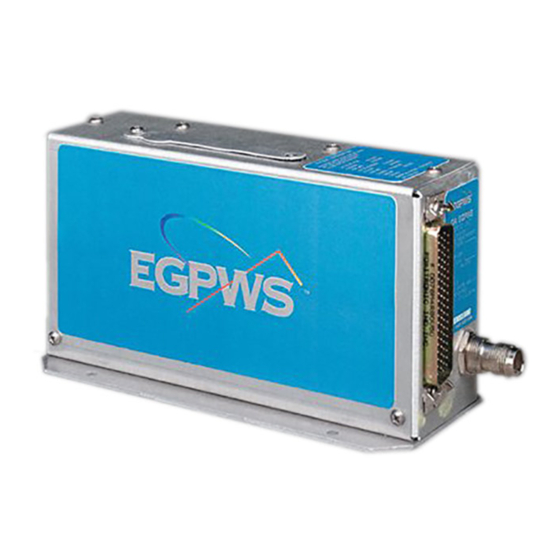
- Page 1 KGP 560 & KGP 860 General Aviation Enhanced Ground Proximity Warning System Pilot’s Guide...
- Page 2 All rights reserved. Reproduction of this publication or any portion thereof by any means without the express written permission of Honeywell International Inc. is prohibited. For further information contact the Manager, Technical Publications; Honeywell Business & General Aviation; One Technology Center; 23500...
-
Page 3: Table Of Contents
Table of Contents KGP 560 & KGP 860 Enhanced Ground Proximity Warning System TABLE OF CONTENTS INTRODUCTION ........... .1 What is the GA-Enhanced Ground Proximity Warning System? . - Page 4 Table of Contents Intentionally left blank Rev 5 Jul/2004 KGP 560/860 Pilot's Guide...
-
Page 5: Introduction
Introduction INTRODUCTION The Bendix/King KGP 560 & KGP 860 General Aviation Enhanced Ground Proximity Warning System (GA-EGPWS) brings state-of-the-art technology in Terrain Display, Situational Awareness, Terrain Alerting and Warning, and Obstacle Alerting and Warning to the General Aviation pilot. The KGP 560 & KGP 860 GA-EGPWS is an affordable,... -
Page 6: What Is The Ga-Enhanced Ground Proximity Warning System
WHAT IS THE GA-ENHANCED GROUND PROXIMITY WARNING SYSTEM? The Bendix/King KGP 560/860 GA-EGPWS is a small lightweight com- puter that can be installed in most single- and multi-engine piston aircraft, small turboprop aircraft and other aircraft in which a Terrain Avoidance &... -
Page 7: Regulatory Standards
Introduction During normal flight operations, the system remains essentially silent, using GPS, altitude and temperature (optional) data in combination with its various database information to provide the pilot with a display of the aircraft position relative to surrounding terrain and known obstacles, thereby providing unprecedented situational awareness for the pilot. - Page 8 Introduction The KGP 560/860 GA-EGPWS may also be installed in aircraft that do not require FAA approved TAWS systems, and may be utilized with an optional set of alerting and warning parameters that are designed espe- cially for smaller piston aircraft and their normal flight characteristics. The FAA has now designated these operational TAWS requirements, under TSO C151b as the Class C curves.
-
Page 9: Ga-Egpws Functions And Features
Functions and Features GA-EGPWS FUNCTIONS AND FEATURES AIRCRAFT POSITION The KGP 560/860 GA-EGPWS uses Global Positioning System (GPS) information from either an aircraft-installed GPS receiver, or an internal GPS receiver contained in the KGP 560/860 computer itself. It is good for the pilot to be aware of the actual position source being used by the system, as the internal GPS is not used for navigation of the aircraft. -
Page 10: Aircraft Altitude
This altitude information allows the system to do two main tasks. First, by using a special “derived-altitude” developed by Honeywell called “Geometric Altitude”, the GPS and uncorrected pressure altitude infor- mation is blended together by the system to provide accurate altitude information, which is using the same Mean Sea Level (MSL) reference as the terrain, obstacle and runway databases in the system. -
Page 11: Terrain, Obstacles & Runway Database
Terrain data is supplied from the same proprietary database used by other Honeywell EGPWS products, and is divided into three regions worldwide. (See the following pictures). The terrain data is divided into grid patterns of various sizes, from areas about 1/4 nm square resolution to areas of about 5 nm square. - Page 12 Functions and Features 75° 75° 60° 60° 45° 45° 30° 30° 15° 15° 0° 0° 15° 15° 30° 30° 45° 45° 60° 60° 165°150° 135° 120°105° 90° 75° 60° 45° 30° 15° 0° 15° 30° 45° 60° 75° 90° 105°120°135°150° 165°180° Regional Database: Americas (shaded areas) 75°...
-
Page 13: Terrain Inhibit Switch
Presently, there are some 100,000-plus obstacles in the database. As more information becomes available, Honeywell plans to expand the obstacle coverage. The current obstacle coverage map can be accessed at the Internet website: http:\\www.egpws.com. -
Page 14: Terrain Awareness Display
Functions and Features nated and a message will be displayed indicating “Warnings Inhibited”. The terrain display, if installed, remains operational. The purpose of the "Terrain Inhibit" switch is to allow aircraft to operate without nuisance or unwanted warnings at airports that are not in the system database. - Page 15 Functions and Features The following figure shows the Terrain Display color patterns when the aircraft is at lower altitudes, with terrain near or above the aircraft altitude for the display range selected by the pilot. Rev 5 Jul/2004 KGP 560/860 Pilot's Guide...
- Page 16 Functions and Features The following figure shows the Terrain Display color patterns when the aircraft is at higher altitudes, where terrain is a least 250 feet below the aircraft altitude for the display range selected by the pilot. The system will adjust colors on the Terrain Display automatically as the aircraft altitude changes.
- Page 17 Functions and Features Installations without a heading input into the KGP 560/860 will either have a NORTH oriented or BLANK display when on the ground. Depending upon configuration, the display will automatically transition to a TRACK UP (MAG XXX TRK) orientation upon reaching a configurable airspeed (typically 10 to 45 kts GPS ground speed).
- Page 18 Functions and Features NOTE: Green colors indicating terrain/obstacles below the aircraft are NOT shown when the aircraft is on the ground, to reduce display clutter and to show only terrain that is significantly higher than the aircraft in the departure area. Green colors will appear when the aircraft has climbed approximately 500 to 800 feet above the elevation of the runway.
-
Page 19: Look-Ahead" Alerting And Warning
Functions and Features Display Orientation Geometric Altitude Display Range Here Magnetic Track is Displayed as MSL or GSL up and at 160°. Nautical Miles Range Rings Peaks Elevation Outer ring is selected Maximum elevation is range, inner ring is half displayed over minimum the selected range. -
Page 20: Runway Field Clearance Floor (Rfcf)
Functions and Features When the “Look-Ahead” function detects a terrain or obstacle threat approximately one minute ahead of the aircraft, the voice alert “Caution Terrain, Caution Terrain” (or “Caution Obstacle, Caution Obstacle”) is given, and a bright, solid yellow “threat area” is shown on the Terrain Display. -
Page 21: Excessive Rate Of Descent Alerting And Warning
Functions and Features Runway Field Clearance Floor (RFCF) EXCESSIVE RATE OF DESCENT ALERTING AND WARNING The KGP 560/860 GA-EGPWS uses both GPS Vertical Velocity and pressure altitude to compute vertical velocity information when the air- craft does not provide specific air data for this purpose. In either case, when the aircraft is descending toward terrain at a high rate for its rela- tive altitude above terrain, the system will provide alerting and warning to the pilot. - Page 22 Functions and Features The following graph represents the envelope of protection provided for Excessive Rate of Descent scenarios: Excessive Descent Rate Initially, the voice alert “Sink Rate” will be heard, and the yellow caution alert annunciator lamp will illuminate. If the aircraft continues in the high rate of descent, the “Sink Rate-Sink Rate”...
-
Page 23: Inadvertent Descent / Loss Of Altitude After Take-Off
Functions and Features INADVERTENT DESCENT / LOSS OF ALTITUDE AFTER TAKE-OFF The KGP 560/860 GA-EGPWS uses known runway position and eleva- tion information to monitor altitude during take-off and initial climb. This function is active until the aircraft reaches an altitude of approximately 700 feet above the runway elevation used for take-off. -
Page 24: Ga-Egpws Altitude Monitoring
Functions and Features GA-EGPWS ALTITUDE MONITORING The KGP 560/860 GA-EGPWS monitors the various altitude and temper- ature (if used) inputs that it receives during flight for the computation of Geometric Altitude. If there is an abnormal difference detected among these altitude values, the system can provide visual and voice alerts to the pilot. -
Page 25: Bank Angle Alert (Kgp 860 Only)
Functions and Features flaps are not in landing configuration. When the aircraft passes below 300 feet with flaps down, and the gear is up, a Gear Up aural “Caution Gear” is given. When the aircraft passes below 300 feet with the gear down, and the flaps are up, than an aural “Caution Flaps”... - Page 26 Functions and Features Excessive Bank Angle Alert Envelope Rev 5 Jul/2004 KGP 560/860 Pilot's Guide...
-
Page 27: Normal Procedures
Normal Procedures NORMAL PROCEDURES GA-EGPWS SYSTEM SELF-TEST Prior to flight, the system should be tested for proper operation. Normally, this is done by the pilot during the BEFORE TAKE-OFF check. All aircraft power and systems should be up and running, and the GA- EGPWS “Not Available”... - Page 28 Normal Procedures Pressing the Self-Test switch as the Level One Self-Test is completed will initiate Level Two of the internal test capability. Level Two provides information about any faults the system may be detecting. Normally, this will not be necessary. If a normal Self-Test is unsuccessful, a Level Two test is automatically initiated by the system.
-
Page 29: Recommended Procedures For Ga-Egpws Warnings In Flight
Normal Procedures RECOMMENDED PROCEDURES FOR GA-EGPWS WARNINGS IN FLIGHT “PULL UP” If in Instrument conditions or at night where visual judgement of the situation is not assured: 1. Level wings and simultaneously pitch up at a rate of 2 to 3 degrees per second to the aircraft’s BEST ANGLE of CLIMB attitude and speed. -
Page 30: Recommended Procedures For Ga-Egpws Alerts In Flight
Normal Procedures RECOMMENDED PROCEDURES FOR GA-EGPWS ALERTS IN FLIGHT “Terrain Ahead” Condition: Aircraft flight path is in conflict with terrain/obstacle. Action: Take IMMEDIATE action to adjust flight path away from “Obstacle Ahead” threat until alert/warning ceases. “Caution Terrain” Condition: Aircraft flight path is in conflict with terrain/obstacle. Action: Adjust flight path as required away from threat until “Caution Obstacle”... -
Page 31: Additional Information
Additional Information ADDITIONAL INFORMATION AUDIO MESSAGE PRIORITY Only ONE message is produced at any one time. The highest priority voice message takes precedence, and may IMMEDI- ATELY interrupt any lower priority message as shown in the table below. If the aircraft is in a situation that meets more than one condition for an alert or warning at the same time, the higher priority message will be heard until that condition is resolved. - Page 32 Additional Information Note 1: These are the only voices that can interrupt. Note 2: The preface voices will always be given prior to the warning voice. Note 3: Voice message is continuous. Note 4: Voice message will repeat every 10 seconds. Note 5: Voice message may be disabled depending upon configuration.
-
Page 33: Ga-Egpws Cockpit Lamps & Switches
Additional Information Note 5: Voice message may be disabled depending upon configuration. Note 6: KGP 860 only, messages may be disabled depending upon con- figuration. GA-EGPWS COCKPIT LAMPS & SWITCHES A representative sample of a possible annunciator and switch installation is pictured below. -
Page 34: Kgp 560/860 Continued Airworthiness And Database Update Procedures
The KGP 560/860 database is contained in a removable card installed in the top of each unit. It is up the KGP 560/860 customer to determine if a specific database is applicable to their operation. Honeywell estimates that the KGP 560/860 customer will update their database approximately once per year. -
Page 35: Kgp 560/860 Product Support
1-800-247-0230 if calling from within the United States or Canada (913) 712-3145 if calling from outside the United States or Canada (913) 712-3904 FAX e-mail: nav.database@honeywell.com Database updates may also be ordered on-line by visiting www.gpsdatabase.com Note: If ordering a database card for the KGP 560, the serial number of the unit must be given at the time of ordering to ensure getting the proper type of card. - Page 36 Additional Information Intentionally left blank Rev 5 Jul/2004 KGP 560/860 Pilot's Guide...
- Page 37 Honeywell International Inc. One Technology Center 23500 West 105th Street Olathe, KS 66061 Telephone (913) 712-0400 FAX 913-712-1302 Copyright © 2000, 2001, 2003-2005 Honeywell International Inc. All rights reserved. 006-18254-0001 Revision 7 Oct/2005...