Table of Contents
Advertisement
Advertisement
Table of Contents

Related Manuals for RoboSense LiDAR RS-Helios-16P


Summary of Contents for RoboSense LiDAR RS-Helios-16P
- Page 1 RS-Helios-16P User Manual RS-Helios-16P...
- Page 2 RS-Helios-16P User Manual Revision History Modifications Release Date Edited by Issue Original issue 2022-5-9 1.0.0 1. Updated Time Synchronization description 2022-6-29 1.0.1 Firmware Version 2.Updated description...
- Page 3 RS-Helios-16P User Manual Terminologies MSOP Main data Stream Output Protocol DIFOP Device Info Output Protocol Field Of View Precision Time Protocol Network Time Protocol Global Positioning System Universal Time Coordinated Wave_mode Echo flag Protocol version number, 00 represents old version, 01 represents the latest Protocol version Temp...
-
Page 4: Table Of Contents
RS-Helios-16P User Manual Content Safety Notices ............................... 1 Helios Series Products ............................2 Product Appearance and Interface ........................ 3 Product Appearance........................3 Aviation Plug and Pin Definition ....................3 Interface Box ............................3 Unboxing & Installation ............................. 6 Standard Package ..........................6 Sensor Mounting .......................... - Page 5 C.7 Set RSView Data Port ..........................50 Appendix D RS-Helios-16P ROS&ROS2 Package ....................51 D.1 Install Software ............................51 D.2 Download & Compile RoboSense LiDAR Driver Package ............. 51 D.3 Configure PC IP ............................52 D.4 Real Time Display ............................52 D.5 View Offline Data ............................
- Page 6 This manual is protected by copyright. Any rights arising from this copyright are owned by RoboSense. Reproduction of this manual or part of the manual is only permitted within the legal scope of the copyright law. Without obtaining any authorization, this document shall not be abridged or translated.
-
Page 7: Safety Notices
Heed Warnings - All warnings on the product and in the operating instructions should be adhered to. Servicing – Except for what’s described in this manual, the sensor has no field serviceable parts. For servicing, please contact RoboSense sales or the authorized distributors. -
Page 8: Helios Series Products
RS-Helios-16P User Manual 2 Helios Series Products Model Number of Channels Remark Helios-5515 -55°~+15° Wide FOV Helios-1615 -16°~+15° Uniform 1°Vertical Resolution Helios-16P -15°~+15° Uniform 2°Vertical Resolution This manual is for the Helios-16P product... -
Page 9: Product Appearance And Interface
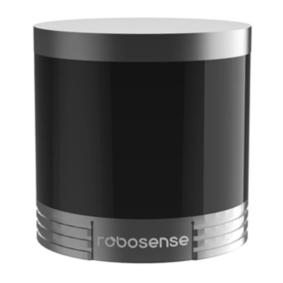
RS-Helios-16P User Manual 3 Product Appearance and Interface 3.1 Product Appearance Aviation plug interface side Figure 1 LiDAR Coordinate and Rotation Direction 3.2 Aviation Plug and Pin Definition RS-Helios-16P has an aviation plug attached to the bottom of the LiDAR, the definitions of the specific pins of the aviation plug are as shown in the table below: Operating Color... - Page 10 LED lights up. If the power indicator is dimmed, the Interface BOX may not work properly. Please check whether the power input is normal. If the power input is normal, the Interface BOX may be damaged. Please contact RoboSense technical support & sales for help.
- Page 11 RS-Helios-16P User Manual receives GPS PPS information input. The definitions of pins of the GPS port are detailed in the figure below: Table 2 GPS Port Definition Function Pin No. GPS_PPS GPS_GPRMC SYNC_OUT1 Note: When the "ground" of RS-Helios-16P is connected to an external system, the negative polarity ("ground") of the external system and the "ground"...
-
Page 12: Unboxing & Installation
Screw Pack M3X8 *4, M3X12 *4 Note: There might be variants of the sensor and accessories that you are going to purchase or interested in, please confirm the details with RoboSense Sales. Sensor Mounting 3xM3 Screws, 4-5mm above mounting surface;... - Page 13 RS-Helios-16P User Manual Screw Specifications GB/T70.1, M3x12, hexagon socket head, material SCM435, electroplated trivalent chromium black zinc, grade 10.9, with drop resistance coating. GB/T70.1, M3x8, hexagon socket head, material SCM435, electroplated trivalent chromium black zinc, grade 10.9, with drop resistance coating. ...
-
Page 14: Quick Connection
RS-Helios-16P User Manual The precise locator pins on the mounting base should strictly follow the dimensions of the locator holes at the bottom of the LiDAR, and the height of the locator pin should not be higher than 4mm. We recommend using aluminum alloy for the mounting base material, which facilitates heat dissipating of the LiDAR during operating. - Page 15 RS-Helios-16P User Manual The wiring diagram of the Interface Box connection is as shown in the figure below: To PC Network To GPS Interface Box To power adapter Figure 6 Interface Box Connection...
-
Page 16: Sensor Specifications And Features
The data above is only for serial production products, and may not be applicable to any samples, testing devices and other non-production versions. If you have any questions, please contact RoboSense Sales. The ranging accuracy takes a 50% NIST diffuse reflector as the target. The test results may be affected by environment conditions, including but not limited to factors such as ambient temperature and target distance. -
Page 17: Point Cloud Display
RS-Helios-16P User Manual Table 5 Ranging Capability of LiDAR Channel Vertical Angle(°) 10% NIST(m) Range(m) Channel No. 13° 15° 9° 11° 5° 7° 1° 3° -3° -1° -7° -5° -11° -9° -15° -13° 5.2 Point Cloud Display 5.2.1 Coordinate Mapping Since the data packet output by the LiDAR only provides the horizontal rotation angle and distance parameters, in order to present a 3D point cloud image, the angle and distance information in polar coordinates need to be converted into x, y, z coordinates in the Cartesian... -
Page 18: Reflectivity
RS-Helios-16P User Manual 5.3 Reflectivity RS-Helios-16P measures the reflectivity of objects. The reflectivity is an index that measures the ability of an object to reflect light and is greatly related to the material of the object itself. Therefore, the reflectivity information can be used to distinguish objects of different materials. RS-Helios-16P reports calibrated reflectivity values from 0 to 255, among which diffuse reflectors report values from 0 to 100, and retroreflectors report values from 101 to 255. -
Page 19: Return Mode Flag
RS-Helios-16P User Manual enough to hit multiple objects, it will produce multiple reflections. RS-Helios-16P analyzes the received multiple returns, and can be set to only report the strongest return, first return or the last return each time, or the strongest and last return, the strongest and first return, the first and the last return at the same time, depending on the laser return mode settings. -
Page 20: Time Synchronization
RS-Helios-16P User Manual Figure 8 RS-Helios-16P Different Phase Settings Using the RS-Helios-16P Web Interface, users can check and modify the Phase Locking settings, click Setting > Phase Lock Setting, for the "Phase Lock" parameter setting. The phase locking value can be set from 0 to 359. 5.6 Time Synchronization RS-Helios-16P supports GPS+PPS and PTP time synchronization methods. -
Page 21: Ptp Time Synchronization
The length of GPRMC messages reserved in the DIFOP packet of RS-Helios-16P is compatible with the GPRMC message format sent by most GPS modules on the market. If any incompatibility occurs, please contact RoboSense technical support. 5.6.3 PTP Time Synchronization... -
Page 22: Ptp Wiring Method
1. The PTP Master timing equipment is a third-party equipment that needs to be purchased by the user independently, which is not included in the RoboSense standard product shipping package. 2. As a PTP Slave device, our LiDAR only obtains the time sent by the PTP Master, and does not make accuracy judgments. -
Page 23: Communication Protocol
RS-Helios-16P User Manual 6 Communication Protocol The communication between RS-Helios-16P and computer is through Ethernet and by sending UDP packets. There are mainly two types of communication protocols, as shown in the following table: Table 8 Communication Protocols Abbreviation Function Type Packet Size Protocol... -
Page 24: Main Data Stream Output Protocol(Msop
RS-Helios-16P User Manual 6.2 Main Data Stream Output Protocol(MSOP) Main data Stream Output Protocol is abbreviated as MSOP I/O type: device output, computer analysis Default port number: 6699 6.2.1 Header The header has 42 bytes and is used to identify the beginning of the UDP data packet. The structure of the Header is as shown in the table below: Table 9 MSOP Header Header (42 bytes) -
Page 25: Data Blocks
RS-Helios-16P User Manual 6.2.2 Data Blocks As shown in the table below, the Data Blocks in the MSOP packet store the data measured by the sensor, and has a total of 1200 bytes. There are a total of 12 data blocks in one MSOP Packet. Each data block has 100 bytes and represents a complete measurement. - Page 26 RS-Helios-16P User Manual The MSOP packet structure of dual return data is as shown in the figure below: bytes bytes (byte 21 to reserved store timestamp bytes (0x00,0xF First return Second return Figure 13 MSOP Packet Definition of Dual Return Data 6.2.2.1 Channel Data Each channel data has 3 bytes, the upper two bytes store distance information, and the lower one byte stores reflectivity information, as shown in the figure below.
- Page 27 RS-Helios-16P User Manual Distance information contains 2 bytes, the unit is cm, the resolution is 0.25cm. 1. Calculate distance based on distance data in the data packet: 1) Find the distance value in the data packet and convert to a hexadecimal number: 0x01 ,0x40 2) Convert to a 16bit unsigned integer: 0x0140 3) Convert to a decimal number: 320 4) Calculate according to the distances resolution...
-
Page 28: Device Info Output Protocol(Difop
RS-Helios-16P User Manual interpolation (please refer to Section 6.2.2.3 for the interpolation method). 6.2.2.3 Azimuth Value Interpolation Because the RS-Helios-16P reports the azimuth value for every-other 16-laser firing sequence, when the LiDAR works in single return mode, for the firing sequence which does not report the azimuth value, it’s helpful to interpolate the un-reported azimuth value. - Page 29 RS-Helios-16P User Manual information, calibration information, motor operating configuration, operating status, and fault diagnosis information to users. By reading DIFOP, users can learn specific information of various parameters of the LiDAR currently in use. A complete DIFOP packet consists of a synchronization header, data area and a tail. Each DIFOP Packet is 1248-byte long, including an 8-byte long synchronization header, 1238-byte long data area and a 2-byte long tail.
- Page 30 RS-Helios-16P User Manual Reserved GPRMC Corrected vertical angle Reserved Corrected horizontal angle Reserved Tail 1246 Tail Note: The Header (the DIFOP identifier) in the table above is 0xA5,0xFF,0x00,0x5A,0x11,0x11,0x55,0x55, it can be used to identify the packet. The tail is 0x0F,0xF0. For detailed definition of information registers as well as their usage, please refer to Appendix B of this user manual.
-
Page 31: Vertical Angles And Exact Point Time Calculation
RS-Helios-16P User Manual 7 Vertical Angles and Exact Point Time Calculation 7.1 Channel Number and Vertical Angle RS-Helios-16P has a vertical field of view from -15°to +15° with uniform vertical resolution of 2°. The 16 laser heads are also called 16 channels. The laser channels and their designated vertical angles are as shown below. - Page 32 RS-Helios-16P User Manual Table 12 MSOP Packet Time Offset of Exact Laser Point Timing in Single Return Mode Table 13 MSOP Packet Time Offset of Exact Laser Point Timing in Dual Return Mode...
-
Page 33: Troubleshooting
RS-Helios-16P User Manual 8 Troubleshooting When using the sensor, users may encounter some common problems, this chapter lists some common problems and the corresponding solutions. Problem Solution The red LED indicator in the Check whether the input power connection and polarity are Interface Box is off or blinking normal. - Page 34 RS-Helios-16P User Manual Make sure that the data packets received by wireshark are MSOP packets. Check whether there is excessive traffic and/or collisions on network. Check whether there are other network devices in the network sending excessive broadcast packets, which slows the sensor down.
-
Page 35: Appendix A Web Interface
RS-Helios-16P User Manual Appendix A Web Interface RS-Helios-16P can only be accessed and controlled by its Web Interface, through which users can perform various operations on the RS-Helios, including setting LiDAR parameters, viewing LiDAR operation status, updating firmware, etc. There are mainly four screens of the LiDAR Web Interface, namely the Device, Setting, Diagnostic, and System. - Page 36 RS-Helios-16P User Manual Figure A-2 General Setting Page of the Web Interface 1. Communication of LiDAR supports both unicast (default) and broadcast modes. Destination IP address 255.255.255.255 indicates broadcast mode. The default factory setting of the LiDAR IP is 192.168.1.102 2.
- Page 37 RS-Helios-16P User Manual Figure A-2.2 Angle Pulse Setting Page at the Web interface 1. Angle Pulse Setting: Set the angle pulse triggering feature, which by default is turned off. 2. Trigger Mode: There are two starting angle trigger modes. Mode1 means that the starting pulse width is increased by 25% (default), and Mode2 means that the starting pulse width is not increased;...
-
Page 38: Device Diagnostic Screen
RS-Helios-16P User Manual Note: 1. The Device IP and the Destination PC IP must share the same network segment, otherwise the connection won’t be successful; 2. The MSOP and DIFOP port number can be set from 1025 to 65535, and the MSOP port and DIFOP port cannot be set to the same port;... -
Page 39: Device/System Upgrade Screen
RS-Helios-16P User Manual A.4 Device/System Upgrade Screen Click the System button on the front page of the Web Interface, you will see the System Screen, where you can update the top board firmware, bottom board firmware, software, web and motor firmware. - Page 40 RS-Helios-16P User Manual Figure A-5 Select the Right Firmware 3. When the new firmware is successfully uploaded, the file name of the firmware will appear in the box behind the Top Board Firmware Update, click Update to initiate the update process. Figure A-6 Click Update...
- Page 41 RS-Helios-16P User Manual 4. After the Update process completes, the Web Interface will prompt Update Successful, and the LiDAR will automatically restart, after the sensor is restarted, load the Web Interface again to check if the firmware update is successful. Figure A-7 Update Successful Note: The upgrade package name must meet the following requirements before it can be upgraded...
-
Page 42: Appendix B Information Registers
RS-Helios-16P User Manual Appendix B Information Registers Here are definitions and more details on the information registers as mentioned in Section 6. B.1 Motor Speed (MOT_SPD) MOT_SPD (2 bytes in total) Byte No. byte1 byte2 Function MOT_SPD Register description: (1) This register is used to configure the motor rotation direction and motor speed; (2) The data storage adopts the big-endian format. -
Page 43: Fov Setting(Fov_Set
RS-Helios-16P User Manual B.3 FOV Setting(FOV_SET) FOV_SET (4 bytes in total) Byte No. byte1 byte2 byte3 byte4 Function FOV_START FOV_END Register Description: Set the azimuth range that the sensor can output valid data, the values of FOV_START and FOV_END could be any integer between 0 to 36000, corresponding 0~360°, the data storage adopts the big endian ordering. -
Page 44: Bottom Board Firmware Version(Bot_Frm)
RS-Helios-16P User Manual B.6 Bottom Board Firmware Version(BOT_FRM) BOT_FRM(5bytes in total) Byte No. byte1 byte2 byte3 byte4 byte5 Function BOT_FRM Register description: This register corresponds to the top board firmware version: Register value: 00 01 03 01 00 Segmentation of value: 0x0001030100 Bottom board firmware version: 01030100 B.7 Motor Firmware Version(MOT_FRM) MOT_FRM (5 bytes in total) - Page 45 RS-Helios-16P User Manual Function Channel 4 vertical angle Channel 5 vertical angle Channel 6 vertical angle Byte No. byte19 byte20 byte21 byte22 byte23 byte24 byte25 byte26 byte27 Function Channel 7 vertical angle Channel 8 vertical angle Channel 9 vertical angle Byte No.
-
Page 46: Corrected Horizontal Angle
RS-Helios-16P User Manual B.10 Corrected Horizontal Angle(COR_HOR_ANG) COR_HOR_ANG(48 bytes in total) Byte No. byte1 byte2 byte3 byte4 byte5 byte6 byte7 byte8 byte9 Function Channel 1 horizontal angle Channel 2 horizontal angle Channel 3 horizontal angle Byte No. byte10 byte11 byte12 byte13 byte14 byte15... -
Page 47: Software Version(Software_Ver
RS-Helios-16P User Manual B.12 Software Version(SOFTWARE_VER) SOFTWARE_VER(2 bytes in total) Byte No. byte1 byte2 Function SOFTWARE_VER This register describes the version compatibility of the host computer. B.13 UTC Time(UTC_TIME) UTC_TIME (10 bytes in total) Byte No. byte1 byte2 byte3 byte4 byte5 byte6 byte7... -
Page 48: Fault Diagnosis(Falt_Digs
RS-Helios-16P User Manual Vdat = value/4096 V Vdat_12V_reg = value /4096 * 24.5V Vdat_5V_reg = value / 4096x11 V Vdat_2V5_reg = value / 4096x10 V Vdat_APD = 516.65*(value)/4096-465.8 V(negative value) The unit above is volt (V). B.15 Fault Diagnosis(FALT_DIGS) FALT_DIGS (40 bytes in total) Byte No. -
Page 49: Gprmc Data Packet-Ascii Code Data Type
RS-Helios-16P User Manual GPRMC flag: GPRMC signal is invalid bit1 GPRMC_LOCK GPRMC signal is valid UTC Lock flag: LiDAR internal time is not synchronized with UTC time bit2 UTC_LOCK LiDAR internal time is synchronizing with UTC time No input GPRMC Input Bit3 Status With input... -
Page 50: Appendix C Rsview
RoboSense website (http://www.robosense.ai/resource). Launch the downloaded installer and follow the instructions to finish the installation. After installation is completed, a shortcut will be generated on the desktop. Make sure the installation path only contains English characters. -
Page 51: Set Up Network
RS-Helios-16P User Manual C.3 Set Up Network As mentioned in Section 2, the LiDAR has a factory default IP address to be sent to computer. Therefore, by default, the static IP address of the computer needs to be set to 192.168.1.102, and the subnet mask needs to be set to 255.255.255.0. -
Page 52: Capture Streaming Rs-Helios-16P Data To Pcap File
RS-Helios-16P User Manual Figure C-3 RS-Helios-16P Data Streaming in RSView C.5 Capture Streaming RS-Helios-16P Data to PCAP File 1. Click the Record button when streaming (Figure C-4). Figure C-4 R RSView Record Button. In the “Choose Output File” dialog that pops up, set the save path and file name, and then click the Save (S) button (Figure C-5). -
Page 53: Replay Captured Data From Pcap File
RS-Helios-16P User Manual 3. Click the Record button again to stop saving pcap data. C.6 Replay Captured Data from PCAP File You can use RSView to replay or check the pcap file saved from RS-Helios-16P. You can press the Play button to play or select frames in the data that you are interested in. You can also use the mouse to select a portion of 3D point cloud which the details will then be tabulated in a spreadsheet for analysis. - Page 54 RS-Helios-16P User Manual Figure C-7 Open Recorded pacp File 3. In the pop-up “Sensor Configuration” dialog, add and select the correct RS-Helios-16P configuration file and click the OK button. 4. Click the Play button to play or pause the data. Use the Scrub sliding tool to slide back and forth to select frames at different positions in the data.
- Page 55 RS-Helios-16P User Manual Figure C-10 RSView Spreadsheet Display 7. Click Show only selected elements in Spreadsheet to get the data corresponding to the selected points (Figure C-11). Figure C-11 RSView Show only selected elements Tool 8. Click the Select All Points tool, which turns your mouse into a data point selection tool (Figure C-12).
-
Page 56: Set Rsview Data Port
RS-Helios-16P User Manual Figure C-13 RSView List Selected Points Tool 10. Any selected points can be saved via Spreadsheet>Show only selected elements>Output CSV data. C.7 Set RSView Data Port The default MSOP port number of RS-Helios-16P is 6699, and the default DIFOP port number is 7788. -
Page 57: Appendix D Rs-Helios-16P Ros&Ros2 Package
ROS2 users: Install and test the basic functions of ROS2 Eloquent according to the link (https://index.ros.org/doc/ros2/Installation/Eloquent/). 3. Download and install libpcap-dev. D.2 Download & Compile RoboSense LiDAR Driver Package You can get the latest LiDAR driver package from https://github.com/RoboSense- LiDAR/rslidar_sdk, or contact our technical support to get it. After downloading, please read the README file in the driver package carefully, which describes in detail how to compile and use the LiDAR driver package. -
Page 58: Configure Pc Ip
RS-Helios-16P User Manual config/config.yaml file in the driver package to RSHELIOS_16P. Run the following command in the terminal to compile: cd ~/catkin_ws catkin_make 3. Compilation in ROS2 Create ros2 working directory: cd ~ mkdir -p catkin_ws/src Copy the rslidar_sdk driver package to the ROS2 working directory ~/catkin_ws/src. Open the CMakeLists.txt file in the rslidar_sdk driver package, and change the set (COMPILE_METHOD ORIGINAL) at the top of the file to set (COMPILE_METHOD COLCON). -
Page 59: View Offline Data
You can use rslidar_sdk to parse the saved offline pcap file into point cloud data for display. 1. Modify the parameters in rslidar_sdk/config/config.yaml msg_source: modified to 3 pcap_directory: configure to the absolute path of the pcap file: (e.g./home/robosense/RSHelios.pcap) 2. Open the terminal and run the node program: cd ~/catkin_ws source devel/setup.bash roslaunch rslidar_sdk start.launch... -
Page 60: Appendix E Mechanical Drawings
RS-Helios-16P User Manual Appendix E Mechanical Drawings... -
Page 61: Appendix F Sensor Cleaning
RS-Helios-16P User Manual Appendix F Sensor Cleaning In order to be able to accurately sense the surrounding environment, RS-LiDAR needs to be kept clean, especially the optical ring lens. F.1 Attention Please read the contents of this appendix F carefully and completely before cleaning RS-LiDAR, otherwise improper operation may damage the sensor. - Page 62 RS-Helios-16P User Manual...
Need help?
Do you have a question about the LiDAR RS-Helios-16P and is the answer not in the manual?
Questions and answers