
Related Manuals for Green Valley LiAir X3

Summary of Contents for Green Valley LiAir X3
- Page 1 LiAir X3 User Guide • GreenValley International Inc. LiAir X3 UAV LIDAR System User Guide GreenValley International Inc. Table of Contents Page 1...
-
Page 2: Table Of Contents
LiAir X3 User Guide • GreenValley International Inc. Content Read This First ............................4 Important Notices ...........................4 LiAir X3 System ...........................6 5.1 Technical Specification ........................7 .................................8 2.2 Product Structure ..........................8 2.3 Product Composition ........................10 2.3.1 Laser Scanner ........................10 2.3.2 Position and Orientation System (POS) ..............12 2.3.3 Control and Storage Unit .................... - Page 3 LiAir X3 User Guide • GreenValley International Inc. Data Processing ............................ 28 6.1 Project Folder Structure ......................28 6.2 Open Project ............................ 30 6.3 Select and Configure Parameters ..................31 6.3.1 POS Processing Settings ....................31 6.3.2 Laser Scanner Settings ....................35 6.3.3 Camera Settings .......................
-
Page 4: Read This First
LiAir X3 User Guide • GreenValley International Inc. 1. Read This First Important Notices LiAir X3 system use Class 1 (IEC60825-1:2014) eye-safe laser sensors. If you have any concerns, please contact GVI for details. Please read this manual carefully before operating the system, and the system operator must be at least 18 years old. - Page 5 LiAir X3 User Guide • GreenValley International Inc. When not in use, store LiAir X3 system and accessories in a cool and dry environment. Make sure the device is powered off when performing maintenance and cleaning. 10. The working temperature of this equipment is -20 ℃ ~50 ℃ . Below/exceed this temperature range, it may cause wrong measurement results, data loss or equipment damage.
-
Page 6: Liair X3 System
LiAir X3 User Guide • GreenValley International Inc. 2.LiAir X3 System LiAir X3 is a new generation of light-weight UAV LiDAR system developed by GreenValley International. It integrates light-weight LiDAR scanner, self-developed inertial measurement unit, 2600MP high-resolution mapping camera and high performance computing platform. -
Page 7: Technical Specification
LiAir X3 User Guide • GreenValley International Inc. System Principles: 1. The system collects data by receiving and executing hardware switches or commands sent by LiPlan to control the device. 2. All the collected raw data are stored in the TF card, and after the data collection is completed, it is copied to the local computer for data processing. -
Page 8: Product Structure
LiAir X3 User Guide • GreenValley International Inc. Consumption 22 W Working Temperature -20 ~ 50℃ Storage Temperature -30 ~ 60℃ Drone Model DJI M300 RTK Display and Control Application LiPlan Georeferencing Software LiGeoreference 2.2 Product Structure 1 — Power Port (PWR): Connects the power cable to power up the system. - Page 9 LiAir X3 User Guide • GreenValley International Inc. Explanation of ON/OFF button operation and LED light status descriptions Color/Status Description Flashing Red (Four Times a System is powered on and Second) initializing Solid Green System initialization completed Flashing Green The project has been...
-
Page 10: Product Composition
S is the distance from the sensor to the target, c is the speed of light, and Δt is the round- trip time of the laser. The LiAir X3 product integrates the Livox Avia laser and supports two modes of non- repetitive scanning and repetitive scanning. This product uses the repetitive scanning mode, with a FOV of 70.4°... - Page 11 LiAir X3 User Guide • GreenValley International Inc. Please note that the effective range of Livox Avia is different in different FOV regions. The closer to the edge of the FOV, the shorter the effective range. Please be careful with the range to avoid incomplete acquisition coverage.
-
Page 12: Position And Orientation System (Pos)
Global Navigation Satellite System (GNSS) Global navigation satellite system, or (GNSS) on LiAir X3 supports, mainly includes GPS, GPS (the U.S.), Galileo satellite navigation system (Europe), BeiDou Navigation Satellite System (China), and GLONASS (Russia). -
Page 13: Control And Storage Unit
LiAir X3 User Guide • GreenValley International Inc. LiAir X3 POS System Performance (after post-processing) Azimuth 0.038°(1σ) System Accuracy Attitude 0.008°(1σ) Data Frequency 200 HZ 2.3.3 Control and Storage Unit Function: 1. Receiving the commands from the computer and executes the commands. -
Page 14: Gnss Base Station
LiAir X3 User Guide • GreenValley International Inc. 2.3.5 GNSS Base Station The main function of the ground GNSS base station is to observe the same point for a long time, so that it has a high single-point accuracy and serves as a differential reference for the UAV mobile station. - Page 15 LiAir X3 User Guide • GreenValley International Inc. Base Station Indicator Lights Light Status Status Description Solid Red Base station power supply is normal, 3.6 W Flashing Red Low battery, battery needs to be replaced Solid Blue Recording base station data...
- Page 16 LiAir X3 User Guide • GreenValley International Inc. Base Station Specifications: Signals 120 dynamic channels GPS:L1,L2,L2C,LC GLONASS:L1,L2,L2C BDS:B1,B2 GALILEO:E1,E5a,E5b,ALtBOC,SBAS,QZSS, L-band Single point L1: 1.5 m Single point L1/L2: 1.2 m Horizontal SBAS: 0.6 m Positioning DGPS: 0.4 m Accuracy RT-2: 1 cm + 1 ppm Initialization time: <10 s...
-
Page 17: Product Components
LiAir X3 User Guide • GreenValley International Inc. 3. Product Components ① LiAir X3 LiDAR System ② U SB Cable ③ GNSS Antenna Kits ④ 256GB TF Card ⑤ Card Reader ⑥ Documentation/User Guide Note: Please refer to the actual product list for delivery. -
Page 18: Data Acquisition
LiAir X3 User Guide • GreenValley International Inc. 4. Data Acquisition 5.1 Set Up GNSS Base Station Select an open area for positioning Place the GNSS antenna at an open area in order to ensure the antenna can get access to the GNSS satellites as many as possible. - Page 19 LiAir X3 User Guide • GreenValley International Inc. Note: When connecting the base station and the base station power cable, you need to align the red dot on the power cable with the recessed part of the interface before connecting.
- Page 20 LiAir X3 User Guide • GreenValley International Inc. Take the above picture as an example, if the height of the measuring instrument is 1.6 meters, the actual height of the base station antenna is: Antenna Height= Record base station data Procedures: ower on the base station,then...
-
Page 21: Device Installation
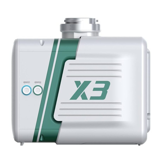
LiAir X3 User Guide • GreenValley International Inc. d) Power off the base station. Note: When the base station is set up on an unknown point, the base station needs to start collecting data 15 minutes before the flight operation, and stop collecting data 15 minutes after the operation ends. - Page 22 LiAir X3 User Guide • GreenValley International Inc. Install the GNSS Antenna Kits, GNSS1 is connected to the rear antenna, and GNSS2 is connected to the front antenna (front refers to the flight direction). Make sure there is enough space for the TF card and insert it into the system, then remove the dust cover from the bottom of the device.
-
Page 23: Parameter Setting
LiAir X3 User Guide • GreenValley International Inc. 5.3 Parameter Setting The LiAir X3 system will remember the parameters set last time, if there is no need to modify, the setting steps can be skipped. The acquisition parameters of LiAir X3 mainly include laser parameters, camera parameters, etc. - Page 24 LiAir X3 User Guide • GreenValley International Inc. Note: Google Chrome or IE11 browser is recommended. Page 24...
- Page 25 This section can be used to configure the laser and camera data acquisition modes. The LiAir X3 device has the following acquisition control modes: Flight Mode : This mode is the factory default setting. In this mode, when the device...
-
Page 26: Workflow
LiAir X3 User Guide • GreenValley International Inc. 5.4 Workflow 1. Power on the drone, press and hold the ON/OFF button of the system for at least 3 seconds to turn it on, and wait for the indicator light to be solid green, which means the system is in a normal state. -
Page 27: Data Downloading
5.Data Downloading 5.1 LiAir X3Data Download LiAir X3 data is stored in the TF card, including project files, LiDAR data, IMU data, log files, etc. Insert the TF card into the computer, and copy the corresponding project files to the computer (Not the folder with _NAV suffix). -
Page 28: Data Processing
LiAir X3 User Guide • GreenValley International Inc. 6. Data Processing LiGeoreference is a LiDAR point cloud georeferencing software developed by GreenValley which allows users to merge range measurements collected by mobile, UAV or airborne laser scanning systems with position and orientation information recorded by integrated IMU and GNSS sensors. - Page 29 LiAir X3 User Guide • GreenValley International Inc. Project folder is named with UTC Time, including: Base folder is used to store the ground GPS base station data. Calibrate folder is used to store calibrated files (*.cal). Please notice that: do not remove or delete this folder, otherwise, the performance of georeferencing will fail.
-
Page 30: Open Project
LiAir X3 User Guide • GreenValley International Inc. 6.2 Open Project Open LiGeoreference software, Click “ File ” icon on the toolbar to open LiGeoreference project file (.live) through “Browse” icon. Users can also open the project file via “Recent Projects” icon which refers to history project opened before. -
Page 31: Select And Configure Parameters
6.3.1 POS Processing Settings LiGeoreference software has pos calculation and point cloud calculation functions. Users could directly use LiGeoreference software to calculate LiAir X3-H’s trajectory, or choose to use other third-party software to perform pos processing procedure. 1. Using LiGeoreference to Perform POS Processing Click the "POS Process"... - Page 32 LiAir X3 User Guide • GreenValley International Inc. Select LiNav processing mode Select the processing mode according to the length of the trajectory. It is recommended to use the general mode. When the length of the trajectory is more than 10 km, the long baseline mode can be selected.
- Page 33 LiAir X3 User Guide • GreenValley International Inc. If the local base station format is Log format, select the NovAtel option. Enter the Base Station Coordinates When there is no precise base station coordinate, users could select "Average" mode. And the positioning principle is single point positioning, which leads to meter-level errors between the point cloud coordinates calculated by this method and the true coordinates.
- Page 34 LiAir X3 User Guide • GreenValley International Inc. 2. Import External IMU or Existing POS Data Select "External Input" under Process Mode to import .pos data. The external input function supports importing the original IMU data and the processed POS data, and the specific format includes *.pos, *.out, *.pof, *.sbtc, *.imu.
-
Page 35: Laser Scanner Settings
LiAir X3 User Guide • GreenValley International Inc. 6.3.2 Laser Scanner Settings Normally, the user does not need to change the parameters of the laser setting interface. If users want to limit the output power range by reflectivity, distance and scanning angle, users could change the range via clicking “Filter”... -
Page 36: Georeferencing Point Cloud Data
LiAir X3 User Guide • GreenValley International Inc. 6.4 Georeferencing Point Cloud Data 1. Select Georeference Rage Users could select the range to be georeferenced as needed. And there are two modes to be selected, including "trajectory selection" or "draw polygon". And this document only introduces the operation process of using the "trajectory selection"... - Page 37 LiAir X3 User Guide • GreenValley International Inc. 2. Select Processing Module After opening the project, LiGeoreference will select “POS Process” and “Georeference” module by default. Users could check and re-choose the function modules as needed. Note: If there is no image data, please do not choose "Colorization" module, otherwise the program will prompt an error.
- Page 38 LiAir X3 User Guide • GreenValley International Inc. 4. Data Quality Assessment Reports If the user needs to view the “Trajectory Report” and the “Image Overlap Report”, click the "Trajectory Plot" (or " Trajectory Report ") or “Image Overlap Report” (only suitable for devices with cameras) under the "Tools"...
- Page 39 LiAir X3 User Guide • GreenValley International Inc. Satellites Number: Click to open the plot to show the relation between number of satellites, which can be reached, and the GPS time. This tool is used to show the number of satellites can be reached by the device each time during the data acquisition. Satellites number is shown on the Y-axis.
- Page 40 LiAir X3 User Guide • GreenValley International Inc. PDOP: Position dilution of precision, or PDOP, shows the distribution of the GNSS satellites. Click to show the plot of PDOP. The smaller PDOP is, the better the distribution File Data Coverage: Click to show the plot of data coverage situation. This is used to show the data coverage relation among base station data, IMU data, and GNSS data of the moving device.
- Page 41 LiAir X3 User Guide • GreenValley International Inc. Estimated Position Accuracy: Click to plot the position accuracy. The X-axis shows the GPS time. The Y-axis shows the position accuracy. Red line is for position accuracy in East direction. Green line shows the position accuracy in North direction. While the blue line shows the position accuracy in height direction.
- Page 42 LiAir X3 User Guide • GreenValley International Inc. Position Separation: Click to plot the position separation. This plot shows the differences of position in East, North, and Up directions during the forward-backward processing. Attitude Separation: Click to show the plot of attitude separation. This plot is used to show the difference among the angles in Roll, Heading, and Pitch directions during the forward- backward processing.
- Page 43 LiAir X3 User Guide • GreenValley International Inc. Height Profile: This plot shows the changes in height during the data acquisition. Velocity Profile: This plot shows the changes in velocity during the data acquisition. Red line is for the changes in East direction. Green shows the changes in North direction. While the blue line shows the changes in up direction to the ground.
- Page 44 LiAir X3 User Guide • GreenValley International Inc. Image Overlap Report The image overlap report lists the image overlap. The report could check whether the photos are lost. Page 44...
-
Page 45: System Transportation And Maintenance
LiAir X3 User Guide • GreenValley International Inc. 7. System Transportation and Maintenance 7.1 Operation Notice To ensure the reliable use of the system and the safety of the operation personnel, please observe the following notices during installation, use and maintenance. -
Page 46: Equipment Maintenance
LiAir X3 User Guide • GreenValley International Inc. 7.2 Equipment Maintenance Before turning on the device, check whether the scanner lens is clean, if there is any stains, it should be cleaned immediately. After the equipment is used, check whether the scanning window of the scanner is dirty.
Need help?
Do you have a question about the LiAir X3 and is the answer not in the manual?
Questions and answers