Table of Contents
Advertisement
Quick Links
Advertisement
Table of Contents
Troubleshooting

Related Manuals for wingtra One


Summary of Contents for wingtra One
- Page 2 Table of Contents Introduction Quick Start Guide WingtraOne Package Content WingtraOne Deliveries WingtraOne Image Sensor QX1 WingtraOne Image Sensor RX1 WingtraOne Image Sensor RedEdge Safety Guidelines Environmental Conditions Safety Parameter Regulations Warranty Disclaimer Charging of WingtraOne Charging Acessories Charging WingtraOne Flight Batteries Flight Preparation Handling of WingtraOne Download-Maps-for-Offline-Use Create-a-New-Flight-Plan Advanced Flight Planning Preflight-Checklist Flying Flight Modes and In-Flight Interactions Flight Feedback Return-to-Home Assisted Mode Failsafe Scenarios WingtraOne PPK Postprocessing...
- Page 3 Geotagging Mapping Recommendations Image Postprocessing Software Process WingtraOne images with Pix4D Update and Maintenance Maintenance of WingtraOne Update WingtraPilot & WingtraOne Update WingtraHub Update Android OS FAQ / Troubleshooting Access Flight Logs Preflight Checklist Troubleshooting Handling of WingtraOne Troubleshooting WingtraOne 40MP RX1 Troubleshooting WingtraOne 20MP QX1 Troubleshooting Announcements and Release Notes Wingtra Release WingtraOne Documents...
- Page 4 Introduction WingtraOne User Manual — Release 1.8 Congratulations and a warm thank you! for being a Wingtra Customer. We hope you get the best out of your new aerial data collection tool! To get started, make yourself familiar with the support and feedback setup, and have a look at our quick start guide. Support and Feedback Setup This knowledge base should always be your first point of contact where most queries have been addressed already. We want you to enjoy the best experience possible and will be happy to support you in the following ways as well. Adhoc Support If you are on the field and cannot take-off due to technical reasons, please check the Tips and Tricks section below. If your issues are still not solved, you can call us under the following number, where a Wingtra employee will respond immediately during working hours (8am - 6pm, CET). +41 44 505 15 38 (Adhoc support only) General Support and Feedback For all questions that are not time-critical and cannot be answered by this knowledge base, please write open a new ticket. We are also very happy to receive emails regarding your feedback about our product. Tips and Tricks...
- Page 5 Introduction Tip 1: Search this Knowledge Base for Help Most of your questions are likely answered in one of the chapters in this knowledge base. Please try different search terms if you cannot find your answer. For most update to date content of the Knowledge Base please refer to the online version https://support.wingtra.com. Tip 2: Go through the Quick Start Guide Reassess the quick start guide. It describes all steps that need to be performed before, during, and after flight. It also links you to detailed explanations provided in different chapters. Tip 3: Repower WingtraOne Corner cases can lead to an unexpected situation that prevents WingtraOne from taking off. In case you cannot solve your issue with tips 1 and 2, repower WingtraOne and try again. Tip 4: Submit a support request If you require further help or assistance for using our WingtraOne please submit a support request. We will get back to you as soon as possible.
- Page 6 Quick Start Guide WingtraOne Quick Start Guide Use WingtraOne to collect high-end aerial imagery with accurate geolocation! The following 4 video tutorials show you in 12 minutes all basic steps you need to perform before, while, and after your flight. If you are looking for more detailed information, browse the knowledge base or use the search function. Check before you leave the Office Plan your Flight Setup your Flight in the Field...
- Page 7 Quick Start Guide Fly & Collect Images...
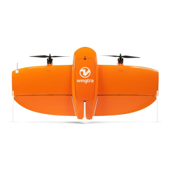
- Page 8 WingtraOne Deliveries WingtraOne Deliveries WingtraOne is a VTOL drone with the capability of taking off and landing vertically like a helicopter. For mapping mission, it transitions into cruise flight regime and matches the endurance and speed of fixed-wing airplanes. Your WingtraOne is shipped with the following accessories. Pilot Box 1. Remote control (RC) 2. Tablet 3. Flight batteries (2 flight sets) 4. Telemetry 5. Charger 6. Charging cables, Wind measuring tool 7. Pitot covering tool, SD card adapter, Hex-wrench tool WingtraOne...
- Page 9 WingtraOne Deliveries 1. Flaps 2. Middle stand 3. Propellers 4. Motors 5. Battery compartment 6. Ready-to-Fly button 7. Top cover - access to camera, electronics 8. Airspeed sensor (Pitot Tube) 9. Side stands 1. Payload (Camera) 2. Distance sensor...
- Page 10 WingtraOne Image Sensor QX1 WingtraOne 20MP QX1 The following explaination is valid for WingtraOne IDs >1135. The corresponding guide for WingtraOne systems <=1135 you will find on page 11ff in WingtraOne Manual PDF 1. The WingtraOne QX1 SD card is not inside the camera but inserted into the drone directly. 2. The QX1 camera is fixed with a safety ring. In normal operation you do not have to take out the camera. Adjustment of settings and focus happens through WingtraPilot. 3. Universal payload connector (USB-C) 4. Multiport QX1 connector (micro-USB) 5. Push button for PPK upgrade 6. Manual trigger button Important note about the QX1 camera: This camera will be called R10C in some third party tools (e.g. in Pix4D). Check and Adjust Camera Settings QX1...
- Page 11 WingtraOne Image Sensor QX1 In order to change the camera settings of the WingtraOne 20MP QX1, you first need to power on your WingtraOne. Then open WingtraPilot on your tablet and connect the telemetry. Once that WingtraOne is connected to WingtraPilot, you will see a camera icon in the top right corner of WingtraPilot (1). Create a new Flight Plan. Select QX1 20MP as camera option and the correct lens. 20mm Pancake lens as well as 15mm Voigtländer lens are supported. To change the camera settings, click on the camera icon (1) and a tab pops up shown in the image above. Here you can find a list of all the parameters that you can change. You can click on every parameter (2) and choose the value that suits best your need. In case the parameters do not update, use the refresh option (3). Furthermore, you can reset the parameters to default values (4). Exposure Shutter Aperture, White Mode Speed [s] f-Number Balance M: Manual AUTO 1/2000 F4.5 AUTO The default settings in the table above are valid for both, the 20mm and 15mm lenses, and give good results in large range of light conditions. In case of very dark conditions you can increase shutter time (do not go beyond 1/1000s). In case of very bright conditions you can decrease the shutter time (e.g. to 1/4000s). Focus of the QX1 20mm lens is calibrated for every camera individually before delivery. In the unlikely case that the lens gets out of focus and you got blurry images after a flight, WingtraPilot offers a focus calibration feature. For the 15mm lens, you adjust aperture value and focus on the lens. Make sure that the focus ring on the lens is turned to infinity. Caution: Remove QX1 with 15mm Voigtländer lens for transport - The 15mm Voigtländer lens protrudes the payload compartment of WingtraOne. For WingtraOne operation this is perfectly fine, for transport it is recommended to remove the camera from the drone. To do so, unplug the multiport connector (4), press the safety ring that holds the QX1 camera on the push button (2) and remove the camera.
- Page 12 WingtraOne Image Sensor QX1 WingtraOne QX1 Preflight Check On the preflight checklist you will find an element that contains "Camera: Click here to check the camera.". Once that you press it, the camera will check that the SD card is inserted correctly and that the interface between drone and camera works reliably. This process can take some time, please be patient until the button becomes green. In the case that the button turns red, first check that the SD card is inserted correctly and that the lens is not covered with the protection. Then try again. If you run into trouble, please check the WingtraOne QX1 Troubleshooting Section before submitting a support request.
- Page 13 WingtraOne Image Sensor RX1 WingtraOne 40MP RX1R2 1. SD card slot (use at least 128GB SD card size) 2. Battery compartment 3. Closure lid - has to stay open 4. Mode dial - default "2" 5. Power ON/OFF switch - default "ON" 6. Focus ring 7. Aperture selection ring 8. Focus Mode dial During the flight, the dummy battery powered by WingtraOne needs to be inserted into the battery compartment. To change the settings without powering on WingtraOne, the external camera battery can be used. The Charging Accessories chapter tells you how to charge this battery. Check and Adjust Camera Settings RX1R2 In most cases, the default camera settings (Mode Dial on 2) should be fine. If you want to change the settings, you have to power on WingtraOne and adjust the exposure settings.
- Page 14 Setting g Mode Quality Dial f-Number Mode Manual Multi Auto Exposur Segme 1/2000 fine The default settings give good results in large range of light conditions. The maximum ISO the camera will adjust is ISO 6400. In case of dark conditions you can decrease the shutter speed down to 1/1500s or open the aperture further (take the camera out and turn the aperture ring to a smaller number). To save different exposure settings permanently they have to be stored as a memory recall function. Set the mode dial to "M" and adjust the desired settings on the camera like file size, compression, metering mode, WB, shutter priority, shutter speed, or ISO. Go to the settings menu and save the settings to memory recall "1" or "3". Make sure not to overwrite the default settings by Wingtra on "2". Then turn off and on the camera via the Power switch on the camera. To use the desired exposure settings set the Mode Dial to the respective setting. WingtraOne takes a series of test pictures after you press the Ready-to-Fly button during the preflight procedure to check if the camera is setup correctly, i.e. to make sure that the SD card is inserted correctly and triggering from the autopilot is possible. We recommend opening the WingtraOne cover and inspect the routine on the camera screen. After pressing the "Ready-to-Fly" button the camera is switched off and on again, than the test pictures are taken (you can see the counter of remaining space on SD card on top left of the screen going down), and finally the camera is switched off again. In case the screen is going black for >5s during the procedure, check if SD card is inserted. If you run into trouble, check the WingtraOne RX1 Troubleshooting Section before submitting a support request. Caution: The manual aperture ring can be set to any value only mechanically via the Aperture Selection Ring. There is no storage setting for the correct aperture in manual mode. Image Quality Settings It is possible to increase the image quality settings to extra fine, and RAW + fine. These settings can improve the image quality even further. However, the file size of individual images increases significantly from ~18MB with fine to ~38MB (extra fine) and ~44MB +18MB (with RAW and fine). The continuous write speed in the camera during image acquisition is limited. To trigger reliably every image do not use the image quality setting extra fine below 1.4cm/px GSD (@75% frontal overlap), and below 2.1cm/px (@75% frontal overlap) for raw + fine setting. Please note: Image file size directly effects the postprocessing speed of geotagging, file copying and orthophoto generation. To change...
- Page 15 WingtraOne Image Sensor RX1 If the settings are not correct you can set them yourself. To save the setting on memory recall go to page 8 in the image setting tab chose "memory" and select "1" or "3". Finally turn off the camera via the Power switch on the camera. To access the setting for the next flight adjust the mode dial to the desired memory recall position. Note: once you overwrite the preconfigured settings they cannot be automatically restored. For more information about the camera see the official Sony Documentation.
- Page 16 WingtraOne Image Sensor RedEdge WingtraOne RedEdge The WingtraOne RedEdge offers a multispectral image acquisition. The camera aquires 5 individual images at the same time in spectral bands of blue, green, red, red edge and near IR. For camera specifications, technical details and camera related support please refer to the Knowledge base of Micasense 1. Reflectance tag 2. RedEdge camera 3. On/Off (pressing >3s) and trigger (press <1s) button 4. SD card slot 5. DLS sensor 6. GPS & Compass 7. Payload connector (USB-C) Caution: Make sure to use the provided 32GB SDHC SD card. SD cards wth high capacity (type SDXC) or lower read/write speeds are not compatible with RedEdge. Executing a Flight with WingtraOne RedEdge...
- Page 17 WingtraOne Image Sensor RedEdge On WingtraPilot welcome menu, create a new Flight Plan and select "Micasense RedEdge" as camera. Plan your flight as described in Create a new Flight Plan. Follow the preflight checklist: On preflight check nr. 7 (Configure RedEdge), you have to configure the RedEdge camera by connecting to it from a web browser like Chrome (see below). On preflight check nr. 11 (Calibrate RedEdge), take at least one calibration image (see below). Fly the mission After landing perform the following two steps before depowering WingtraOne: Take again a calibration image by holding WingtraOne over the reflectance tag and clicking the small button on front side of RedEdge. Depower RedEdge by holding the button on front side of RedEdge for 3 seconds. Retrieve SD-card from RedEdge and access your flight images Configure RedEdge Camera Operation of WingtraOne RedEdge requires to configure the camera to the desired flight plan parameters in a separate camera user interface. This user interface can be accessed via Wifi and webbrowser (Chrome). You can use the tablet itself or any other device as your smartphone. To configure RedEdge camera: 1. Power on WingtraOne 2. Connect via Wifi to the RedEdge camera (SSID = rededge // passwort = micasense) 3. Open the browser app (Chrome) and access the page http://192.168.10.254 4. Go to status tab (house tab). Check free space on SD card, GPS signal reception and time 5. Go to configure tab (gear tab). Set Auto-Capture Mode to Overlap. Set target altitude to flight altitude of your planned Flight Plan. Set Along-Track Overlap to frontal overlap of your planned Flight Plan. Press save...
- Page 18 WingtraOne Image Sensor RedEdge Calibrate RedEdge Camera Before and after each flight the RedEdge camera needs to be calibrated with the provided reflectance tag. Only a timely calibration guarranties reliable spectral information of your covered flight area To calibrate RedEdge camera: 1. Make sure a SD-card is inserted in the RedEdge camera 2. Place the reflactance tag leveled onto the ground 3. Power on WingtraOne, lift it up, and hold it with camera facing downwards ~1m over the reflactance tab. Make sure to hold WingtraOne leveled and do not cover the reflectance tag with a shadow from you or the WingtraOne. 4. Trigger at least one image of the reflectance tag by pressing the button on the front of the camera (see picture on top of article. Place WingtraOne back on ground...
- Page 19 WingtraOne Image Sensor RedEdge Flying WingtraOne Rededge on low altitudes above Takeoff If you are standing on a hill and fly over ground that lies below takeoff altitude you can enter a situation where RedEdge does not capture images. The camera only captures images when flying higher above takeoff than half your planned altitude. E.g. If you set up a flight plan with flight altitude of 120m above ground, enable terrain following, take off from a hill and part of your flight is lower than 60m above takeoff, it will stop triggering images. Please consider to switch to time based triggering at maximum trigger speed 1s in situations where your area covers significant altitude differences or you want to fly below 60m above home. To change to time based triggering change the Auto-Capture Mode to "Timer", and chose an appropriate time period to have sufficient frontal overlap for you GSD (minimum is 1s corresponding to 16m trigger distance in no-wind condition). Caution: do not forget using the "Start" button prior to take-off to start triggering and after landing to stop triggering. Further Information For further information about RedEdge camera please refer to Micasense RedEdge Manual...
- Page 20 Environmental Conditions Environmental Conditions In order to ensure flight safety, certain restrictions on environmental conditions need to be followed. Check the weather forecast (e.g. on windfinder) for wind, rain, and temperature. Gather information about the condition of the site, e.g. intensity of radiation fields and altitude above mean sea level. Make sure environmental conditions are as follows: Wind gusts must not exceed 30 km/h (8 m/s, 16 kts). Check with the anemometer before flying and do not fly if gusts on ground exceed 6 m/s on open fields (in confined spaces you have to rely on forecasts only). As a rule of thumb, wind speeds of 6m/s on ground on open fields correspond to wind speeds of ~8m/s in 10m-20m altitude (forecast altitude) and ~10m/s in 100m altitude. WingtraOne will return home automatically if wind speeds exceed 12m/s during flight. If you fly in high winds, check our recommendations in the advance planning chapter. Do not fly in case of rain, snow, or fog Ambient temperature must lie between -10 and 40 degree Celsius Do not fly in areas which probably have high-intensity radiation. Do not fly more than 3000 m altitude above mean sea level.
- Page 21 Safety Parameter Safety Parameters WingtraPilot features a couple of safety parameters to ensure safe operation throughout the entire operation. The parameters give you the possibility to influence the automatically triggered RTH scenarios described in Return to Home. The safety parameters are accessible on the top right during mission planning via the drop down menu below the Flight Plan information. Before starting a flight, one can adjust the parameter. Keep in mind the following considerations: Geofence radius around Home Defines the maximum allowable distance from Home in the particular mission. Prevents a fly-away of the WingtraOne beyond this distance. When creating or opening a flight plan the maximum radius is set to 1200 m, which corresponds to the maximum visual line of sight. Increasing it to more than 3000 m, low battery RTH may not function properly and the drone may not return to home. Plan your mission with care. You may void your warranty. Geofence altitude above Home Defines the maximum allowable altitude above Home in the particular mission. Prevents a fly-away of the WingtraOne beyond this altitude. Per default the maximum altitude is set to 400m before each take-off. Minimum RTH altitude above Home Defines the minimum altitude on which WingtraOne returns to home in a RTH. If current altitude is lower than the defined Minimum RTH altitude, WingtraOne will climb to the set value in a loiter circle and only then fly directly Home. Per default Minimum RTH altitude above Home is set to 60m before each take-off. Adapt Minimum RTH altitude to the mission requirements in particular in difficult terrain and when using Ground elevation offsets. Connection loss timeout Defines time span after which WingtraOne will execute an RTH if both RC and telemetry...
- Page 22 Safety Parameter connections are lost. Note: Since no telemetry connection is available, you will not receive feedback on the state of WingtraOne. Per default Connection loss timeout is set to 10s before each take-off. Adapt Connection loss timeout to your mission requirements. For flights beyond visual line of sight and with obstacles in the direct line of sight increasing the timeout might be required to ensure that WingtraOne follows and completes the defined Flight Plan. Caution:Without RC or telemetry connection you have no means of interacting with your WingtraOne. Do not increase connection loss timeout unnecessarily and make sure not to violate your local law. Minimum ground clearance Defines the minimum distance between the flight altitude and the terrain altitude. Important: If the minimum ground clearance parameter is higher then the defined altitude above Ground, the flight altitude will adjusted to match the ground clearance parameter. Use the minimum ground clearance parameter to account for trees, houses and obstacles. Set the parameter to have a margin to the highest obstacle in the flight area. Note: The minimum ground clearance parameter accounts for uncertainity in the elevation data ~which is approximately +- 20m.
- Page 23 Regulations Regulations Regulations for the usage of drones differ from country to country. The limitations vary from restricted areas to a pilot license requirement. Please check the law that applies in the country you are flying. Regulations in Switzerland In Switzerland the Federal Office of Civil Aviation (FOCA) is in charge of regulations relating to drones, which can be found here. The most relevant regulations are: Do not fly over groups of people. Do not fly beyond visual line of sight. Do not fly in restricted areas.
- Page 24 Warranty Disclaimer Warranty Disclaimer Any changes to the physical drone or the electronics will lead to a loss of warranty. That also applies to changes to any accessories such as RC or tablet. Be aware that improper operation can cause serious injury and property damage. If you desire any additional features, feel free to contact us. We will give our best to improve the system according to your demands. Make sure you always operate your WingtraOne on the newest software release. Operating WingtraOne on outdated code will lead to a loss of warranty. For further information please, check the End-User-License-Agreement (EULA) and warranty terms.
- Page 25 Charging Acessories Charging Accessories Operating WingtraOne safely requires fully charged accessories. In particular the tablet running WingtraPilot and Remote Control need to be sufficiently charged to allow for monitoring WingtraOne during flight and to trigger the appropriate failsafe actions if necessary. Charging WingtraPilot Tablet The tablet can be charged at any standard USB port via the supplied USB-A to micro USB cable. The shipped flight battery charger has a USB-A port on its right side. Plug in the USB cable into the tablet and connect it to the charger. Make sure that the charger is connected to a power supply. Using the flight battery charger you can charge WingtraPilot tablet as well on the go with a 12V power supply. For further information how to connect the flight battery charger please check the Charging WingtraOne Flight Batteries. If you use any other USB charging equipment make sure that the used charger can supply at least 2A to achieve satisfying charging speeds. Fully charged the tablet running WingtraPilot app lasts up to 4 hours continuous WingtraOne operation. Charging External Camera Battery To charge the external RX1 camera battery, the USB-A to micro USB cable (same as for the tablet) and the charging device located in the Pilot Box can be used. Charging Remote Control (RC) The remote control is charged with the included 12V power adapter. Plug in the power adapter and connect it to the RC. Make sure the RC is turned off. A small green LED on the backside should be on. If the LED turns off and the power adapter is still connected the battery of the RC is fully charged. Fully charged, the RC lasts up to 8 hours continuous WingtraOne operation. Battery Replacement of Anemometer...
- Page 26 Charging Acessories The batteries of the anemometer last for at least half a year if operated at a normal rate. Please make sure to check the battery charge indicator on the display of the anemometer regularly. If battery runs low please replace the batteries with 3 new standard AAA batteries. To do that you need to open the lid on the back side using a default cross tip screwdriver.
- Page 27 Charging WingtraOne Flight Batteries Charging WingtraOne Flight Batteries The following explaination is valid for WingtraOne IDs >1135. The corresponding guide for WingtraOne systems <=1135 you will find on page 28ff in WingtraOne Manual PDF Before going to the field you have to charge the flight batteries, the remote control (RC) and the tablet. The following sections describe how to charge the flight batteries. See Charging Accessories for details how to charge RC and tablet. Li-Ion Batteries The WingtraOne is powered by a pair of 4S3P Lithium-Ion batteries. For a charging manual see below. Caution: Lithium-Ion battery packs may get hot, explode or ignite, and cause serious injury if exposed to abusive conditions. Be sure to follow the safety warnings listed below: Do not pierce the battery with nails, strike the battery with a hammer, step on the battery, or otherwise subject it to strong impacts or shocks. Do not expose battery to water or salt water, or allow the battery to get wet. Always use the correct charging mode (LiIo CHARGE). Do not leave battery packs unattended during charging and make sure to place the batteries away from easily flammable environments such as wood or carpet. It is recommended to charge batteries in a fire proof container. Keep batteries within 10°C to 40°C (50°F to 104°F) before they are used. Do not leave them in the sun or in a hot car. We expect all users of Lithium-Ion batteries to be professionals and to have the capability to handle emergency cases. Charging Li-Ion 4S3P Batteries You can use the included charging system either on a power plug or on the field using car battery for charging. Set up your charging system as shown below and follow the following instructions: Select the mode by clicking on “Batt Type”, navigate to LiIo mode with the “Dec” and “Inc” buttons, and confirm with the “start/enter” button. Set the charging current to 7.5A, which corresponds to 1C. To start changing this setting and to confirm press “enter”.
- Page 28 Charging WingtraOne Flight Batteries Confirm your settings by pressing the “enter” button for 2 seconds. Check the settings (LiIo CHARGE mode, 7.5A), and confirm by pressing “enter”. Charging of empty batteries takes approximately 1 hour. Once the charging is finished you get an audio confirmation and you can see the message "finish" on the display (16.4 Volt corresponds to fully charged batteries). Press "stop" before you disconnect the batteries. Caution: Use and charge the 4S batteries always in pairs as they are labeled (pairs have the same number and color), i.e. do NOT fly with two batteries with different color labels. Charger Setup (Office) Charger Setup (Car Battery)
- Page 29 Charging WingtraOne Flight Batteries...
- Page 30 Handling of WingtraOne Handling of WingtraOne Carry WingtraOne You can carry the WingtraOne easily if you hold it at the wing area between the propellers and the battery compartment or at the motor mounts. Attach and detach Middle Stand The middle stand is not symmetric. Make sure that the shape of the midsection of the middle stand matches the shape of the airframe. The middle stand can not be inserted properly in the wrong direction. To attach the middle stand, we recommend holding WingtraOne with one hand and turning it vertically. Then simply attach the middle stand and secure it with the elastic band. To detach the middle stand, lift WingtraOne by holding the two motor mounts. Turn WingtraOne vertically and place one hand between the upper motor mount and the battery compartment. With the other hand, remove the security elastic band and detach the middle stand. Power on WingtraOne Open battery compartment and insert batteries Plug in the small black micro-USB signal port Power on WingtraOne by connecting the yellow ports, the cables need a firm push. Make WingtraOne Ready-to-Fly WingtraOne is equipped with a single LED-button — the Ready-to-Fly button — which needs to be pressed in the preflight procedure. Before pressing the button, no signals are sent to the motors and flaps. After powering on, WingtraOne enters a neutral state (not ready-to-fly), which is indicated by a slowly blinking Ready-to-Fly button (- - - - - -). By pressing the button, you put WingtraOne into Ready-to-Fly state, indicated by a double blinking LED (-- -- -- --). When WingtraOne enters the Ready-to-Fly state, it runs a routine that checks the functionality of both flaps by moving them back and forth, ending in a steady flap deflection. It then starts a process to check the functionality of the camera by capturing some test pictures. For further details, see the preflight checklist chapter.
- Page 31 Handling of WingtraOne Once WingtraOne is in Ready-To-Fly state and all preflight checks have been fulfilled successfully, it's only then that you can start the flight from tablet. During flight, the button is not blinking but solid on (-- ---------). After landing, the LED changes back to blinking (-- -- -- --), which means that WingtraOne can be approached without risk.
- Page 32 Download-Maps-for-Offline-Use Download Maps for Offline Use On the settings tab, select “Offline Maps” and “Add new set”. Navigate to the desired location, choose the right map type, zoom options (defaults of 14-18 should normally be fine), give the set a descriptive name. If you want to download elevation data for the selected area, you can check the box "Fetch elevation data" located below the selected Map type. By clicking on download, you start the download of the map tiles and, if selected, the elevation data. Be patient if the tiles are not loading immediately. If it does not progress for several minutes, restart WingtraPilot, navigate to the settings tab, select "Offline Maps" again, and click onto your new set. On the right side click onto "resume download" and be patient again. A green dot in the bar will appear once the download of the map tiles (and elevation data if selected) has completed as shown below.
- Page 33 Create-a-New-Flight-Plan Create a New Flight Plan To start planning a flight, you have to "Create a new Flight Plan" from the welcome menu of WingtraPilot. You can open the welcome menu by clicking on the Menu button on the top left. Follow the wizard to setup the high-level settings of the Flight Plan — Do you want to start from scratch or based on an existing Flight Plan? What camera do you use? Click on "Finish" and you will enter the flight planning display of WingtraPilot: The flight planning procedure itself contains these steps: (Optional) Import KML Set Home Add Area(s) (Optional) Adjust Geofence Step 1: (Optional) Import KML You can plan your flight based on KML files you import into WingtraPilot. Copy a KML to the tablet (get it via email, download from any cloud, or transfer it to the tablet with an SD card). Within WingtraPilot, click on the KML item (A), and press the + sign on the top right. Navigate to your KML file and select it. WingtraPilot is able to display points, lines, and polygons from your KML file. If you do not see the objects of your KML file, center the view on the KML using the center option on the left (A). You can transform every polygon of the KML into an area of the flight plan individually (see step 3). Check out the WingtraPilot Troubleshooting section if the kml import does not work.
- Page 34 Create-a-New-Flight-Plan Step 2: Set Home for Takeoff and Landing Add Home by clicking on the first button on the left (A). If you are on the field with WingtraOne powered on and connected to the tablet, Home is set to WingtraOne's current position automatically. If you plan the flight beforehand in office, you can move it to the place where you intend to takeoff — it will be adjusted to WingtraOne's location once you are on the field. Adjust "transition altitude" and "transition direction" on the right side (B) such that WingtraOne will not collide with any obstacle. WingtraOne will take off, rise to your "transition altitude" above Home, transition into forward flight, fly to the drawn loiter circle, loiter up to the area altitude and start data collection. After finishing data collection, it will fly back to the loiter circle at the altitude of the last area, loiter down to "transition altitude", fly back to the Home point, transition above Home, and land. Step 3: Add Area(s) To map a region of interest, you have to add one or several area(s) to your Flight Plan. You can add them manually or by importing a KML file and transforming polygons of the KML file into areas. After adding an area, define if you want to enable terrain following, set the desired GSD and overlaps, and define the connection between different areas. Add Area(s) manually: You can add one or several area(s) manually by clicking on the area item (A). Move the corners until you draw the area(s) that you want to map. Additional corners can be added by clicking on points in between any two corners. By clicking on a corner you will remove it. Areas can be removed by pressing the cross in the top right corner of the area dialog box.
- Page 35 Create-a-New-Flight-Plan Add Area(s) from KML: WingtraPilot can import and display KML files and lets you tranform polygons of the KML into area(s) of the Flight Plan. Copy a KML to the tablet (get it via email, download from any cloud, or transfer it to the tablet with an SD card). Within WingtraPilot, click on the KML item (A), and press the + sign on the top right. Navigate to your KML file and select it. WingtraPilot is able to display points, lines, and polygons from your KML file. To convert one of the KML polygons to a flight area, drag and drop the polygon name from the KML list to the Flight Plan editor on the right side (B). Terrain Following: For every area, you can define if terrain following should be enabled or not. If terrain following is enabled, WingtraOne will adjust the flight altitude for every sweep to achieve your GSD (respectively your flight altitude). WingtraPilot uses elevation data of the SRTM database with a spatial resolution of 30m. Please be aware that the elevation data is subject to uncertainty and does not account for vegetation or buildings (for further information check Advanced Flight Planning). Terrain following is enabled by default as it ensures best data quality (uniform GSD and overlaps as set in planning) and makes your flight safer. Please be aware that you need to pay extra care in certain situations as e.g. in mines where terrain changes substantially over time, or in steep terrain (slope > 100% or 45deg). GSD, Overlaps, Flight Direction: For every area, you can choose the desired ground sampling distance, which defines the size of a pixel on the ground. It is directly linked to the flight altitude that can be adjusted alternatively. In most cases, it is advisable to adjust the flight direction. You can also adjust the side and front overlaps of the images. Decrease the side overlap to maximize the area/minimize the flight time. Increase the overlaps to optimize the final map quality. Reliable orthomosaics can be created with imagery down to 60% front and side overlaps for areas without forest or buildings. For more sophisticated landscapes, you have to increase the overlaps. Connection between different Areas: When inserting more than one area, they are connected through a loiter waypoint. This is a circle on which the WingtraOne loiters from the altitude of the previous area to the one of the next. Its location can be manually adjusted during Flight Plan setup to enable safe transition from one area to the next one. Step 4: (Optional) Adjust Geofence and RTH settings You can adjust the geofence, which is the maximum allowed distance from Home, by clicking on the respective menu on the right side (B). Click on the triangle to unfold the menu. By default, horizontal geofence is set to 1200m and vertical geofence is set to 400m. Increasing the geofence size allows the user to operate WingtraOne beyond visual line of sight (BVLOS). Before changing the geofence limits, make sure that WingtraOne is operated within the local legal boundaries. If the flight exceeds 3km horizontal or 800m vertical distance from Home (in specific situations as high winds or high flight altitude even earlier), successful RTH on low battery can not be guaranteed and requires expert planning. Minimum RTH altitude defines the lowest altitude in which RTH is performed. You can change it from the default of 60m if necessary. In case RTH is engaged in cruise and WingtraOne flies below the specified altitude, it will first climb to this altitude before flying back to the loiter circle and performing the planned landing. In case WingtraOne is higher than the value set here, it will return to loiter circle...
- Page 36 Create-a-New-Flight-Plan Flight Planning on the Field As flight planning with WingtraPilot is very easy, we recommend planning easy flights directly on the field. If planning is performed on the field, it is recommended to set up equipment (power on WingtraOne → connect telemetry → start WingtraPilot) before planning the flight. Make sure you have internet access on the field or download offline maps before going to the field. Change WingtraPilot Settings The flight planning interface can be adapted to your usage by changing several parameters in the General Settings tab within WingtraPilot such as: Map provider (Google, Bing, Amap, Google Ditu) Map type (Street, Satellite, Terrain, Hybrid) Enable local coordinate system (for China) Enable elevation data. Only if this option is enabled, terrain following can be used and ground clearance checks are enabled (see Advanced Flight Planning). We strongly recommend enabling elevation data being aware that: A) elevation data is subject to uncertainty (for normal, not too steep or changing terrain you can expect uncertainty below +-20m) B) elevation data models the terrain profile. That means it does not account for objects like buildings or trees C) the data can be outdated (and hence incorrect) in case terrain is changing substantially (e.g. in mines), and D) uncertainty in steep terrain is higher than normal Units (metric, imperial) Language (English, Chinese, Japanese)
- Page 37 Create-a-New-Flight-Plan Under "Advanced options", you can furthermore "Enable custom side overlap settings", which allows you to plan flights with negative overlaps. This is useful for applications, where an image sample of a large area is required but no stitching. Additionally, the format of the optionally generated geotagging file (csv) can be chosen. How the csv file will be structured, depending on your choice, can be seen below the drop-down list. To generate the geotagging file during the normal geotagging procedure, "Create CSV tag file" needs to be checked in the tab Geotagging before geotagging is started. Finally there is an option to change the user mode. Please always use the basic mode, all functionality is given in the basic mode and wingtra mode is only for support purposes. Caution: Never switch to Wingtra mode unless you are told by the Wingtra Support.
- Page 38 Advanced Flight Planning Advanced Flight Planning Flying Large Flight Plans Flying in Difficult Terrain Flight Direction Flying in High Winds Flying Large Flight Plans Covering very large areas requires the splitting into multiple flights. WingtraPilot offers the feature to resume a Flight Plan after landing to swap the batteries. When Return-to-Home is triggered either manually or by low battery, the plane returns to land. At this point the part of the Flight Plan that was not flown yet can still be adapted. So can be the geofence and other safety settings. To resume the Flight Plan simply go through the preflight checklist again and launch the flight. The resume point is shown on the map as displayed above (R). Flying in Difficult Terrain For mapping in difficult terrain there are some options to facilitate path planning. Normally, you will enable terrain following in difficult terrain. See below for advice for safe flying in specific challenging situation (mines, obstacles, steep terrain, BVLOS behind mountains or buildings). Loiter Waypoints: In order to circumnavigate certain regions, you can make use of loiter waypoints. Those are automatically inserted between two areas. More of them can be inserted manually by pressing and holding the area button and then tapping the loiter waypoint button displayed in the figure above. Note that the entry and exit altitudes are usually linked to the areas, but when the adjacent element is not an area, it can be adjusted to suit the path planning needs.
- Page 39 Advanced Flight Planning Altitude Graph: The lower part of WingtraPilot features an altitude graph that indicates the flight altitude over the planned flight. You can display the altitude graph by pressing the button on the bottom right corner in the Flight Plan menu of WingtraPilot. Please note that when not flying the full Flight Plan, e.g. in resume operation, the altitude graph does not indicate the true flight, but the full Flight Plan. Terrain Following: WingtraPilot offers the option to use terrain elevation data to enhance safety of your flight and to facilitate flying with constant altitude above ground. The elevation data can either be fetched online when planning the mission or cached prior to planning (see Download Maps for Offline Use). Terrain following can be enabled for every area individually. If it is enabled, every sweep is flown at an individual altitude, ensuring consistent GSD resolution. The desired GSD or altitude above ground can be specified as usual. Use of the elevation data needs to be enabled when starting WingtraPilot for the first time or later on, by clicking the respective option in the WingtraPilot Settings menu. Ground Clearance Checks: All your Flight Plan is checked for ground clearance when uploading the Flight Plan to WingtraOne. You define a "minimum ground clearance" in the safety tab. It is good practice to set the value 20 meter higher than the tallest object within the region you are flying over and is set to 40m by default. In case you violate the ground clearance check along the line Home --> loiter circle, you will be warned at upload time by a safety wizard. You can either adapt transition altitude at this point to comply with the ground clearance also in this part of the flight or continue with your planned value. In case you violate the check at any other point (e.g. on connecting lines or if flight altitude is set lower than minimum ground clearance) you will not be able to upload your Flight Plan. Check the altitude graph to see where you violate ground clearance. Caution: Elevation data, as well as position measurements of the WingtraOne are subject to uncertainties. Also, the used elevation data does not consistently account for vegetation, buildings or other obstacles. The ultimate responsibility for sanity of the planned Flight Plan remains with the operator. Flying in Difficult Terrain - Mines / Changing Terrain Pay extra care if you want to map regions in which terrain is changing substantially. This is e.g. the case in active mines. For such situations please increase your margins, i.e. get a feeling how much your terrain differs from the SRTM database and adjust "minimum ground clearance" accordingly. In case you are unsure, consider disabling terrain following and use the "ground elevation offset" feature (see below) for your flight. Flying in Difficult Terrain - Obstacles / Buildings / Forest The terrain data within WingtraPilot does not account for forest or other obstacles like buildings. If you want to map forest or buildings, make sure to set the ground clearance to an appropriate value (we recommend normally the height of the tallest building + 20m). Since the mapped objects lie higher...
- Page 40 Advanced Flight Planning than the ground used in planning, effective GSD is typically better (lower) and overlaps are worse (lower) than planned. Therefore it is recommended to map forests and populated areas with higher overlaps. To enhance stitching robustness for such use cases, it is furthermore recommended not to fly very low (use slightly higher GSD than elsewhere). Flying in Difficult Terrain - Steep Terrain For steep terrain (slope > 100% or 45deg) you need to be extra careful in flight planning. The spatial resolution of the elevation data (SRTM database) is 30m and the steeper the terrain, the higher the uncertainty of the data. Moreover, overshoots of WingtraOne in turns (especially in high winds) can lead to substantial risk in steep terrain. If you can afford, please consider using higher GSD (fly higher above ground) than normally. Furthermore, it is recommended to set the ground clearance parameter to a higher value to account for the additional uncertainty. Manually check points along the Flight Plan that come close to ground, rocks, or other obstacles. Flying in Difficult Terrain - BVLOS behind Mountains or Buildings For the special case, where you have to fly behind a mountain or tall building (i.e. there is a mountain or building in between you and the flying drone, which is higher than the flight altitude), you have to adjust the "minimum RTH altitude" to ensure WingtraOne will not collide with the mountain in case RTH is triggered while being behind the mountain. Adjust "minimum RTH altitude" to the height difference between takeoff and the highest point of the mountain plus a sufficient margin (e.g. plus 50m). In order to perform such a flight, you likely have to increase the "connection loss timeout" and will fly blindly. Such a flight is considered highly risky - make sure you know what you are doing. Ground Elevation Offset Feature In case you disable terrain following for a specific area, you can make use of the ground elevation offset feature. Without terrain following WingtraOne will fly every area on a constant altitude. In order to account for differences in ground elevation, you can set a ground elevation offset. If you takeoff e.g. on a hill and want to map fields that lie 50m below Home, you can set the "ground elevation offset" for the respective area to -50m. Like that, WingtraOne will adjust its Flight Plan to achieve the desired GSD and overlaps at the specified ground level. Be aware that points that lie above your specified ground will be mapped with better (lower) GSD but with worse (lower) overlaps than set in planning. Flight Direction The selection of the most appropriate flight direction requires the consideration of different parameters. Flying parallel to the longest edge decreases the number of turns, which leads to the minimal flight duration. With this strategy, the maximal coverage can be reached. In case of notable wind, it is further advisable to fly orthogonally to the wind direction. Thus, the front overlap is not being influenced by the wind and regular stitching is ensured. Another method to improve stitching, especially for homogeneous areas, is not to fly aligned with linear structures (such as roads or cultivated fields). As a consequence, the number of similar looking images can be reduced. The most important fact, which needs to be considered when choosing the flight direction, is that there is enough space for the turns, so that they do not interfere with objects close by. Finally it is recommendable to fly along a slope rather than in its direction. A wave form of the ground elevation in the altitude graph indicates the latter, while a flat ground with steps at the turnarounds would be ideal.
- Page 41 Advanced Flight Planning Flying in High Winds WingtraOne can be operated safely in the specified wind bounds without caring about wind direction during flight planning. Nonetheless flight behavior and data quality is influenced by wind and can be optimized if you follow some recommendations: 1. Set the flight direction such that the sweeps are flown perpendicularly to the wind. In case of present elevation, you probably want nonetheless fly parallel to contour lines. 2. In case you fly far away (> 1-2 km) and WingtraOne has to fly against the wind on the way back to home, RTH on 38% battery remaining is on the limit. Be prepared to trigger RTH manually earlier (e.g. on 40% or 50% battery remaining). 3. Reserve more space for takeoff and landing. 4. If flight behavior during descent looks unstable, take over in Assisted Mode and land manually (WingtraOne is less stable while descending, by taking over, you stop the descent and WingtraOne stabilizes). 5. Forward and backward transition are most stable if you face forward transition into the wind. Within the specified wind bounds, WingtraOne can handle all orientations but if you have the space, orient forward transition into the wind during planning and place WingtraOne onto ground such that it does not need to turn during ascent.
- Page 42 Preflight-Checklist Preflight Checklist You are guided through the process of setting up your WingtraOne by the preflight checklist within WingtraPilot. The checklist slightly differs depending on the camera and WingtraOne ID you are flying with. See here for RedEdge specific preflight checks. As the operator, you have to go through the preflight checklist within WingtraPilot before you can start the flight. If any of the preflight checks fails (e.g. sensor failure), the respective preflight check turns red and starting the flight is not possible. Below you can find an explanation for every checkpoint in the preflight checklist and troubleshooting advice if a check fails. 1. Ground clearance without Takeoff/land at least 40m? This point in the checklist is an automated test. It facilitates flight planning with save altitudes for you. As soon as you have added a home location and added a flight area the flight altitudes will be automatically checked to guaranty the flight path has at least the defined ground clearance to the terrain elevation data. To modify the minimum ground clearance parameter check safety parameters box on the right side. Note: This preflight check is only available if elevation data is enabled. Check WingtraPilot settings to activate the usage of elevation data. 2. Hardware: Distance sensor clean? Propellers not damaged and well attached? Camera lid removed? Check if the distance sensor is dusty or is covered by something (snow, tape, ...). The distance sensor is located at the tail of WingtraOne, next to the middle stand. If it is not clean or if you are not sure if it is clean, take the time to clean it with a clean blanket.
- Page 43 Preflight-Checklist Visually check if propellers are not damaged and well attached. Try by hand to unscrew the propeller: hold motor with one hand and the propeller with the other hand and try to open it - the red propeller has a normal right-handed thread, the green propeller has a left-handed thread. If the propeller unscrews by hand, tighten the nut with the torx or hex-wrench tool as much as you can. See the maintenance chapter for how to replace a propeller if damaged. Remove the camera protection lid. Put it in the Pilot Box, it is easy to lose. Confirm by clicking the checkpoint in the checklist. Do not fly if any part of WingtraOne is damaged. 3. Connect telemetry link to tablet and power on WingtraOne. This point in the checklist is an automated test. Connect the telemetry to the tablet at the entry on the right of the home button. WingtraPilot automatically connects to WingtraOne as soon as the telemetry is connected to the tablet and WingtraOne is powered on. If automatic connection can not be established, you can manually connect to your vehicle in the Settings tab by clicking on the "Telemetry" button on the left side. On the bottom, click on "Add". Select Type "Serial" and Baud Rate "57600" and click "ok". If you still cannot connect, repower and make sure that you have attached the telemetry and powered on WingtraOne. 4. Check battery voltage This is an automated test. WingtraPilot checks whether the battery voltage is above 30V. If the voltage is below 30V take-off is prevented and you have to switch batteries. In the following further battery failure cases, WingtraOne will refuse takeoff when trying to start the flight: battery too hot (>40°C (>104°F)) battery too cold (<10°C (<50°F)) batteries are not charged evenly 5. Check even takeoff position This is an automated test. WingtraPilot checks whether WingtraOne is standing on even ground. Move WingtraOne if the check is red. If WingtraOne is level and the check stays red, repower WingtraOne. 6. Turn on the remote control (RC) Switch on the RC on the On/Off button in the middle of the RC. After switching it on, it automatically connects to WingtraOne and you can see the RC battery charge and the signal strength of the connection on the top left of the RC screen. This check is not yet automated, confirm by clicking the checkpoint in the checklist. 7. Check GPS signals This is an automated test. Depending on the weather and the location, it can happen that your WingtraOne does not receive GPS lock for several minutes. If GPS lock cannot be established after more than 5 minutes, try to repower WingtraOne. If you still fail to get reception, submit a support request. 8. Press Ready-to-Fly button on your WingtraOne...
- Page 44 Preflight-Checklist You make WingtraOne ready to fly by pressing the Ready-to-Fly button for 2 seconds. There will be a confirmation sound and the Ready-to-Fly button will start to blink with double blinks ( -- -- -- -- ). This checkpoint will automatically turn green as soon as the Ready-to-Fly state is reached. By making WingtraOne ready to fly, the startup routine of the flaps start. If WingtraOne does not react when pressing the Ready-to-Fly button, try again and make sure that you hold the button for 2 seconds. If it still does not work, repower WingtraOne. For more information about the Ready-to-Fly state, see the chapter on how to handle WingtraOne. 9. Check startup flap movement After making WingtraOne Ready-to-Fly, the flaps perform a startup routine (see video above). Check if it is run correctly and confirm by pressing this checkpoint. After the routine the flaps will stay in a steady deflection. Caution: DO NOT FLY if the routine does not run properly (e.g. one flap is not moving at all) and contact the Wingtra Support. 10. Camera readiness This check will test camera connectivity as well as availability of a SD card to store the image and flight data on. Click the check item and WingtraOne will try to write data into the camera during the test process. The checkpoint will turn orange which indicates the camera test process is on-going, wait for it to be finished. Once the test process is finished successfully, the checkpoint will turn green. In case the checkpoint stays orange for more than 1 minute, click the check again and the process is initialized freshly. If you own a WingtraOne with ID ≤ 1135, please refer to page 47 in this WingtraOne Manual for this check. 11. Calibrate airspeed...
- Page 45 Preflight-Checklist Take the pitot cover out of the pilot box and cover the pitot tube with it. Start airspeed calibration by clicking on the checkpoint in the checklist. The automated calibration is finished when you hear the beep. Remove the pitot cover after successful calibration! If airspeed calibration fails, you can restart it by clicking onto the respective checkpoint again. 12. Review Flight Plan and upload to WingtraOne After you have planned your flight, make sure you always review the flight plan. Close the checklist and check the parameters and the planned flight path. Make sure WingtraOne will not collide with any obstacles. The altitude graph allows you to review flight altitudes properly. Note, that having terrain data enabled (see Check 1) greatly helps to set flight altitudes correctly. Be extra careful with the transition direction and altitude as well as the loiter circle altitude. Click on this checkpoint in the preflight checklist to upload the flight plan to WingtraOne. WingtraPilot saves the Flight Plan automatically when you upload it by clicking on the checkpoint. In case you make any changes after uploading the flight plan, WingtraPilot will ask you to upload it again, which can be done by pressing the checkpoint again. If GPS position drifts more than 2m between Flight Plan upload and takeoff, the check turns back to white and you have to upload again. At the same time further flight plan sanity checks are performed and a warning is issued if they are not fulfilled: Infeasible Flight Plan In case the first Flight Plan item after Takeoff or the last Flight Plan item before Landing lies lower than Transition Altitude, your Flight Plan is rejected. WingtraPilot will give you the option to automatically insert a loiter waypoint at the respective location. It is recommended to insert the waypoint and manually adjust it (move it to a save location and adjust waypoint entry/exit altitude to a save value). Camera SD card storage too low (Only available for WingtraOne ID > 1135) WingtraOne checks for enough free space on the SD card to store the calculated number of images for the uploaded flight plan onto the SD card. Clear more space on the SD card to make sure all images are saved. If you ignore the warning and continue the mission upload, be aware that you might miss some images towards the end of the mission. Safe transition altitude Checks if the minimum ground clearance for takeoff and land is satisfied. In case you know that the transition altitude you set is save you can continue as planned. We recommend to accept the suggest transition altitude by clicking yes. Geofence Violation Both the horizontal geofence radius and the geofence altitude are checked to be compatible with the defined mission. If required increase geofence parameter in the safety box on the right.
- Page 46 Preflight-Checklist 13. Check whether there are no people within 5m around the plane and if the environmental conditions and airspace are suitable to fly. Check if the environmental conditions are suitable to fly. Also check that your flight does not violate laws. Make sure no people are close to WingtraOne. In case of wind, it is advisable to be more than 5m away from WingtraOne during takeoff and landing. Confirm by pressing this checkpoint in the checklist. 14. Once you have successfully completed all previous steps, you can fly WingtraOne. To start the flight click on "Start Flight" and move the slider left to right. The Ready-to-Fly button will go solid green (-------) once WingtraOne starts flying.
- Page 47 Flight Modes and In-Flight Interactions Flight Modes and In-Flight Interactions The flight regime of WingtraOne is either hover or cruise. Hover is the vertical mode that is used during takeoff and landing, cruise is the horizontal, forward flight mode, where WingtraOne flies like a fixed-wing aircraft. WingtraOne flies in the following three flight modes: Auto Mode This is the normal mode in which WingtraOne flies the planned flight autonomously from takeoff to landing. Return-to-Home (RTH) If RTH is engaged, WingtraOne flies back to the Home point and lands autonomously. For more details, see the Return-to-Home chapter. Assisted Mode You can fly WingtraOne manually in Assisted Mode. For a detailed description of how to fly with the remote control (RC) see chapter Assisted Mode. Possible Interactions The following table summarizes your options to interact during flight in order to switch between the flight modes and regimes. Make sure to observe WingtraOne and be prepared to interact especially during the landing. Action Consequence Emergency Kill all motors and spiral down. Stop: Return-to- The plane flies back autonomously, performs the planned landing Home: procedure and lands. Assisted Gives the pilot authority via the RC. Engage only if you know how Mode: to fly the WingtraOne! Transition (Only works Lets WingtraOne transition between hover and cruise. in Assisted Mode): You can take all described actions from the RC by pressing the respective buttons. To trigger Emergency Stop you have to click the red button 3 times within 2 seconds. You can engage Return- to-Home (RTH) and trigger Emergency Stop also from tablet by clicking on the respective buttons and moving the slider from the left to the right as shown in the videos below. Emergency Stop can be useful when landing to enforce motor shut off. This can be used when landing on shiny surfaces that are hard to detect by the distance sensor.
- Page 48 Flight Modes and In-Flight Interactions Caution: THERE IS NO WAY TO REGAIN CONTROL ON EMERGENCY STOP! Emergency Button Triggered from the Tablet RTH Engaged from the Tablet...
- Page 49 Flight Feedback Flight Feedback WingtraPilot displays all information which are required to monitor the WingtraOne flight. A: Information about warnings, GPS quality, and remaining battery. B: Change the center of the map C: Options to take over. For more details see the In-Flight Interactions Chapter. The small WingtraOne icon on the display which moves along the flight path after you start the flight shows you the current position and heading of the WingtraOne. On the bottom of the screen, you can see information about the planned flight and the current flight altitude. The default operating mode for WingtraOne is Auto mode. You will be notified by WingtraPilot with a voice message when the operating mode is changing to RTH or Assisted mode. All information in the WingtraPilot app are updated with at least 1 Hz frequency and with high precision measurement.
- Page 50 Return-to-Home Return-to-Home RTH is triggered automatically as a failsafe scenario or it can be triggered manually. Engage RTH if you realize something is wrong and you want WingtraOne to come back autonomously. If RTH is engaged, WingtraOne flies back to the planned loiter circle on its current flight altitude. If the current altitude is lower than the "minimum RTH altitude", WingtraOne will first rise to the "minimum RTH altitude" before flying back. It then loiters down to the planned "transition altitude", flies back to the Home point, transitions above the Home point and lands. The detailed RTH procedure depending on the position and the flight regime of WingtraOne can be seen in the two figures below. You can take over manually during Return-to-Home by switching to Assisted Mode. RTH Procedure in Cruise RTH Procedure in Hover...
- Page 51 Manual Flying in Assisted Mode Use the remote control for manual flying in Assisted Mode. Read the following section carefully before you switch to Assisted Mode. Use the "Assisted" button (5) on your RC to switch from Auto or RTH Mode to Assisted Mode. The flight regime will stay as it was before you switched to Assisted Mode, i.e., if you engage Assisted Mode during cruise flight, you will take over in cruise, and if you engage Assisted Mode during hover flight, you will take over in hover flight. Be aware that there are no extended safety features (collision avoidance or similar) available for WingtraOne. Flight Instructions The main reason to take over (switching to Assisted Mode) should be to hold or adjust the position before landing. Taking over in cruise is a safety feature that can be used e.g. in case of bird attacks or if RTH can not be performed safely. When flying in Assisted Mode you won't be able to collect images. The easiest point in time to take over is when WingtraOne is hovering. In this case, WingtraOne is stabilized and it will stay at its current location. If you need to change to Assisted Mode during cruising, it is therefore advisable to immediately do a back-transition to change to hover. With that procedure you will have time to think before further actions need to be taken. Caution: WingtraOne can severely harm people if handled inappropriately. Only fly WingtraOne manually if you know what you are doing. Caution: Depending on GPS quality, WingtraOne can drift for several meters. Be prepared to react. Hover Flying WingtraOne in hover works similarly to flying a multicopter. WingtraOne will keep its position if you do not touch the sticks. Likewise, it will move according to your control stick input. Cruise You can fly WingtraOne in cruise mainly with two control inputs: rising/sinking (pitching) and turning. WingtraOne will fly at constant altitude, speed (16m/s), and heading if you do not touch the sticks and rise/sink/turn according to your control stick input. Transition Use the "Transition" button (6) to transition from hover to cruise or vice versa. Forward-transition (hover->cruise): Make sure you are on a safe altitude before you transition into forward flight (cruise). There is no option to rise or interact in any way during transition! Back-transition (cruise->hover): The back-transition needs a lot of space. Engage it 50m before you reach the point at which you want to hover. Always engage back-transition at a safe distance and altitude away from obstacles and yourself. There is no option to interact in any way during transition! Landing If you are flying in Assisted Mode in cruise, transition back to hover by using the "Transition" button (6) at a safe distance and altitude. In case of low wind, change the heading after back transition such that the Wingtra logo is facing you to simplify the navigation. Direct WingtraOne to its intended landing position. WingtraOne will use its distance sensor to detect landing and switch-off the engines at 25cm distance above ground. As a safety feature, WingtraOne only listens to the distance sensor if landing is commanded, which means that the left stick on the RC is pushed down. Remote Control...
- Page 52 Assisted Mode Menu navigation buttons, to navigate the RC's settings - don't change them. 2. On / off switch, turns RC on / off 3. Navigation stick right 4. Navigation stick left 5. Engage Assisted Mode: allows you to take manual control of WingtraOne 6. Transition: performs the "transition" maneuver — switching from cruise to hover regime and vice versa (only works when flying in Assisted Mode) 7. Return-to-Home: initiates WingtraOne to autonomously fly home and land 8. Emergency button - when pushed three times within two seconds this will terminate the flight by cutting the power to the engines Control Sticks...
- Page 53 Assisted Mode Use the control sticks to fly manually in Assisted Mode. These are carefully tuned and allow you to maneuver easily and safe. The flight controller limits the range of possible manoeuvers to prevent WingtraOne from exceeding load factor. Assisted Mode - Cruise Input Result Left Stick: Up & Down gain (stick up) or lose (stick down) altitude Input Result Left Stick: Left & Right perform turns in the respective direction Input Result increase / decrease flight speed Right Stick: Up & Down (airspeed will stay within safe boundaries, which is between 14-20 m/s)
- Page 54 Assisted Mode Assisted Mode - Hover Input Result Left Stick: Up & Down gain and lose altitude Input Result Left Stick: Left & Right change heading (turn around central axis) Input Result Right Stick: Up & Down back and forth (pitching) Input Result move left and right (move aircraft along the Right Stick: Left & Right...
- Page 55 Assisted Mode Right Stick: Left & Right wing)
- Page 56 Failsafe Scenarios Failsafe Scenarios There are several scenarios where WingtraOne will take action by itself and engage a certain failsafe routine. Check out the image below. If your WingtraOne ID ≤ 1135, you will get a warning at 35% battery charge and RTH is triggered at 25%. Return-to-Home (RTH) RTH is triggered when the geofence is violated, when wind speed exceeds 12 m/s, when both telemetry and RC connection are lost, or when battery charge triggers this failsafe. It can also be triggered manually, see Flight Modes and In-Flight Interactions. More details about the execution can be found in the Return-to-Home Chapter. Warning Warnings are issued acoustically and visually on the tablet. The mission can still be continued, but caution is advised.
- Page 57 Failsafe Scenarios Land on Spot / Hover Down This is the most extreme failsafe, as it forces WingtraOne to perform a backtransition and land on the spot where it is at currently. It is triggered on GPS loss, or if battery voltage drops very low. It is only enforced if WingtraOne is in auto or RTH mode and not if you are in assisted mode. If it is triggered by the battery, you can take over manually by switching to Assisted Mode. However, you cannot take over manually if it is triggered by GPS loss, as Assisted Mode does not work without GPS. Last known WingtraOne Location Especially if there is a crash, you can click to check the last known GPS location of WingtraOne. Assisted-Transition From curise flight regime you can go to hover regime any time by pressing the Assisted button and then the Transition button on the RC. When Assisted-Transition is triggered, WingtraOne will immediately change into hover flight regime and stabilize itself in the air. Example situations when you should consider such manoeuver are: Unplanned approach of an object, e.g. helicopter, bird, etc. When WingtraOne behaves abnormally or looks unstable in the air. When you simply need time to think about what the WingtraOne should do next. After you manage to get the WingtraOne into a safe situation, you could trigger the RTH function, the WingtraOne will then bring itself back to the Home point and land safely autonomously. Emergency Stop There are some extreme situations which might resort you to using the Emergency Stop button to minimize the risk. For example: A manned aircraft is approaching the WingtraOne at a very high speed - stopping the motor will avoid the WingtraOne crashing into the manned aircraft and prevent any injury. WingtraOne is very close to crashing into a building due to planning mistake - stopping the motor will avoid the WingtraOne crashing into the building with motor spinning and reduce the risk of injury. Failure of a single motor or part of the wing is damaged - stopping the remaining motor will make sure the WingtraOne do not deviate its path into an unwanted direction. It is very important to note that the Emergency Stop function should only be triggered in extremely critical situations simply because there is no way to reverse it.
- Page 58 Failsafe Scenarios...
- Page 59 WingtraOne PPK WingtraOne PPK The WingtraOne PPK (post processing kinematics) enables high-precision mapping without the need of using GCPs (ground control points) to correct a map that is created based on images captured by the WingtraOne. The system uses correction data collected with a base station on ground to assign high-precision position information to the images after your flights. Get Started with WingtraOne PPK Together with your WingtraOne PPK unit you will receive a brochure. It guides you in how to deploy the PPK module and our PPK processing software WingtraHub. Furthermore it gives a summary of the PPK workflow. Follow the brochure and perform the step by step software setup below in order to set up your system and learn the workflow. PPK Briefly Explained Post processing kinematics (PPK) uses correction data of a base station on ground to correct the GNSS data of WingtraOne after your flight. It allows to assign centimeter precision geotags to your images. This geotagging process happens within the Windows WingtraHub application after your flight(s), typically back in the office. You will need the following data:...
- Page 60 WingtraOne PPK 1. Images from camera on WingtraOne 2. GNSS data from PPK module on WingtraOne 3. Base files (RINEX) from your base station 4. Base location of your base station To acquire images and the GNSS data, you need a WingtraOne PPK drone with which you perform a normal flight. All data will be saved to the camera SD card in an organized manner, focus on your flight - WingtraOne will ensure that your data (images and GNSS data) is saved on the SD card. Correction data of the base station is logged into "Receiver Independent Exchange Format (RINEX)" files. You have to provide these base files (RINEX) and the exact location of your base station. There are different options how you can acquire the base files and the base location; depending on your country, location and the surveying equipment you own, decide for one of the 4 options described further below. The base files (RINEX) need to cover the full period of your flight - make sure they start before your takeoff and stop after you landed. Normally you will get 3 files (with endings .h, .n, and .o) and WingtraHub will use all 3 of them. As logging interval we recommend a value between 1s and 10s. The base location needs to be provided in WGS84 coordinates with ellipsoidal height (altitude above ellipsoid). In case you know your base location in local coordinates, make sure to use an exact transformation between your coordinate system and WGS84, ellipsoidal. The images will be tagged in WGS84 coordinates with ellipsoidal height. Together with the tagged images, WingtraHub will save a geotags.csv file and a geotagging report for every project. The geotags.csv file contains the following columns: image_name, lat, lon, alt, 0, 0, 0, horizontal accuracy, vertical accuracy. PPK geotagging is not adding attitudes to the csv file, this is why you will see 3 columns with value zero. Due to the high-precision position information, the final accuracy in the map is best if no attitude information is used while processing. Step by Step PPK Software Setup (WingtraHub) Step 1: Download WingtraHub and Tutorial Click the button above to download WingtraHub and the tutorial data. Unzip the downloaded folder in which you will find the .exe file and a folder called WingtraProjects. You can leave it in your downloads folder and delete after finishing the tutorial or save it locally in case you want to rerun the tutorial on a later point in time. WingtraHub requires Windows OS 10. Step 2: Install WingtraHub Unzip the download and double click the WingtraHub.exe file. You may grant permission for an untrusted source. Step 3: Insert One-time License Activation USB Stick and PPK License Dongle Insert the two USB sticks of your PPK kit to your computer. The orange One-time License Activation...
- Page 61 WingtraOne PPK Step 4: Tutorial & Activation Process the sample map to finalize the setup and learn to process WingtraOne PPK data. Note that the provided images are thumbnails only. The sample project in full resolution is available here (4.5GB). Start WingtraHub and select the downloaded WingtraPilotProjects folder which contains the tutorial project. WingtraHub will display all projects within your WingtraPilotProjects folder. Select the sample project and click "next" to reach the processing page. On the lower-left corner click on "Select license file". Browse to the USB stick (only one USB stick will be visible) and select the file within the LICENSE folder. Restart WingtraHub. Select the WingtraPilotProjects folder and go to the processing page again. You can now unplug the orange dongle - keep it at a safe location in case you want to process PPK data on another machine in future. For your sample project, make sure the option "PPK processing" is activated. Select the base files (RINEX). You can find them in the Base folder beside the WingtraPilotProjects folder. WingtraHub displays the 3 files only once - select it and WingtraHub will use all three for processing. Define the base location. The base location needs to be provided in WGS84 coordinates with ellipsoidal height or in Cartesian coordinates. For the sample project, you can find the coordinates in a text file within the /base folder. Manually add a new base station with the coordinates and give it a descriptive name - WingtraHub will remember your base stations. Start processing and observe the processing steps. For batch processing of several projects, WingtraHub will automatically process one project after the other. Have a look at your results. Navigate to /WingtraProjects/sample_project/OUTPUT and inspect the geotag pdf report, the geotags.csv file and the geotagged images. Use the images and the csv for processing in Pix4D, Agisoft Photoscan or alike. Finished! Go flying and process your first PPK projects Now that you successfully completed the WingtraOne PPK tutorial, you are ready for your first real project. Take your system to perform one or several flight(s), insert the camera SD card to your computer, select the /WingtraProjects folder on the SD card and run geotagging accordingly. For different options how to provide your base files (RINEX) and base location check out the next section. Your base station options...
- Page 62 WingtraOne PPK General base station requirements In general most base station modules and brands work in combination with WingtraOne PPK. The minimum requirements for a base station are: Possibility of continuous logging with logging interval of 15s or faster (recommended for highest accuracy 1s) Logging at least two frequencies L1 (1575.42MHz) and L2 (1227.60MHz). Receiving Constellations GPS + GLONASS (optional for high precision). Possibility to save / convert logging data to RINEX files (receiver independent exchange format) with version 2.11 or newer. Option 1: Use subscription to a CORS or VRS network In most parts of the world there exist "Continously Operating Reference Station (CORS)" networks. They consist of a number of fixedly installed base stations to which you can subscribe. They offer web services that let you download base files and base location. Download RINEX files from the nearest CORS base station in your network. The base location is normally given in a local coordinate system. Make sure you use an exact conversion between your local coordinates and WGS84 with ellipsoidal height. Alternatively, most of the networks offer a "Virtual Reference Station (VRS)" option, that interpolates the correction data of several nearby CORS stations to further improve the accuracy of your project. Option 2: Use your own RTK enabled base station If you want to use your own RTK GNSS base station, place it at an open space when arriving at the field. Measure the base location with the device and make sure to save the coordinates. Start logging of the base station file >10min before you takeoff for the first flight and log continuously until after your last landing. Depending on the base station model, you will log the file to a SD card in the receiver or stream it to a laptop or mobile device. The raw GNSS static files from your receiver (trimble: .t00, topcon: .tps, leica: .m00, septentrio: .sbf) need to be converted to the RINEX file format. Option 3: Use your own non-RTK base station and place it on top of a point with known coordinates If you own a GNSS base station that is not RTK enabled, you need to provide the base location manually. This can be done by placing the base station on top of a point with known coordinates. Make sure you know the height of the pole to calculate the base location based on the known coordinates. The base location is defined at the GNSS receiver antenna center. Arriving on the field, place the base station on top of the known location and start logging before taking off for the first flight. Depending on the base station model, you will log to an SD card in the receiver or stream it to a laptop or mobile device. The raw GNSS static files from your receiver (trimble: .t00, topcon: .tps, leica: .m00, septentrio: .sbf) need to be converted to RINEX file format. Option 4: Use your own non-RTK base station and use third party applications to calculate the base location in retrospect In case options 1-3 are not available and you own a GNSS base station, you have the additional option to calculate the base location in retrospect using third party software. For this workflow, place the base station once arriving on the field, configure the GNSS receiver as base station and start logging. Depending on the base station model, you will log the RINEX file to an SD card in the receiver or stream it to a laptop or mobile device. In order to get sufficiently accurate results, the static...
- Page 63 WingtraOne PPK GNSS observation time should be at least one hour. Earliest two days after your flights, you can upload the RINEX files to an online GNSS data processing facility that uses earth-wide orbit, clock and earth rotation corrections to estimate the base location in retrospect. A widely used third party software that works world-wide is the Australian service Auspos. Upload your RINEX files earliest two days after the data collection and you will get back the base location with a detailed report via email. WingtraOne PPK processing - Troubleshooting If you get a failure on PPK processing in WingtraHub or not 100% PPK fix, check the following points: Check that the date and the time of your base file match with the time of your flight. You find the UTC date and time of takeoff for each flight in the WingtraHub Projects overview. Check if your RINEX files covers the entire flight time from take-off to landing. Check if you inserted and selected the correct base location with the right coordinate system (WGS84, ellipsoidal height).
- Page 64 Geotagging Geotagging The following explaination is valid for WingtraOne IDs >1135. The corresponding guide for WingtraOne systems <=1135 you will find on page 61ff in WingtraOne Manual PDF For every flight mission, a folder with the project's name is created on the SD card in the "WingtraPilotProjects" folder. Both the collected images and GNSS data of the corresponding flight are saved in this project folder. You can geotag the collected images on the field after completing each flight or in the office after completing multiple flights throughout the day. To assign the geotags to the images, please go through the following description about the non-PPK and PPK geotagging process. Non-PPK Geotagging For non-PPK geotagging, you can do it on the tablet by using WingtraPilot or a Windows 10 computer using WingtraHub. Check out the PPK Chapter for information about how to install and setup WingtraHub. All you have to do is take out the SD card from the camera after the flight(s), put it into the tablet or computer, and start the geotagging procedure as follows. 1. Go to the "Geotagging" tab in WingtraPilot/WingtraHub and select the "WingtraPilotProjects" folder on your SD card. 2. Select the project(s) which you would like to geotag, then click "Next".
- Page 65 Geotagging 3. If you want a faster tagging process and do not need the coordinates embedded into images, you can check the "Csv output only" box to get only the coordinates of the images in a single csv file. 4. Click "Start tagging" to start the process. 5. Once the geotagging is done, WingtraPilot will inform you if the process was successful. The results of the geotagging process are described at the bottom of this article. PPK Geotagging For PPK geotagging, you can only do it on a Windows 10 computer by using WingtraHub. Check out the PPK Chapter for information about how to install and setup WingtraHub. The PPK geotagging process is similar to the non-PPK geotagging process, but with some extra data needed from the user's side. Just take out the SD card from the camera after the flight(s), put it into the computer, and start the geotagging procedure as follows. 1. Go to the "Geotagging" tab in WingtraHub and select the "WingtraPilotProjects" folder on your SD card. 2. Projects with PPK enabled are labelled with "PPK" on the bottom right corner of the project boxes. 3. Select the project(s) which you would like to geotag, then click "Next". 4. Check the "PPK processing" checkbox to enable PPK geotagging. 5. If you want a faster tagging process and do not need the coordinates embedded into images, you can check the "Csv output only" box to get only the coordinates of the images in a single csv file. 6. Select your base file and provide the base location of the base station for each project.
- Page 66 Geotagging 7. Click "Start tagging" to start the process. 8. Once the geotagging is done, WingtraPilot will inform you if the process was successful. A geotagging report which contains the information of the PPK geotagging process will be produced as well. We recommend you to go through the PPK tutorial to learn more about the details regarding PPK geotagging process. Results of Geotagging After geotagging, you get accurate geolocation information for each flight image. It is provided in a csv file in the OUTPUT folder of your project, and, if selected, in the EXIF metadata of your images. Here is an overview of the final content of the project folder inside "WingtraPilotProjects" folder: /DATA subfolder: All GNSS data available for this particular project. /IMAGES subfolder: All unmodified images for this particular project. /OUTPUT subfolder: All output data from the geotagging process. /DATA/date_time.json file: A text file containing time, GNSS coordinates and attitudes for all images (for non-PPK geotagging). /DATA/date_time.sbf file: A binary file containing the GNSS information of the mission for PPK geotagging purpose. /OUTPUT/imagename.jpg files: Tagged images with GNSS coordinates and exact GPS time embedded as EXIF tags. /OUTPUT/projectname.csv file: A geotags text file, which contains the relevant meta infomration for all flight images: If Pix4D type csv file output is selected: imagename, latitude [decimal degrees], longitude [decimal degrees], altitude [meter], omega [°] (0° for WingtraOne PPK), phi [°] (0° for WingtraOne PPK), kappa [°] (0° for WingtraOne PPK), Accuracy Horz [meter], Accuracy Vert [meter]. If Agisoft type csv file output is selected: label, latitude [decimal degrees], longitude [decimal degrees], altitude [meter], Yaw [°] (0° for WingtraOne PPK), Pitch [°] (0° for WingtraOne PPK), Roll [°] (0° for WingtraOne PPK) /OUTPUT/geotagging.pdf file: A report which contains all the information regarding the geotagging process. Caution: The output GNSS coordinates from the geotagging process for WingtraOne PPK and WingtraOne without PPK differ! Please refer to the table below for the correct coordinate system. The coordinate system of the output GNSS coordinates from the geotagging process are as shown in the table below: Height Reference Version Coordinate System System WGS84...
- Page 67 Geotagging Above mean sea level Non-PPK WGS84 height (egm96) To learn more about how to use these output data from the geotagging process, please refer to the Image Post-Processing Software article.
- Page 68 Mapping Recommendations Mapping Recommendations There are several recommendations we can provide to aid you in generating and evaluating maps with WingtraOne. Original Data Quality The quality of the data collected by WingtraOne is a very important element in obtaining an accurate map. Image quality, light condition, and flight path overlap are the three factors which effect the most on the quality of the original data. Image quality High resolution images are essential to ensure a successful stitching (orthophoto generation). All of our cameras were thoroughly chosen to guarantee high quality images. Especially for projects with high requirements, it is advisable to use the first-rate sensor RX1RII. For more details about our diverse range of sensor options, check out our homepage. Light condition The default camera settings provided by us cover a large range of light conditions. Nevertheless, it is advisable to check the images after the first flight to make sure the images are not underexposed or overexposed. The orthomosaic generation favors images with many distinctive features which are constant over all images. Therefore, flying on a bright but cloudy day would be ideal to prevent shadowing. Shadows darken areas which reduce the visability of features. Additionally, it results in appearance changes between images, as the position of the sun changes during the flight. Overlap The default overlap (front and side) parameters are set to 70%, which is a good compromise between stitching robustness and data volume. Increasing the overlaps improves the stitching quality but at the same time the processing time, including geotagging, will increase as well. The side overlap is additionally linked to the flight duration as the number of rows increases. On the other side, the front overlap is only affecting the number of images. Geolocation accuracy Flight imagery can be geotagged after the flight. More details about the coordinate system of the geotags can be found in the Image Postprocessing Software Chapter. When flying with a WingtraOne without PPK the geotagging accuracy of single images is in the range of a few meters. When flying with a WingtraOne with PPK an absolute geotagging accuracy down to 1 cm can be achieved. With both options, the resulting products have a high relative accuracy, which allows to measure lengths or volumes accurately. For projects, where high absolute accuracy is required, you can either use a WingtraOne PPK or you can add ground control points (GCPs). When flying with a WingtraOne without PPK, we recommend to use at least 5 GCPs and 3 check points. Distinctive and stable features on the ground or additionally added marks can be used. The points should be measured accurately and placed in order that each point is visible on multiple images. Most postprocessing software allow the import of GCP coordinates and provide an interface to mark them in the images. Make sure to specify the coordinate system and height system correctly.
- Page 69 Mapping Recommendations...
- Page 70 Image Postprocessing Software Image Postprocessing Software Output images of WingtraOne are postprocessing tool chain agnostic. That means geotagged images can be used with any postprocessing and mapping software of your choice. For optimal processing results we recommend using the created .csv file to import the precise geolocation and accuracy information of every image into the postprocessing software. If you combine images of multiple flights to one postprocessing project you can use the import .csv function in the postprocessing multiple times for all individual *.csv files (e.g. Pix4Dmapper) or create manually one large *.cvs combining the individual files to one file. WingtraOne with Pix4D products Wingtra AG is official reseller of Pix4D software products. Pix4Dmapper and other software solutions of Pix4D offer state-of-the art stitching and 3D reconstruction of aerial imagery on the desktop and in the cloud. It guarantees excellent quality maps produced by WingtraOne flight imagery. We are very happy to help you to find a matching licence for your needs and quote licences to you. Please contact support@wingtra.com or open a support request to place your inquiry. For a free trial of Pix4Dmapper please click https://cloud.pix4d.com/ and create an account. For more information how to create a Pix4d project using WingtraOne images please check out the Process-WingtraOne images with Pix4D article.
- Page 71 Process WingtraOne images with Pix4D Process WingtraOne images with Pix4D To process a project with Pix4dmapper please follow the step by step instructions. You may use the PPK tutorial data for a sample project General Recommendations WingtraOne data sets in particular from WingtraOne RX1 can be very large. Please make sure to have enough computing resources available. We recommend >= 32GB RAM, >6 core and enough high speed SSD storage. For complete specifications please refer to the pix4d support page. Speedy processing can be done in the pix4d cloud. Please note that for processing with the correct image coordinate system of WingtraOne PPK data and custom project settings like GCPs or special output formats you cannot use the Pix4d cloud directly but you have to setup the project using the desktop version and upload the project from within Pix4dmapper Pro. Step 1 - Open Pix4dmapper and create a new project Step 2 - Select images Click select images or select directories to add either specific images or all images inside one folder. Browse to the OUTPUT folder of your WingtraPilot Project. You may add images of multiple projects by adding them subsequently.
- Page 72 Process WingtraOne images with Pix4D Step 3 (only for WingtraOne PPK images) - Adjust coordinate system of images When processing WingtraOne images without PPK you can directly go to Step 5. Caution: The default selection of image coordinate system is not correct for WingtraOne PPK flight images! To adjust the correct coordinate system please click on "Edit". In the popup select "Advanced Coordinate Options" and choose "Geoid Height Above WGS 84 Ellipsoid [m]" and give 0.0m offset.
- Page 73 Process WingtraOne images with Pix4D Step 4 (only for WingtraOne PPK images) - Import accuracies for image positions To ensure successfull processing with highest precision, import position accuracy information from the *.csv file in the OUTPUT folder of your project. Click select "From File" (1) define the File Format "Latitude, Longitude, Altitude" and browse (2) to the *.csv file of your project and open the respective file (3). If you imported multiple projects you can select multiple the respective *.csv files sequentially. Note: to have the correct *.csv file structure please make sure to have selected pix4d csv file type in WingtraHub or WingtraPilot settings.
- Page 74 Process WingtraOne images with Pix4D Step 5 - Define output coordinate system Select your desired output coordinate system. In case you want to import GCPs or check points, the output coordinate system needs to be the one in which you measured your ground control points. Note, you can change it later when importing the points. Step 6 - Select processing template Select your desired processing template which defines the resolution and quality of the output, the required computing resources as well as the desired outputs of processing. As a default setting the predefined "3D Maps" template is a good option. The processing options can be changed after you pressed "Finish" and stored as a personal template to be directly accessible for future projects.
- Page 75 Process WingtraOne images with Pix4D Step 7 - Option 1 - Generate basic output Now you can start the processing. Make sure to have all three process steps selected and start the processing of the project by clicking on "Start" or continue with Step 8 Step 7 - Option 2 - Generate output including check points or ground control points (GCPs) Start the the processing step 1 of Pix4dmapper. After completion of the initial processing import and mark your GCPs (for more details please check out Pix4d Support - How to add and mark GCPs). Make sure you select the correct coordinate system for your GCPs. Depending on the purpose of your GCPs you may add them as check points only. Checkpoints will not affect the processing result but enable you to check the accuracy of your results. After importing and marking your GCPs re-optimize the results and run processing step 2 and 3 of Pix4Dmapper by clicking "Start". Step 8 (optional) - Process in Pix4D cloud To save computing resources or process multiple projects in parallel you can upload the projects from Pix4Dmapper to the cloud and process them there. If you defined the project correctly in Step 7 it will consider your custom outputs and GCPs even when processing in the cloud. Click on "Project/Upload Project Files" and select "Start Processing" before clicking "Upload". Note, upload speeds are considerably higher compared to upload in the browser interface of pix4d cloud.
- Page 76 Process WingtraOne images with Pix4D...
- Page 77 Maintenance of WingtraOne Maintenance of WingtraOne Basic Maintenance Tasks of WingtraOne The WingtraOne does not need extensive maintenance in normal operation. Nevertheless it is worth to perform the following checks and tasks: Clean the optics of the camera. Use a soft dry glass cleaning cloth to wipe the lens gently. If you have interchangeable lenses make sure that both sides of the lenses are clean. Check the camera settings by reviewing image properties of taken images. We recommend using our default settings as mentioned in the respective camera knowledge base article WingtraOne 20MP QX1 and WingtraOne 40MP RX1R2. Visually check the middlestand, sidestands and propellers for cracks or damages. Visually check the flight batteries for damages. In case of a damage take a picture and contact Wingtra Support Check if the flight batteries plugs sit tight once they are fully plugged in. Visually check that motor mounts are straight and not bend. Visually check that the airspeed sensor is not blocked by particles. Check that the flaps move without any resistance once WingtraOne is depowered. Check that your camera sits tight in the camera mount. Visually check for other potential damages on your WingtraOne hull. Make sure that all supplied equipment described in WingtraOne Deliveries is available and functional. It is recommended to perform a detailed maintenance check after every 20 flights cycle and an extensive maintenance check after every 300 flights cycle. Please use the WingtraOne Maintenance Assessment Form as a guideline when you are performing the maintenance checks and submit it to Wingtra Support once you finished the checks. In case of a damage, question or any doubt on the state of your WingtraOne please submit a support request. Repairs of WingtraOne We provide official WingtraOne Support Docs that describe how to replace parts that can get damaged during transport or after tipping while landing WingtraOne on uneven ground. Make sure to follow the procedures exactly as described and contact your Reseller or submit a support request in case anything is unclear. Maintenance that can be done by yourself as a WingtraOne customer Repair WingtraOne ID <= 1135 WingtraOne ID > 1135 Replacement of Propellers Replacement of Pitot Tube Replacement of Side Stands...
- Page 78 Maintenance of WingtraOne Rededge Camera Changing from Rededge to RGB Camera Straighten motor mount Packing WingtraOne for return shipment Maintenance that is done by Wingtra or Wingtra Resellers Repair WingtraOne ID <= 1135 WingtraOne ID > 1135 Replacement of Motor Mounts Replacement of Propeller Adapter Recalibration of Autopilot Sensors...
- Page 79 Update WingtraPilot & WingtraOne Update WingtraPilot & WingtraOne You will profit from software updates Wingtra provides for both WingtraPilot and the WingtraOne firmware. When connected to the internet WingtraPilot will inform you when a new update is available. To enable the latest software improvements please follow the instructions below to update your WingtraPilot and WingtraOne. Caution: Before updating the operating system of your tablet, please have a look at Update Android The updating process consists of three main steps Download latest release Updating WingtraPilot Updating WingtraOne Step 1: Download Latest Wingtra Release Start WingtraPilot. Open the Update menu under the WingtraPilot Settings tab On the left side (A) you will see the release information of the latest Wingtra release and the information that this release hasn't been downloaded yet. The Wingtra release contains both a WingraPilot and a WingtraOne Firmware release. Using the drop down menu you can also take a look at the release information of earlier Wingtra releases. On the right side (B), click on "Download latest Wingtra release vX.Y.Z" to start the download of the latest Wingtra release. Make sure you are connected to the internet. Wait until the top progress bar is full and you see "Download complete" in (B). If the download does not complete within 5 minutes, close WingtraPilot and try again. You can now continue with the WingtraPilot update.
- Page 80 Update WingtraPilot & WingtraOne Step 2: Update WingtraPilot In (A), click on "Update WingtraPilot to release Version vX.Y.Z" Follow the installer. You may grant the permission to install an application from an unknown source. After the installation is complete, WingtraPilot will close and you will be asked if you want to open it again. Click on "Open". In case the installation of WingtraPilot fails, you can also download it by clicking on DOWNLOAD WingtraPilot 1.8.1 and install manually. Step 3: Update WingtraOne Firmware The following explanation is valid for WingtraOne IDs >1135. The corresponding guide for WingtraOne systems <=1135 you will find on page 71ff in Manual PDF...
- Page 81 Update WingtraPilot & WingtraOne Ensure that your WingtraOne is powered off. Remove SD card of camera of WingtraOne and insert it into tablet. Click on "Select root folder of SD card to copy files" and select SD card root folder. After copying has finished, remove SD card from tablet and reinsert it into camera of WingtraOne Power WingtraOne and connect telemetry to tablet Once connected an update dialog box should appear asking for the update of WingtraOne to start as shown below Click on "Update now" to start update process. WingtraPilot will lose telemetry connection for about 1 minute during the update process. It is important not to unpower the WingtraOne during the update process. If update was successful, WingtraPilot shows the following dialog. By clicking on ok, you finalize the update process.
- Page 82 Update WingtraPilot & WingtraOne If update of WingtraOne fails, please repower WingtraOne and see if it succeeds. If it still fails, unpower WingtraOne, restart the WingtraPilot app and try the update process again. In case it fails again, submit a support request. Step 4: Open the Manual Go to My Files app and open the Manual_vX.Y.Z.pdf located in /device storage/WingtraPilot/Releases/vX.Y.Z/ make sure you use Adobe Acrobat Reader App to open the manual. To add a direct link to the manual from the homescreen go to the My Files app and mark the manual file (hold on the filename for 1s), click on MORE in the top right corner and select "Add shortcut on Home screen" Step 5: Verification Open WingtraPilot freshly (click on tablets menu button left of home button and close the app, restart the app). On the Welcome menu: Check if version number is X.Y.Z Power on WingtraOne, connect telemetry to the tablet, go to the Settings tab, then General and check if there is “WingtraOne Firmware Version: vX.Y.Z”. Submit a support request in case the version number is not correct or you are in doubt if it is correct. Open the Manual from the home screen. Troubleshooting Message shows up that update failed If WingtraPilot shows the following failure dialog, WingtraOne was not able to update. You need to retry updating WingtraOne by again copying update files to the SD card via WingtraPilot and follow the procedure as described above.
- Page 83 Update WingtraPilot & WingtraOne Message shows up that previous version restored If WingtraPilot shows the following dialog, WingtraOne was not able to update and restored to previous version. After confirming this dialog you need to restart update by again copying update files to the SD card via WingtraPilot and follow the procedure as described above. I get a warning about non-compatibility of WingtraPilot and Firmware versions In order to ensure safety, we introduced a check if the version of WingtraPilot and WingtraOne are compatible. In the case that the versions are not, you will be forced to update the oldest version of the two. The message that you will see, will look like the image below. Until you don’t disconnect WingtraOne or you don't update one of the two, you will not be able to use WingtraPilot anymore.
- Page 84 Update WingtraHub Update WingtraHub You will profit from software updates Wingtra provides for WingtraHub. When connected to the Internet WingtraHub will inform you when a new update is available. To enable the latest software improvements please follow the instructions below to update your WingtraHub. The updating process consists of two main steps Download latest release Updating WingtraHub Download latest release Start WingtraHub. Click on Settings and then select the Update tab. On the left side you will see the release information of the latest release and the information that this release hasn't been downloaded yet. Using the drop down menu you can also take a look at the release information of earlier releases. On the right side, click on "Download latest release vX.Y.Z" to start the download of the latest release. Make sure you are connected to the Internet. Wait until the top progress bar is full and you see "Download complete". If the download does not complete within 5 minutes, close WingtraHub and try again. You can now continue with the WingtraHub update. Step 2: Update WingtraHub...
- Page 85 Update WingtraHub Click on "Update WingtraHub to release Version vX.Y.Z" Follow the installer. You may grant the permission to install an application from an unknown source. WingtraHub will stop during the installation. You will be asked if you want to launch it again after update was succesful. Troubleshooting How can I uninstall WingtraHub Press Windows key + S on keyboard. Type Control Panel Click on Programs -> Uninstall a program Right click on WingtraHub and select uninstall/change...
- Page 86 Update Android OS Update Android OS The following instructions guarantee smooth use of WingtraPilot on the tablet. Make sure to only update the android operating system of the tablet after we advise you to do so. At the moment the tablet should be on android 7.1.
- Page 87 Access Flight Logs Access Flight Logs The following explaination is valid for WingtraOne IDs >1135. The corresponding guide for WingtraOne systems <=1135 you will find on page 66ff in WingtraOne Manual PDF Prepare WingtraOne for the Log Transfer To prepare your WingtraOne for accessing Flight Logs, insert the SD card into the camera, and then power on the WingtraOne. Transfer the Logs Click on Settings, and then select the tab "Flight Logs" in WingtraPilot. Once on this site, press the button to start log files transfer and wait for the confirmation message. It is important to note that this process may take up to 3-4 minutes. The transferred flight logs are stored on the camera SD card in the folder "WingtraFlightLogs". This folder can be accessed by inserting SD card into the tablet, or via your personal computer. Send Flight Logs to Wingtra support On tablet or computer, log into support.wingtra.com and submit a support request. Describe your issue as detailed as possible, attach the zipped folder located under /WingtraFlightLogs on the SD card, and submit the request.
- Page 88 Access Flight Logs...
- Page 89 Preflight Checklist Troubleshooting Preflight Checklist - Troubleshooting Known Issue: Initialization Failure of WingtraOne In rare cases, WingtraOne fails to initialize the sensors correctly during boot up. In this situation you either fail on the even ground preflight check, see WingtraOne heavily drifting or rotating in the map, or get the following warning: "PREFLIGHT FAIL: Gyro inconsistency. Reboot WingtraOne." Reboot WingtraOne in this situation. Known Issue: Upload of Flight Plan fails The telemetry link between WingtraPilot and WingtraOne can be unstable on ground during upload of your Flight Plan. In this situation you get one of the following warnings and the preflight check is not going green. Click again on the preflight check to retry uploading. "Communication timed out. Please retry uploading your Flight Plan." "WingtraOne did not respond. Please retry uploading your Flight Plan." I get a warning: "WingtraOne is not fully set up" This warning should not appear in normal operation, it indicates that flight parameters are not initialized or sensors are not calibrated correctly. If this warning appears during update process click it away and finish the update (WingtraOne is e.g. not fully set up if the not-yet firmware of the drone is older than the version of WingtraPilot). In other cases, restart WingtraOne and check if it appars again. If it still appears, please submit a support request. "WingtraOne is not fully set up. Please repower WingtraOne. If the Problem persists please contact support." I get a warning about airspeed exceeding 4 m/s In rare cases airspeed calibration is not very accurate (e.g. if there was airspeed or other induced pressure spike during calibration. If you get the following warning when trying to start the flight, re- calibrate airspeed sensor by clicking on the respective preflight check again. "Airspeed measurement exceeds 4 m/s threshold. Please re-calibrate airspeed sensor." I get a warning about negative pressure difference In rare cases airspeed calibration is not very accurate (e.g. if there was airspeed or other induced pressure spike during calibration. If you get the following warning when trying to start the flight, re- calibrate airspeed sensor by clicking on the respective preflight check again. "Negative pressure difference detected! Please re-do the airspeed calibration. If issue persists, please contact support." I get a warning about not responding to store parameters...
- Page 90 Preflight Checklist Troubleshooting The following warning should not appear in normal operation. If this warning appears, restart WingtraPilot and WingtraOne and check if it appars again. If it still appears, please submit a support request. "WingtraOne did not respond to command: Store parameters." I get a warning about WingtraOne not responding If WingtraOne is not responding, you will get the following warning. If it appears, repower WingtraPilot and Wingtraone as instructed. If it reappears again, please submit a support request. "Your WingtraOne is not responding. If this continues shutdown WingtraPilot, restart your WingtraOne letting it boot completely, then start WingtraPilot."...
- Page 91 Handling of WingtraOne Troubleshooting Handling of WingtraOne - Troubleshooting Q: What happens if I click Ready-to-Fly button again? You should not do so. If you press Ready-to-Fly button a second time, WingtraOne will go back to neutral state (- - - - - -). This action is not recommended and you will hear a beeping sound. Repower WingtraOne in this situation. Q: What do I do if I observe some abnormal occurences on the drone? You should react according to the suggestions given in the Failsafe Scenarios chapter immediately. After retrieving the drone, follow the instructions in the Access Flight Logs chapter to extract the logs and submit them to us together with a support request.
- Page 92 WingtraOne 40MP RX1 Troubleshooting WingtraOne 40MP RX1 - Troubleshooting Q: The images are over or underexposed. Check whether you use the memory recall function 2 with the correct default settings, see RX1 chapter. Check whether the EV correction dial is set to +-0 EV. Q: The images look blurry The focus is not set to infinity. To set the focus distance correctly, power on the WingtraOne. Make sure that the camera is in Manual Focus mode (see RX1 chapter) and turn the Focus Ring on the lens such that the focus indicator on the display just reaches infinity at the right edge. Continuously turning further will make the image blurry again. Check whether camera is in none macro mode. Q: The camera does not keep the adjusted settings after repowering WingtraOne To store camera capture settings permanently the camera has to be turned off and on again via the On/Off switch. Depowering the WingtraOne directly cuts the power of the camera and does not keep time to save settings. Q: The geotagging process lasts very long The file size of individual images taken with the RX1R2 is up to 25MB (for quality setting "extra fine" up to 40MB, for RAW+jpeg up to 45MB+25MB). For large projects with high overlaps that results in project sizes up to 40GB of image data (for default settings). Handling this amount of data on the tablet can take up to 60min of processing time. We recommend using image quality settings "fine" as defined in the RX1 chapter. Furthermore, geotagging speed can be increased by selecting the option "csv only". Q: No images are taken No SD card was inserted during flight. The SD card adapter is locked (small slider on adapter on "lock"). The On/Off switch is on Off. Image Database Recovery Shows Up. See Q: Image Database Recovery Shows Up). Q: Image Database Recovery Shows Up If folders other than the project folders created by geotagging are deleted from the SD card it may happen that image database recovery mode is coming up when the camera is powered on. This prevents the camera from taking images. To recover from the error state confirm the dialog. To prevent the problem, delete only the WingtraPilotProjects folder and not full content of the SD card. Q: Can I take and tag RAW images?
- Page 93 WingtraOne 40MP RX1 Troubleshooting WingtraOne RX1RII can take raw images. Please see section RX1 chapter to configure the camera correctly. Note that you need to take jpeg and RAW images at same time because the geotagging functionality relies on the presence of .jpeg files. Geotagging images in the WingtraPilot app will not write geolocation information to the raw files. Use the .csv file containing the geolocation information for each individual image for further processing. Because the amount of data to be saved is large, the minimal GSD recommended when taking RAW images is 2.1cm/px (@75% frontal overlap).
- Page 94 WingtraOne 20MP QX1 Troubleshooting WingtraOne 20MP QX1 - Troubleshooting Q: What is the meaning of the different camera icon colors? Within WingtraPilot you will see a camera icon on the top right corner. Non-readiness of the camera, ongoing processes, or anything else non-normal will be indicated with one of the following color codings: Grey: No camera was detected by WingtraPilot (WingtraOne doesn’t send heartbeat or camera identification). In this situation, the camera check in the safety checklist is disabled. Please wait for 1-2 minutes and repower in case the icon stays grey. Check the cable between WingtraOne and camera. If it stays grey, submit a support request Yellow: Camera setup is in progress, all settings and focus are being set. In this situation, the camera check in the safety checklist is disabled. Please wait for 1-2 minutes and repower in case the icon stays yellow. If it stays yellow, submit a support request Red: Mismatch between camera on WingtraOne and camera of Flight Plan. In this situation, the camera check in the safety checklist is disabled. Please check if you have created or opened a Flight Plan that matches your payload. Double check if you have inserted the right payload into WingtraOne and if the universal payload connector (USB-C) is in place. Repower WingtraOne. Create a new Flight Plan with the right camera. If the icon stays red, submit a support request. Black: All good, camera is correctly connected. In this situation the camera check in the safety checklist is enabled. Q: Camera: My camera does not connect to WingtraPilot Make sure that your WingtraOne is powered on. Check that WingtraOne is connected to WingtraPilot. Make sure that all the camera cables are correctly connected (see picture below). Make sure that the camera is powered on (green LED on the camera housing). If WingtraOne is powered but the camera is not, double check the cables before submitting a support request.
- Page 95 WingtraOne 20MP QX1 Troubleshooting Q: Camera: My images are blurry Check if there is dust/water on the lens. QX1 + 15mm lens: The 15mm lens has a calibrated mechanical focus. To check if it set to infinity, take camera out of mount and check if the focus ring is turned to the infinity sign. QX1 + 20mm lens: The 20mm lens has a calibrated focus settings. If you have had a flight with blurry images and there is no dust or water on the lens, perform a focus calibration as described below. Q: Camera: My images are blurry, how can I adjust the focus? For the 15mm lens, the focus is mechanically calibrated and can be adjusted on the lens. Make sure that the focus ring on the lens is turned to infinity. For the QX1 20mm lens, the focus is calibrated for every camera individually before delivery. In the unlikely case that the lens gets out of focus and you got blurry images after a flight, WingtraPilot offers a focus calibration feature. To calibrate focus, perform the following steps: 1. Go to an open space outdoors. Make sure to bring tablet, telemetry, WingtraOne, middle stand, installed QX1 with 20mm lens, and the QX1 SD card (which is plugged into WingtraOne directly). 2. Insert middle stand, place WingtraOne on ground and point the camera to objects with good contours that lie at least 70m away (the building in the sample image below is in fact ~200m away). 3. Power WingtraOne, connect telemetry to tablet, start WingtraPilot and open settings --> camera focus. If you do not see the menu, check that you connected a QX1 20mm payload to your WingtraOne. 4. Read the instructions and start the calibration. Wait for 3 minutes until the 7 calibration pictures are taken. 5. Once the calibration finished, unpower WingtraOne, get the QX1 SD card from the Adapter that is plugged into WingtraOne and insert it to a computer (you can go back to office for the following steps). You will find a .tar file containing the images (use e.g. 7-Zip, WinZip, WinRar to unzip).
- Page 96 WingtraOne 20MP QX1 Troubleshooting Open the first image, zoom into an object that is >70m away and go through the 7 images (see sample image below). 6. Identify the sharpest image. Note down the focus value of this image (you will find it in the image name). 7. Delete the .tar from the SD card, insert it back into WingtraOne and power the drone. Connect again with WingtraPilot, navigate to settings --> camera focus, and add the focus value manually. 8. Verification (optional): Point the camera again to objects >70m away, power WingtraOne and manually trigger some pictures (see picture on top for the manual trigger button location). Unpower WingtraOne, get the SD card and check the images (you will find them in the DCIM folder). Q: Camera: My images are too dark Increase shutter time. See also the QX1 chapter. Q: Camera: My images are too bright Decrease shutter time. See also the QX1 chapter. Q: Camera: The icon of the camera is grey and I cannot see the parameters First check that your WingtraOne is connected to WingtraPilot. Then try to open a new Flight Plan with the QX1 camera and the corresponding lens selected. Try to press the camera icon. If the icon is still grey, check the wiring as shown in the image above. Repower WingtraOne and check again before submitting a support request. Q: Camera: Some of the parameters are red The red colour on a parameter means that either WingtraPilot could not retrieve this parameter...
- Page 97 WingtraOne 20MP QX1 Troubleshooting when it is connected to the camera, or that the parameter that we wanted to change did not change. Press the refresh button. In this way you will query the parameters on the camera, and you can be sure that every parameter that becomes white represent the actual value on the camera. Now try again to change the parameter (if you want to change). Q: Camera: I get the message "Param set "XX" timeout (no answer)" This warning comes in the case that you are trying to set a parameter on the camera, and for some communication problems WingtraPilot is not aware if this parameter was set correctly on it or not. First press the refresh button in order to see the actual value on the camera. Try to set this parameter again.
- Page 98 Wingtra Release Wingtra Releases WingtraPilot & WingtraOne 1.8 - June 2018 Terrain following: Use of elevation data ensures flight safety and consistent map resolution KML import with option to add polygons automatically to your Flight Plan Increased landing reliability Flight performance improvements Performance improvements for WingtraPilot Support of Google Ditu terrain map Basic WingtraPilot support of Japanese General improvements in camera identification and communication Support for RedEdge-M payload (for WingtraOne ID > 1135) Deep integration of QX1 incl. 20mm and 15mm lenses (for WingtraOne ID > 1135) Manual 1.8 WingtraHub 0.2 - June 2018 Better reporting for PPK processing failure cases Project sorting by flight time General reliability improvements WingtraPilot & WingtraOne 1.7 - April 2018 Faster geotagging on Android 7 Improved failsafe logic for high winds and low battery PPK support - WingtraOne systems with ID > 1135 are PPK capable and need to be operated on version 1.7.0 or newer, for details see the announcement. Manual 1.7 WingtraHub 0.1 - April 2018 Enables geotagging on Windows for WingtraOne systems with ID higher than 1135 Introduces PPK post processing for data gathered with a PPK enabled WingtraOne Release 1.6 - November 2017 Introduced a “ground elevation offset” to map areas that do not lie on home altitude. Altitude above sea level (a.s.l.) is given when WingtraOne is connected. “Loiter Waypoints” are introduced that define how WingtraOne flies between different areas. Additional Loiter Waypoints can also be added manually. Improved visualization of Flight Plan. New “battery swap & resume” feature that allows you to plan large Flight Plans that can be executed in several flights. Enabled flight logs download by connecting the tablet to WingtraOne with the USB cable. Geotags (position and orientation) can be exported to a csv-file. The format of the csv file can manually be specified. Possibility of setting negative side-overlaps for applications that require a large sample area but no stitching.
- Page 99 Wingtra Release Increased level of detail in flight log information and better error reporting. Manual 1.6 Release 1.5 - July 2017 Zendesk is introduced to support you even better. Improved backward transition preventing overshoots if winds < 5 m/s. Support for additional sensors (RX1RII and RegEdge). Removal of "WingtraOne market-entry restrictions", i.e. we get rid off on-top of law restrictions on flying above residential houses and streets. Improved landing by better ground detection and consistent timing of switching off motors. Improved landing accuracy by up to 2m in horizontal position. Increased maximum distance to home and flight altitude. New safety tab in flight planning for direct editing of geofence and minimum Return-to-Home altitude. New compatibility check for WingtraPilot and WingtraOne firmware versions. New in-app update page for downloading and updating new Wingtra releases (includes WingtraPilot, WingtraOne firmware and Manual releases). Selection of camera model when creating a new Flight Plan to configure WingtraOne according to the correct sensor. Geotagging robustified against any preflight images. Re-tagging of previously tagged images is now possible and copying the original images on geotagging can be disabled to save space on SD card. WingtraPilot is now partially translated to Chinese and contains new Chinese map providers. Numerous safety and design improvements, including sensor failure handling, reliable ground station communication, WingtraPilot bug fixes, flight control and reduced computational load. Manual 1.5 Release 1.4 - May 2017 Unified Home, Takeoff, Landing Welcome menu in WingtraPilot for user guidance Different Sensors Support (several RGB, multispectral) Landing accuracy improved Wind alignment after backtransition: In case of wind the WingtraOne will rotate right after back transition to optimally face the wind. Improved flight behavior in hover and cruise Simplified and robustified geotagging Fixed orientation of geotagged images Upgrade process Geofence made adjustable Improvements in Preflight Checklist Manual 1.4 Release 1.3 - March 2017...
- Page 100 Wingtra Release Improvements in flight behavior Improvements in WingtraPilot stability Introduced WingtraPilot on tablet Introduced new Return-to-Home logic with user defined RTH altitude Introduced in-flight replanning of landing based on wind Manual 1.2 Release 1.1 - January 2017 Initial version Manual 1.1...
- Page 101 WingtraOne Documents WingtraOne Documents Manual 1.8. PDF Manual 1.7. PDF Manual 1.6. PDF WingtraOne Technical Specification Sheet Camera Specification Overview WingtraOne Support Docs...
Need help?
Do you have a question about the One and is the answer not in the manual?
Questions and answers