Table of Contents
Advertisement
Advertisement
Table of Contents

Related Manuals for Garmin GPSMAP 64sc SiteSurvey


Summary of Contents for Garmin GPSMAP 64sc SiteSurvey
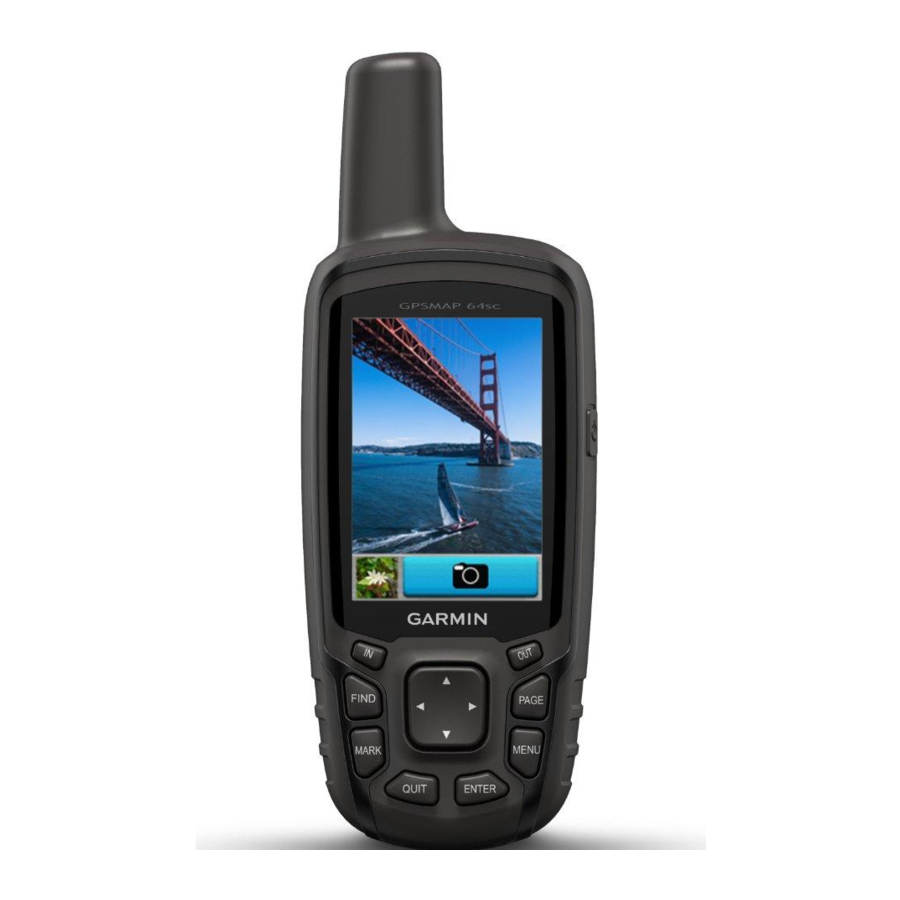
- Page 1 GPSMAP 64sc SiteSurvey ® Owner’s Manual...
- Page 2 HomePort™, and tempe™ are trademarks of Garmin Ltd. or its subsidiaries. These trademarks may not be used without the express permission of Garmin. The Bluetooth word mark and logos are owned by the Bluetooth SIG, Inc. and any use of such marks by Garmin ® is under license. Mac is a trademark of Apple Inc., registered in the U.S.
-
Page 3: Table Of Contents
Table of Content Introduction ......... 1 Editing a Waypoint ............5 Deleting a Waypoint ............5 Device Overviews ..........1 Routes ..............5 Battery Information ..........1 Creating a Route ............. 5 Maximizing Battery Life ..........1 Editing the Name of a Route ......... 5 Turning On Battery Save Mode ........ - Page 4 Device Information ......16 Custom Maps ..............11 Support and Updates .........16 Importing Map Images ..........11 Setting Up Garmin Express ........... 17 Editing Custom Maps ............ 11 Registering Your Device ..........17 Exporting Custom Maps ..........11 Attaching the Carabiner Clip ......17 Collection Fields .............
- Page 5 ................19 Using Optional Fitness Accessories ......19 Tips for Pairing ANT+ Accessories with Your Garmin Device ............19 Troubleshooting ..........19 Resetting the Device ............. 19 Viewing Device Information ........19 Restoring All Default Settings........19 GPSMAP 64sc SiteSurvey ®...
-
Page 6: Introduction
Garmin .Attempting to ® batteries when operating the device in below freezing charge a battery that was not provided by Garmin can conditions. damage the device and void the warranty. Maximizing Battery Life Before you can connect the straight connector of the... -
Page 7: Installing Aa Batteries
Turning On the Device NOTE: The device does not charge when outside the approved temperature range (Specifications, page Hold Keys You can charge the battery using a standard wall outlet or a USB port on your computer. ① from the mini-USB port ②. 1 Pull up the weathe rcap FIND Select to open the search menu. -
Page 8: Opening The Main Menu
Opening the Main Menu level. Text Size: Selects the text size for map items. The main menu gives you access to setup screens including waypoints, tracks, and routes. See Adjusting Detail: Selects the amount of detail shown on the map. the Backlight Brightness, page 15 for main menu Showing more detail may cause the map to redraw... -
Page 9: Navigating With Sight 'N Go
③ Elevation Plot of drift (right or left) from the course. The scale ④ refers to the distance between dots on the course By default, the elevation plot displays the elevation deviation indicator, which tell you how far off course over the distance traveled. -
Page 10: Creating A Waypoint
Creating a Waypoint 4 Enter the new name. You can save your current location as a waypoint. Editing a Route 1 Select MARK. 1 Select Route Planner. 2 If necessary, select a field to make changes to the 2 Select aroute. waypoint. -
Page 11: Tracks Settings
• Select Most Recently. Purchasing Additional Maps • Select Near A Location, and select a location. 1 Go to your device product page at www.garmin.com. • Select On A Specific Date, and enter a date. 2 Click the Maps tab. -
Page 12: Using The Flashlight
1 Select Flashlight > A chirp is a small Garmin accessory that is programmed 2 If necessary, use the brightness slider to adjust the and left in a geocache. You can use your device to find brightness. -
Page 13: Gps Satellite Settings
1 Select Profile Change. map the drive. 2 Select a profile. 3 Open the Garmin or memory card drive or volume. 4 Select an option: Area Calculation • Select an item from a connected device and drag it to My Collection or to a list. -
Page 14: Bluetooth Connected Features
Activity uploads to Garmin Connect: Automatically device (requires an inserted memory card). sends your activity to Garmin Connect as soon as you Collect data on-site using the collection function on the finish recording the activity. -
Page 15: Sending Feature Library To The Device
Sending Feature Library to the Device collection item, click Feature Collect and start a Point/Line/Surface collection. Select File > Send To Device > \\Garmin\SiteSurvey > NOTE: Before you start, you must first import a Feature Library to the device (Sending Feature... -
Page 16: Custom Maps
1 Click the export button in the Custom Maps tab. Custom Maps 2 Select a storage path. Garmin SiteSurvey allows the use of custom maps, users 3 Copy the KMZ files to the directory Garmin\ can edit KMZ/KML/JPEG/GIF/BMP/PNG/TIFF files within... -
Page 17: Sitesurvey Toolbar
(WGS84 / Beijing 1954 / Xian 1980/ CGCS2000). Modify the vertices on a line Modify Vertices 1 Open Garmin SiteSurvey, select File > Import. or polygon 2 Choose the map layer. Delete the vertices on a line or Delete Vertices 3 Select Export, and choose a format. -
Page 18: Data Fields
Data Fields data to appear. Distance To Next: The remaining distance to the next Some data fields require you to be navigating or waypoint on the route. You must be navigating for require ANT+ accessories to display data. this data to appear. 24hr Max Temperature: The maximum temperature Elevation: The altitude of your current location above recorded in the last 24 hours. -
Page 19: System Settings
Select Setup > System > Interface. Trip Odometer: A running tally of the distance traveled Garmin Spanner: Allows you to use the device USB port since the last reset. with most NMEA 0183-compliant mapping programs Trip Time: A running tally of the total time spent by creating a virtual serial port. -
Page 20: Display Settings
0183 output and input. map presentation for optimal use while fishing. Text Out: Provides simple ASCII text output of location Appearance: Sets the appearance of marine navigation and velocity information. aids on the map. RTCM: Allows the device to accept Differential Global Marine Alarm Setup: Sets alarms for when you exceed Positioning System (DGPS) information from a device a specified drift distance while anchored, when you... -
Page 21: Changing The Units Of Measure
Garmin Express™ (www.garmin.com/express) provides Plot Type: Records elevation changes over a period of easy access to these services for Garmin devices. time or distance, records barometric pressure over a period of time, or records ambient pressure changes • Product registration over a period of time. -
Page 22: Setting Up Garmin Express
• GGZ geocache files. Go to www.garmin.com/ the device. geocache. • JPEG photofiles. • GPIcustom POI files from the Garmin POI Loader. Go to www.garmin.com/products/poiloader. Installing a Memory Card WARNING Do not use a sharp object to remove user-replaceable batteries. -
Page 23: Connecting The Device To Your Computer
If you do not know the purpose of a file, do not delete it. Your device memory contains important system files that should not be deleted. 1 Open the Garmin drive or volume. 2 If necessary, open a folder or volume. 3 Select a file. -
Page 24: Appendix
• Before you pair the ANT+ accessory with your Garmin device, move 10 m (32.9 ft.) away from other ANT+ accessories. • Bring the Garmin device within range 3 m (10 ft.) of the ANT+ accessory. • After you pair the first time, your Garmin device automatically recognizes the ANT+ accessory each time it is activated. - Page 25 © 2018 Garmin Ltd. or its subsidiaries Garmin International, Inc. 1200 East 151st Street, Olathe, Kansas 66062, USA Garmin (Europe) Ltd. Liberty House, Hounsdown Business Park, Southampton, Hampshire, SO40 9LR, UK Garmin Corporation No.68, Zhangshu 2nd Road, Xizhi Dist., New Taipei City, 221, Taiwan April 2018 190-01702-2G Rev.
Need help?
Do you have a question about the GPSMAP 64sc SiteSurvey and is the answer not in the manual?
Questions and answers