Table of Contents
Advertisement
Advertisement
Table of Contents

Summary of Contents for Navionics Geonav 5 Touring
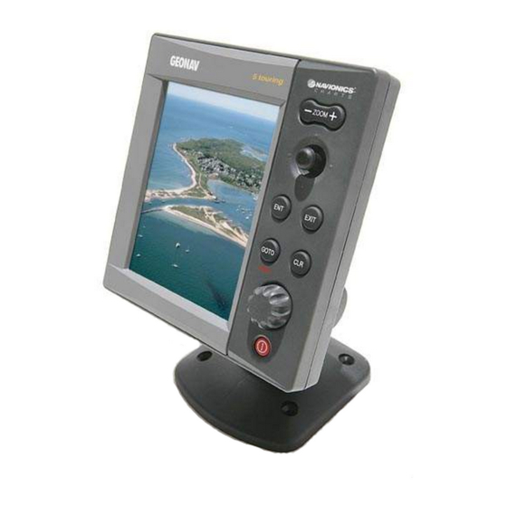
- Page 1 Touring User and Installation Guide...
- Page 3 READ THIS WARNING BEFORE USING THE GEONAV WARNING THE ELECTRONIC CHART IS AN AID TO NAVIGATION DE- SIGNED TO FACILITATE THE USE OF AUTHORIZED GOV- ERNMENT CHARTS, NOT TO REPLACE THEM. ONLY OFFICIAL GOVERNMENT CHARTS AND NOTICES TO MARINERS CONTAIN ALL INFORMATION NEEDED FOR THE SAFETY OF NAVIGATION AND, AS ALWAYS, THE CAPTAIN IS RESPONSIBLE FOR THEIR PROPER USE.
-
Page 4: Introduction
Thanks to the GEONAV and a NAVIONICS Platinum™ or Gold™ electronic chart, you will never get lost even in case of fog, bad weather or dark. -
Page 5: Characteristics
Characteristics CHARACTERISTICS General characteristics • Easy Pilot function for easy and direct control of autopilot • EBL and VRM functions • Multiple display of tracks • Storage of track data including significant additional in- formation such as date, time, latitude/longitude, depth, temperature, etc. - Page 6 Characteristics • Protection against: Reverse polarity Input overvoltage (up to 40 Vd.c.) • Operating temperature: -10°C to +60°C, with external power supply (12 V d.c.) • Storage temperature: -20°C to +70°C, with external power supply (12 V d.c.) Memory characteristics •...
- Page 7 Accessories • Bracket for detachable installation • Power supply cable • User and Installation Guide • Protection cap English...
-
Page 8: Installation And Precautions
Installation and Precautions INSTALLATION AND PRECAUTIONS Precautions To avoid electromagnetic interference, the GEONAV must be positioned at least 25 cm away from the magnetic compass. Wherever possible, the power supply cable shield should be connected to the boat’s ground plate. The GEONAV is water resistant but not waterproof, and should not be immersed totally in water. - Page 9 Fix the unit to the wall with 4 screws 3mm in diameter. Returning used electrical and electronic devices in EU countries Users of electrical and electronic devices are obligated to collect used devices separately. Electrical (electronic) used devices may not be disposed of together with unsorted household refuse.
-
Page 10: Connections
Connections CONNECTIONS Power supply and data connector (10 pins) 1. Power supply + VDC (red wire) (black wire) 2. NMEA 0183 data input GPS IN+ (brown wire) GPS IN- (yellow wire) 3. NMEA 0183 data output DATA OUT+ (violet wire) DATA OUT- (white wire) 4. - Page 11 Connection with fishfinder black-box unit Use the cable supplied to connect the plotter to the power supply source, as well as to NMEA0183 devices such as an external GPS receiver, depth sounder and autopilot, if any. Connect the instrument to the black-box by the available con- nector present in the cable supplied.
-
Page 12: Cartridge Installation
Cartridge Installation CARTRIDGE INSTALLATION Installing the CompactFlash™ Open the cartridge slot cover located on the plotter’s rear side. Insert the cartridge into the appropriate slot, with the label side towards the outside, and push it down. Close the cover exercising light pressure and check that it is perfectly closed, in order to avoid any water infiltration. - Page 13 WARNING: Always use CompactFlash™ cartridges certified by Navionics. The use of non-certified cartridges may result in improper operation of the unit. The CompactFlash™ cartridge can be used as a mass storage device on any PC. The same applies to the GEONAV. However, the plotter needs to find some free space in the cartridge in order to work properly.
-
Page 14: Keyboard
Keyboard KEYBOARD ZOOM-/ZOOM+ • Increases/decreases the chart scale • Enables/disables the Autozoom function JOYSTICK (right/left - up/down) • Moves the cursor across the screen • Switches from Navigation mode to Cursor mode • Selects the options from menus and submenus If pressed: •... - Page 15 • Cancels the setting of data in the windows • Cancels the option selection from the menu Cursor mode: • Deletes all waypoints, starting from the last entered • Deletes the waypoint pointed by the cursor • Deletes the marker pointed by the cursor Navigation mode: •...
-
Page 16: Diagnostic
Diagnostic DIAGNOSTIC The GEONAV features a diagnostic program to verify its cor- rect performance, once installed, and to detect problems that may occur during the use of the unit. To access the diagnostic program, hold the ENTER key pressed when switching the unit on. The GEONAV will switch on and carry out automatically a test of the whole system;... -
Page 17: Navionics Electronic Charts
CompactFlash™ cartridges storing NAVIONICS Platinum™ or Gold™ electronic charts. NAVIONICS electronic charts contain a detailed set of sym- bols, similar to those used on official nautical charts.To dis- play chart boundaries, press the... - Page 18 NAVIONICS Electronic Charts Converting depth values into the units Press GOTO to display the menu, select SETUP, DEPTH UNITS and then set the unit desired in meters, feet or fathoms. The GEONAV will convert all the depth values in the unit selected,...
- Page 19 By querying the symbols for wrecks or obstructions, NAVIONICS Platinum™ or Gold™ charts will provide the most detailed information available. For example, as far as a boat is concerned, the chart will show its name, the wreck year, the hull length, the depth, etc.
- Page 20 Displaying port services NOTE: This function is available only with the NAVIONICS Platinum™ cartridges containing the Port Services feature. If the NAVIONICS Gold™ cartridges are used, the supported functions will be those provided by the chart plotters employing only the Gold™ charts.
- Page 21 Position the cursor on the port icon and press ENTER. A menu will show the options PORTS, PHOTOS, PILOTS and INFO. Select PORTS to display the list of the possible marinas present in the current port: choose the desired marina and press ENTER to display the infor- mation available.
- Page 22 Press ENTER again to carry out a GOTO operation to the service selected. Displaying Tides and Currents data NOTE: This function is available only with the NAVIONICS cartridges containing Tides and Currents data. Position the cursor on the icon representing a Tide or Current station.
- Page 23 Displaying aerial / satellite charts NOTE: This function is available only with the NAVIONICS Platinum™ cartridges. Press GOTO to display the menu, select SETUP, PHOTO OVER- LAY, then LAND or FULL. From a given zoom level on- wards, where available, aerial or...
-
Page 24: Graphic Items
Graphic Items GRAPHIC ITEMS Besides chart data, the GEONAV displays some graphic items useful during navigation. The figure below shows some of these items. 1 - Marker Indicates a point of interest as- sociated with a symbol, a name and a color. 2 - Track segment Recording of the track actually followed by the boat;... - Page 25 7 - Cursor Indicates the position expressed in geographical coordinates (latitude and longitude). It is displayed when the plotter is in Cursor mode. 8 - Heading vector Indicates graphically the boat’s current route. 9 – North indicator Indicates the north direction when the Chart rotation func- tion is enabled.
-
Page 26: Functional Characteristics
Functional Characteristics FUNCTIONAL CHARACTERISTICS This chapter describes some of the most important functions of the GEONAV, as well as the terms most commonly used in this document. Switching on/Switching off the unit To switch the GEONAV on, press the PWR key. To switch it off, keep the PWR key pressed for more than 3 seconds. - Page 27 Cursor mode (manual) When in Cursor mode, the manual cursor is displayed. It is possible to insert, delete and move waypoints, insert and delete markers, display navaid information, etc., but it is not possible to gain access to the depth sounder window. To switch from Navigation mode to Cursor mode, use the joystick.
- Page 28 Functional Characteristics The Chart Rotation function is enabled at a speed greater than 1 knot. To enable the Chart Rotation function, press GOTO, select SETUP, then CHART ROTATION and ON. A message will prompt the user to select the chart scale before activating the chart rotation.
- Page 29 EBL/VRM functions The EBL (Electronic Bearing Line) and VRM (Variable Range Marker) functions allow entering mark- ers and waypoints as range and bearing coordinates with respect to the current position. To enable these functions, rotate the knob to display the EBL, po- sition the line on the bearing desired, then press the knob to enable the VRM ring and adjust...
- Page 30 Functional Characteristics Easy Pilot function The Easy Pilot function allows editing temporarily a route set and followed by the autopilot, but keeping the route unchanged. This function is useful to make real time cor- rections (e.g., because of other boats or to ap- proach points of interests), without having to edit the route planned or disable the autopilot.
- Page 31 Press GOTO and then, by using the joystick, select SETUP, CALIBRATION and then ON. A message will prompt the user to move the cursor to the boat’s true position, appropriately enlarged by the ZOOM+ key. Press ENTER to move the GPS boat’s position to the point indi- cated by the cursor.
- Page 32 Functional Characteristics positioning the manual cursor on the segment itself. The color of chart items can be chosen from DAY, NIGHT or BRIGHT. Press GOTO to display the menu, select SETUP, MODE and then DAY, NIGHT or BRIGHT. Backup copy in the CompactFlash™ To be sure that no data can be accidentally lost, every time data are saved or the unit is turned off, one copy of route, track and marker information will be saved on the cartridge.
-
Page 33: Quick Tour
Make sure that the GPS receiver is connected, insert a Com- pact Flash™ cartridge and press the PWR key. At start-up, all the NAVIONICS charts stored in the Compact Flash™ will be automatically loaded. A message will warn the user that elec- tronic nautical charts do not replace official government charts. - Page 34 GOTO func- tions as well. See the relevant section for more details. NAVIONICS Platinum™ charts provide detailed information that can be displayed at any time. By using the joystick, position the cursor on the chart item desired (symbol for light, buoy, depth area, etc.) and then press...
- Page 35 the joystick; the relative information of the object will be shown. Use the joystick to scroll the information list, then press EXIT to exit and select another item. Press EXIT again to go back to Navigation mode. English...
-
Page 36: Operating Modes
Operating Modes OPERATING MODES CURSOR MODE To plan a new route, or to append waypoints to the existing route, move the cursor by using the joystick and press ENTER. The GEONAV will display the following data: • Route overall length •... - Page 37 > TIDE INFO > RUNWAY > 3D > FISHFINDER The Depth Sounder window is displayed provided that data is received from a depth sounder. The Tide Info window is displayed provided that a NAVIONICS cartridge featuring Tides and Currents data is active (see the Tide Info Window Section).
-
Page 38: Range Window
Range Window RANGE WINDOW This window, always present, shows the following information: • Zoom status (top left corner): - Z+ means the chart can be further enlarged by pressing ZOOM+; - no indication means the chart is shown at the best pos- sible level;... -
Page 39: Navigation Windows
Navigation Windows NAVIGATION WINDOWS These windows are automatically enabled as soon as the GPS re- ceiver has obtained a valid fix (FIX OK). If no route has been entered, the following data will be shown: • Boat’s speed • Chart scale •... - Page 40 Navigation Windows • Sea depth (if available) • Water temperature (if available) NOTE: To display sea depth and temperature values, the GEONAV must be inter- faced with a depth sounder. English...
-
Page 41: Depth Sounder Window
Depth Sounder Window DEPTH SOUNDER WINDOW This window, displayed if the GEONAV is interfaced with a depth sounder, replaces the number indicating the sea depth in the Motor Boating windows with a graph showing the sea bed. If received, the graph shows the water temperature as w e l l . -
Page 42: Trip Window
Trip Window TRIP WINDOW The Trip window shows general data relating to the route fol- lowed. • Average speed from departure • Maximum speed from depar- ture • Time elapsed from departure • Partial distance covered from departure • Overall distance covered To reset all counters (except for the overall distance) before start- ing a new journey, press the CLR... -
Page 43: Satellite Window
Satellite Window SATELLITE WINDOW At start-up the satellite window displays how many and which satellites are tracked by the GPS receiver. The outer circle represents the horizon, the inner one identifies a 45° elevation with respect to the horizon, and the central circle points to the zenith. - Page 44 Satellite Window 2D fix (two dimensions) is available. The altitude value is available only if four satellites are tracked and a 3D fix is obtained. As soon as a valid fix is available, the GEONAV will automati- cally switch to Navigation mode and display the boat’s posi- tion at the best chart range available;...
-
Page 45: General Info Window
General Info Window GENERAL INFO WINDOW This window displays the fol- lowing information on the boat’s current position: • Geographical coordinates (latitude/longitude) • The position correction ap- plied to the latitude and lon- gitude (option SETUP, CALI- BRATION) • Magnetic variation value re- ceived by the GPS •... -
Page 46: Tide Info Window
Tide Info Window TIDE INFO WINDOW When a NAVIONICS cartridge featuring Tides and Currents data is present, this window displays further information, besides the forecast data supplied by selecting the Tides and Currents station. The following data is displayed: •... -
Page 47: Runway Window
Runway Window RUNWAY WINDOW This window displays the following information on the target waypoint: • Name of the target waypoint • Distance from the target waypoint • Estimated time of arrival to the target waypoint • Bearing • Course • Steering angle •... -
Page 48: Window
3D Window 3D WINDOW NOTE: This function is available only with the NAVIONICS Platinum™ cartridges. This window allows displaying a 3D chart image of the area surrounding the current boat’s position. Press the EXIT key repeatedly to display the 3D navigation win-... -
Page 49: Fishfinder Window
Fishfinder Window FISHFINDER WINDOW The Fishfinder window, which is available when the GEONAV is connected to the fishfinder black-box unit supplied, allows displaying the data relative to the objects detected by the unit in the sea area below the boat. The unit works thanks to the Sonar technology, which measures the echo originated by the transmission of a high-frequency sound signal. - Page 50 Fishfinder Window • Depth range The range selection mode (A-RANGE = AUTO, S-RANGE = SHIFT, M-RANGE = MANUAL) and the sensitivity adjusting mode (A-SENS = AUTO, M-SENS = MANUAL) are shown at the lower right-hand corner of the screen. If enabled (see the SETUP menu), the manual cursor will be displayed in red.
- Page 51 BOTTOM ZOOM: Same as BOTTOM LOCK mode, but the enlarged area extends from few meters be- low the seabed to a few meters above, automatically moving ac- cording to depth. In very shallow water, the en- largement is not applicable and therefore the information dis- played on the left side of the screen is not updated;...
- Page 52 Fishfinder Window tween the keel and the seabed using the fish symbol selected from the Setup menu. Symbols are displayed in three different sizes, depending on the strength of the echo detected. In all modes, the depth range can be adjusted automatically (if the relevant option is set to AUTO, in the Setup menu), or manually: by pressing the ZOOM key, a win-...
-
Page 53: Main Menu
Main Menu MAIN MENU The main menu bar, that appears when pressing the GOTO key, allows accessing the following options: ROUTE: To display route information, reverse and delete the route, set the consumption data and save or read data from the cartridge. -
Page 54: Route
Route ROUTE EDITING A ROUTE (CURSOR MODE) Creating a waypoint Using the joystick, move the cursor on the position desired and press ENTER to insert a waypoint. To enter further waypoints, move the cursor and press ENTER. The new waypoint will be appended to the existing route. Up to 99 waypoints per route can be entered, also by using the GOTO functions available from the main menu. - Page 55 EDITING A ROUTE (NAVIGATION MODE) If the manual cursor is displayed, press the EXIT key to enter Navigation mode. Changing the target waypoint Use the “Route to a waypoint” function (see the Functions in the Route Menu Section). WARNING: The route will be modified and the new target waypoint selected will be the first waypoint in the route.
- Page 56 Route POSITION: Waypoint latitude / longitude The arrival time at the waypoint and the fuel consumption will be displayed provided that estimated speed and fuel con- sumption values have been inserted previously (see the Enter- ing speed and fuel consumption data Section). To move within the page and scroll the adjacent pages, use the joystick.
- Page 57 Deleting a route Press the GOTO key to display the menu, select ROUTE, CUR- RENT, DELETE and press ENTER to confirm. The catalog that lists the routes stored in the CompactFlash™ will show the CURRENT item indicating the route currently displayed.
-
Page 58: Track
Track TRACK The Track function allows recording the track actually fol- lowed by the boat. The Track function can be enabled and disabled several times during navigation; in this case, sepa- rate track segments will be drawn. Starting a track To enable the Track function, press the GOTO key to display the main menu, select TRACK,... - Page 59 Recalling a track from the CompactFlash™ Press the GOTO key to display the main menu, select TRACK, OLD and press ENTER to open the track catalog. Select the track desired, then press ENTER to confirm the op- eration or EXIT to exit. Deleting a track Press the GOTO key to display the main menu, select TRACK, CURRENT, DELETE ALL and press ENTER to confirm.
- Page 60 Track Depth values are displayed only if available. By positioning the manual cursor on the starting point of a track segment, a menu will allow changing the segment name, displaying average/maximum speed data, trip length/time, de- leting the single segment as well as changing the single seg- ment color.
- Page 61 The automatic track is active provided that no track has been previously set by the user and is displayed with the same line and color set by default for the user’s track. To save the automatic track, press GOTO, select TRACK, CUR- RENT and SAVE ALL.
-
Page 62: Markers
Markers MARKERS Markers are used to identify points of interest to which names and symbols can be assigned. When a marker is entered, the plotter records also date, time and sea depth and temperature (if available). This data is stored together with the marker name, symbol and color and can be displayed in the window shown by the GOTO MRK menu. - Page 63 Deleting a marker Position the cursor on the marker to delete and press CLR. NAVIGATION MODE Inserting a marker Hold the ENTER key pressed to insert a marker at the boat’s position. A window will display the symbol and the name automatically assigned to the marker;...
- Page 64 Markers leg to the existing route (if no route is available, the new waypoint will be connected to the boat’s position). Press the EXIT key to go back to Navigation mode and enable automatically the Autozoom function. NOTE: To delete a single marker, select it from the GOTO Marker list and press the CLR key.
-
Page 65: Goto Port
Goto Port GOTO PORT Press the GOTO key and select PORT by the joystick. The list will display the latest ten ports previously selected. Choose the desired port by the joystick, or select New and press ENTER to display the whole list of the ports stored in the car- tridge. -
Page 66: Goto Nearest
Goto Nearest GOTO NEAREST NOTE: This option is available only with the NAVIONICS cartridges containing the Port Services features. It allows finding and heading for the nearest port featuring the service desired. The NAVIONICS Platinum™ cartridges offer a wide choice of ser- vices, whereas, when using NAVIONICS Gold™... - Page 67 Tide or current forecast at the nearest survey station NOTE: This function is available only with the NAVIONICS cartridges containing Tides and Currents data. This function allows displaying, within the space of twenty- four hours with respect to the selected date, the tide level and tidal current speed and direction at a survey station in the vicinity.
- Page 68 Goto Nearest Tidal current station • Name of the station • Forecast reference date • Time, speed and direction with respect to the cursor’s position in the graph • Time, speed, direction and slack time of daily flood and ebb streams •...
-
Page 69: Setup
Setup SETUP The Setup menu allows setting the available options. To access the Setup menu, press GOTO to display the main menu, then select SETUP by using the joystick. The menu items are grouped in six sets. When selecting a set by the joystick, the list of the available options will be displayed. - Page 70 Setup By choosing USER, enables/disables the display of the single items. • Easy View (ON/OFF) Enables/disable the Chart Magnification function. • Overzoom (ON/OFF) Enables/disable the Overzoom function. • Presentation (INTER./U.S.) Selects the symbols and colors of chart presentation. • Own Ship Icon Selects the icon that will identify the ship’s position on the screen.
- Page 71 FISHFINDER NOTE: The fishfinder function settings are enabled only when the black-box unit is connected to the instrument. • Sensitivity (AUTO/MANUAL) Chooses the operating mode between automatic mode (suggested) and manual mode (for expert users). • Color line Changes the step value be- tween each couple of adja- cent colors displayed.
- Page 72 Setup • Sonar Features Allows accessing the advanced setting menu relative to the sonar signal (see paragraphs below). • Fish Symbol (ON/OFF) By selecting ON, it is possible to enable and choose the type of icon representing the banks of fish. By selecting OFF, the icon is not displayed.
- Page 73 • Display Mode (NORMAL/BOTTOM LOCK/BOTTOM ZOOM/MARKER VIEW/SYMBOL VIEW) Chooses the type of Depth Sounder window displayed. • Noise (ON/OFF) Enables/disables a filter that allows eliminating transient signals, such as motor ignition, returns coming from other depth sounders or background noise. •...
- Page 74 Setup • TX Settings/Pulse Width Sets the scanning pulse width if the TX Pulse option is set to Manual. • TX Settings/Duty Cycle Sets the scanning pulse duty cycle if the TX Pulse option is set to Manual. The adjustment of these parameters is for expert users.
- Page 75 • Temperature Sets a correction for the value of the water temperature detected by the sensor. • Water Type (SALT/FRESH) Optimizes the operating parameters for sea water or fresh water navigation. FISH FINDER - OTHERS • Simul. Mode (ON/OFF) Enables/disables the black- box unit’s simulator.
- Page 76 Setup • Language (EN/FR/ES/DE/DK/IT/SV/NL/SU/NO/GR) Selects the language. WINDOWS • Selects the auxiliary win- dows to display. For every window, a preview image - whose display can be en- abled/disabled (ON/OFF) - is available. OTHER • GPS (INT/EXT) Selects the internal or external GPS device, or the built-in GPS device with the reception of WAAS/EGNOS differen- tial satellites (if available).
-
Page 77: Goto Lat/Lon
Goto Lat/Lon GOTO LAT/LON Press the GOTO key and select LAT/LONG by the joystick. En- ter the geographical coordinates desired and confirm. The GEONAV will move the manual cursor to the position se- lected; insert a waypoint by pressing ENTER, or a marker by pressing ENTER longer. -
Page 78: Goto Range/Bearing
Goto Range/Bearing GOTO RANGE/BEARING Press the GOTO key and select R&B by the joystick. Enter the range and bearing values relative to the position desired and con- firm. The GEONAV will move the manual cursor to the position se- lected; insert a waypoint by pressing ENTER, or a marker by holding ENTER pressed English... -
Page 79: Mob Function
MOB Function MOB FUNCTION If one member of the crew should accidentally fall overboard, the MOB (Man Overboard) function allows plotting the posi- tion where the fall occurred, providing useful pieces of infor- mation for the rescue. To enable the MOB function, hold the GOTO key pressed longer. The GEONAV will place a special marker on the current posi- tion and show a window with the following data: •... -
Page 80: Autopilot
Autopilot AUTOPILOT The GEONAV allows a boat equipped with an autopilot to fol- low automatically the entered route, compensating for any di- version caused by external conditions (wind, currents, etc.). The GEONAV will display the “PROXIMITY TO WAYPOINT” message to warn the user that the boat is about to reach the target waypoint. -
Page 81: Table Of Contents
INSTALLATION AND PRECAUTIONS ........8 CONNECTIONS ..............10 CARTRIDGE INSTALLATION ..........12 KEYBOARD ................14 DIAGNOSTIC ................16 NAVIONICS ELECTRONIC CHARTS ........17 GRAPHIC ITEMS ..............24 FUNCTIONAL CHARACTERISTICS ........26 QUICK TOUR ................33 OPERATING MODES .............. 36 RANGE WINDOW ..............38 NAVIGATION WINDOWS ............
Need help?
Do you have a question about the Geonav 5 Touring and is the answer not in the manual?
Questions and answers