Table of Contents
Advertisement
Advertisement
Table of Contents

Related Manuals for Lowrance Elite-5 DSI


Summary of Contents for Lowrance Elite-5 DSI
- Page 1 Elite 5 DSI Operation manual...
- Page 2 Navico. Any unauthorized commercial distribution of this manual is strictly prohibited. Lowrance® and Navico® are registered trademarks of Navico. Fishing Hot Spots® is a registered trademark of Fishing Hot Spots Inc. Navico may find it necessary to change or end our policies, regulations and special offers at any time.
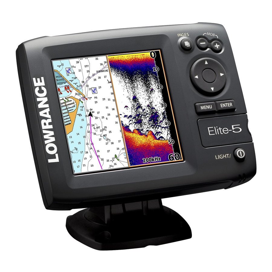
- Page 3 ZOOM Keys: used to zoom in/zoom out (On GPS- PAGES: used to capable units, press keys select pages simultaneously to create Man Overboard waypoint) KEYPAD: controls cursor & selects items on menus MENU: Opens settings, context and page menus ENTEr: confirms...
- Page 4 General Operation Accessing Pages Accessing Settings menu Settings menu Selecting Menu items Fishfinder, GPS and combination units Sonar settings Fishfinder or GPS only units Exiting menus Accessing page menus Press Menu to see if the screen or menu has an exit option).
-
Page 5: Standby Mode
Overlay Data Allows you to display data on the screen. Overlay data can be accessed on the Chart, Sonar and DSI menus. Advanced Mode Enables advanced fea- tures/settings. On some units, advanced mode is enabled by answering to the advanced user question in the Setup Wiz- ard. - Page 6 Sonar Operation Trackback You can review your sonar history by pressing the keypad to the left until the screen starts to move in reverse and the sonar history bar appears at the bottom of the screen. Sonar history bar Move the sonar history bar all the way to the right to resume normal sonar scrolling, or press MENU Exit cursor mode...
- Page 7 Noise rejection: counteracts sonar signal interference by reducing onscreen clutter. Surface Clarity: reduces clutter near the water’s surface (Advanced mode only). Color Changes the look of the display using palettes with varying degrees of color and brightness. Monochrome DSI Color sonar Features Range: selects the section of the water...
- Page 8 Sonar Operation Fishing Mode Depth General Use ≤ 1,000’ Shallow water ≤ 60’ Fresh water ≤ 400’ Deep water ≥ 1,000’ Slow Trolling ≤ 400’ Fast Trolling ≤ 400’ Clear water ≤ 400’ Ice Fishing ≤ 400’ Sonar Options (Traditional) Sonar Settings Settings 50% Ping speed...
- Page 9 Selecting Chart Data Selects map data that will be used on the Chart display (Lowrance or Navionics). GPS features Cursor The keypad moves the cursor around the display, allowing you to scroll the map and select map...
- Page 10 Chart Operation Cancel Navigation Orientation Allows you to select North Up or Course Over Ground (COG) as the map orientation. North up keeps north at the top of the display. Course over ground, rotates the map so your di- rection of travel is at the top of the screen. Accessing waypoints, routes and trails Waypoints Creating a waypoint...
- Page 11 Editing a waypoint The Edit waypoint menu can be accessed by selecting a waypoint and pressing Edit waypoint menu Waypoint name, icon and latitude/longitude can be changed on the Edit waypoint menu. Navigating to a waypoint You can navigate to a waypoint from the ENTEr waypoints menu (shown below) or from the chart screen.
- Page 12 Chart Operation Routes Creating/editing a route Waypoints can be added to a route from the waypoints menu or by selecting them with the cursor on the chart. When editing a route, points can be added at the beginning, end, or between existing route points.
- Page 13 When adding points from the map, use the cursor to select a point and press ENTEr. Repeat that step to add more points. When adding waypoints from the waypoints list, insert press MENU and select want to add another waypoint to the route. 4.
- Page 14 Chart Operation Navigating a route Saving an edited route...
- Page 15 Trails Creating a trail When the unit is turned on, it will start recording trail points after a set amount of time, or after a set distance is traveled; depending on the trail update setting. Trail points are added to the end of the previous trail unless a new trail is created.
-
Page 16: Chart Settings
Chart Operation Navigating a trail You can navigate a trail manually, by steering your onscreen position (arrow) along an exist- ing trail on the chart display, or navigate it like a route. Navigating a trail like a route allows you to use features like off course and arrival alarms. - Page 17 Browse files on information a microSD card (only on units with microSD card slot) Settings Time (GPS only) Sets the clock, time and date formats Tmp/Spd port Allows you to use the Tmp/Spd port on the back of the unit as an NMEA...
-
Page 18: Databases Limited Warranty
Navico Databases License Agreement THIS IS A LEGAL AGREEMENT BETWEEN THE END-USER WHO FIRST PURCHASES THIS PRODUCT AS A CONSUMER ITEM FOR PERSONAL, FAMILY, OR HOUSEHOLD USE (“YOU”) AND NAVICO, THE MANUFACTURER OF THIS PRODUCT (“WE”, “OUR”, OR “US”). USING THE PRODUCT ACCOMPANIED BY THIS LICENSE AGREEMENT CONSTITUTES ACCEPTANCE OF THESE TERMS AND CONDITIONS. - Page 19 LEI Extras™, Inc. is the accessory source for Lowrance sonar and GPS products manufactured by Navico. To order Lowrance accessories, please contact: 1) Your local marine dealer or consumer electronics store. To locate a Lowrance dealer, visit the web site, www.lowrance.com, and look for the Dealer Locator; or, consult your telephone directory for list- ings.
- Page 20 Visit our website: www.lowrance.com © Copyright 2010 *988-10018-001* All Rights Reserved Navico Holding AS...